MyTopo
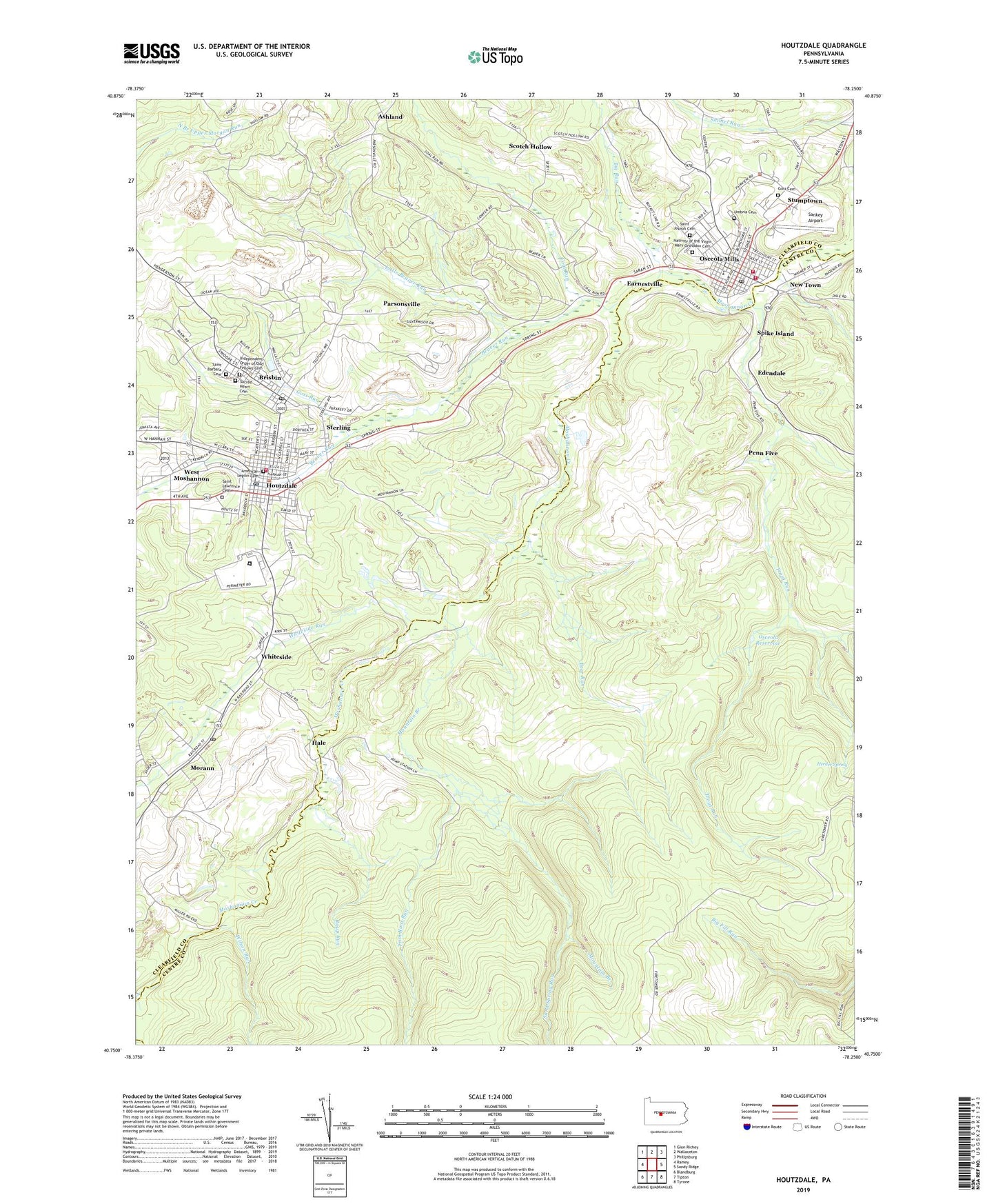
Houtzdale Pennsylvania US Topo Map
Couldn't load pickup availability
2023 topographic map quadrangle Houtzdale in the state of Pennsylvania. Scale: 1:24000. Based on the newly updated USGS 7.5' US Topo map series, this map is in the following counties: Centre, Clearfield. The map contains contour data, water features, and other items you are used to seeing on USGS maps, but also has updated roads and other features. This is the next generation of topographic maps. Printed on high-quality waterproof paper with UV fade-resistant inks.
Quads adjacent to this one:
West: Ramey
Northwest: Glen Richey
North: Wallaceton
Northeast: Philipsburg
East: Sandy Ridge
Southeast: Tyrone
South: Tipton
Southwest: Blandburg
This map covers the same area as the classic USGS quad with code o40078g3.
Contains the following named places: American Legion Cemetery, Ashland, Bear Run, Beaver Run, Beaver School, Beaverton, Big Run, Borough of Brisbin, Borough of Houtzdale, Borough of Osceola Mills, Brisbin, Brisbin Baptist Church, Brisbin Post Office, Christ the King Church, Coal Run, Coal Run Church, Coal Run Junction, Columbia Fire Company Station 22, Decatur Township Police Department, Donegal, Earnestville, Edendale, First United Methodist Church Of Houtzdale, Goss Cemetery, Goss Run, Goss Run Junction, Hale, Herder Spring, Houtzdale, Houtzdale Fire Company 1, Houtzdale Post Office, Houtzdale Ramey Emergency Medical Services Station 47, Independent Order of Odd Fellows Cemetery, Jimtown, Leslie Mine, Little Beaver Run, Morann, Morann Post Office, Moshannon, Moshannon Valley Christian Academy, Mountain Branch, Mountain Top Fire Company 13 Ambulance Substation, Nativity of the Virgin Mary Orthodox Cemetery, New Fellowship Chapel, New Town, Ocean School, Osceola Mills, Osceola Mills Junior High School, Osceola Mills Post Office, Osceola Reservoir, Parsonsville, Penn Five, Roup Run, Rush Consolidated Elementary School, Sacred Heart Cemetery, Saint Barbara Cemetery, Saint Joseph Cemetery, Saint Lawrence Cemetery, Sand Spring Run, Sandy Ridge Fire Tower, Sankey Airport, Scotch Hollow, Spike Island, State Correctional Institution Houtzdale, Sterling, Stumptown, Trim Root Run, Trout Run, Umbria Cemetery, West Moshannon, Whiteside, Whiteside Run, Wilson Run, ZIP Code: 16620


