MyTopo
Grover Pennsylvania US Topo Map
Couldn't load pickup availability
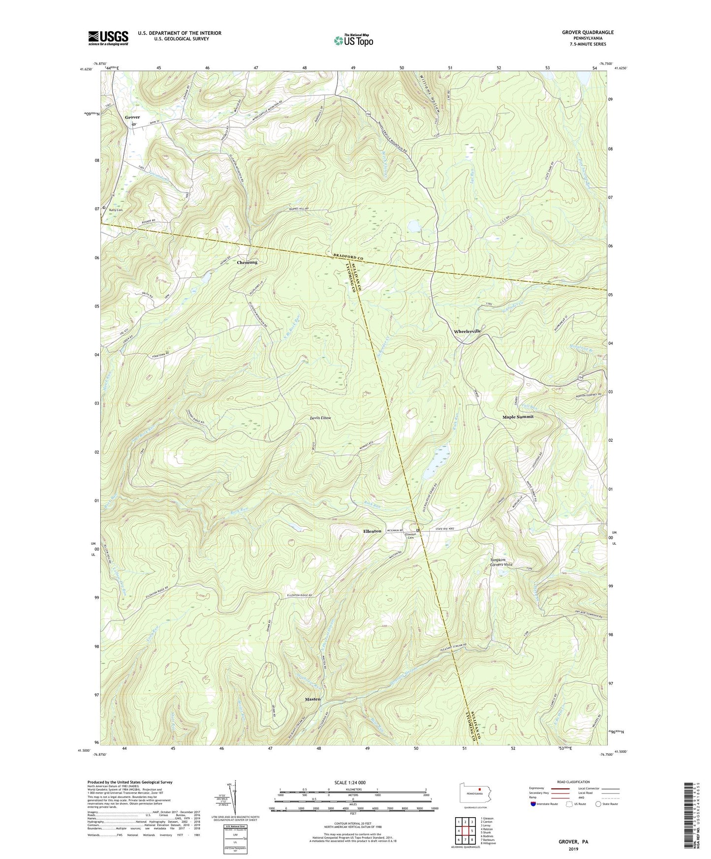
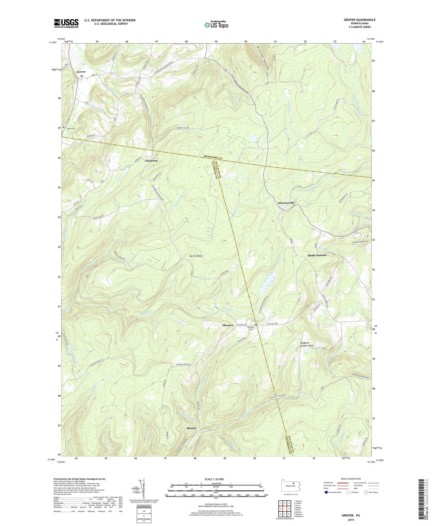
2019 topographic map quadrangle Grover in the state of Pennsylvania. Scale: 1:24000. Based on the newly updated USGS 7.5' US Topo map series, this map is in the following counties: Lycoming, Bradford, Sullivan, Tioga. The map contains contour data, water features, and other items you are used to seeing on USGS maps, but also has updated roads and other features. This is the next generation of topographic maps. Printed on high-quality waterproof paper with UV fade-resistant inks.
Quads adjacent to this one:
West: Ralston
Northwest: Gleason
North: Canton
Northeast: Leroy
East: Shunk
Southeast: Hillsgrove
South: Barbours
Southwest: Bodines
Contains the following named places: Bear Run, Bills Trail, Bovier Run Trail, Bryans Trail, Chemung, Deer Trail, Devils Elbow, East Branch Trail, Ellenton, Ellenton Cemetery, Grover, Grover Post Office, Hoghouse Run, Long Run Trail, Maple Summit, Maple Summit Church, Masten, Miles Road Trail, North Branch Rock Run, North Pleasant Stream, Parsons Hill Church, Rutty Cemetery, Short Run Trail, South Street School, Tompkins Corners, Tompkins Corners Vista, Township of McNett, Wheelerville, ZIP Code: 17768