MyTopo
Ralston Pennsylvania US Topo Map
Couldn't load pickup availability
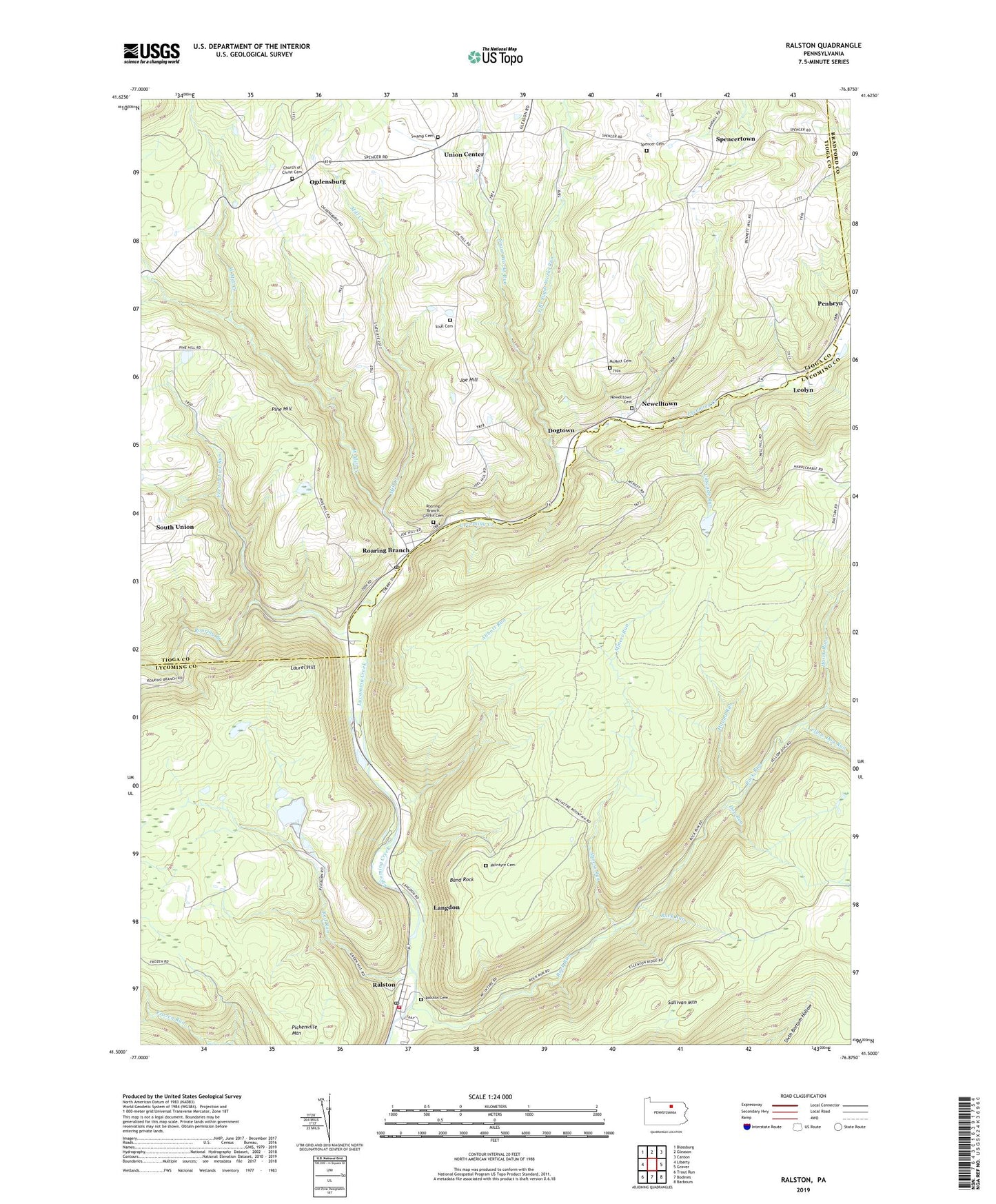
2023 topographic map quadrangle Ralston in the state of Pennsylvania. Scale: 1:24000. Based on the newly updated USGS 7.5' US Topo map series, this map is in the following counties: Lycoming, Tioga, Bradford. The map contains contour data, water features, and other items you are used to seeing on USGS maps, but also has updated roads and other features. This is the next generation of topographic maps. Printed on high-quality waterproof paper with UV fade-resistant inks.
Quads adjacent to this one:
West: Liberty
Northwest: Blossburg
North: Gleason
Northeast: Canton
East: Grover
Southeast: Barbours
South: Bodines
Southwest: Trout Run
This map covers the same area as the classic USGS quad with code o41076e8.
Contains the following named places: Abbott Run, Band Rock, Band Rock Vista, Buck Run, Cascade Run, Church of Christ Cemetery, Crandalltown Trail, Doe Run, Doe Run Trail, Dogtown, East Branch Sugar Works Run, French Lick Run, Hawk Run, Hound Run, Joe Hill, Joe Hill School, Langdon, Laurel Hill, Leolyn, Maggio Estate Dam Number Two, McIntyre Cemetery, McIntyre Wild Area, McNett Cemetery, Mill Creek, Miners Run, Newelltown, Newelltown Cemetery, Ogdensburg, Old Loggers Path, Penbryn, Pine Hill, Ralston, Ralston Cemetery, Ralston Post Office, Ralston Volunteer Fire Company Station 17, Red Run, Roaring Branch, Roaring Branch Griffin Cemetery, Roaring Branch Post Office, Rock Run, South Union, Spencer Cemetery, Spencertown, Stull Cemetery, Sugar Works Run, Sullivan Mountain, Swamp Cemetery, Township of McIntyre, Township of Union, Union Center, West Mill Creek, Yellow Dog Run, ZIP Codes: 17763, 17765