MyTopo
Gleason Pennsylvania US Topo Map
Couldn't load pickup availability
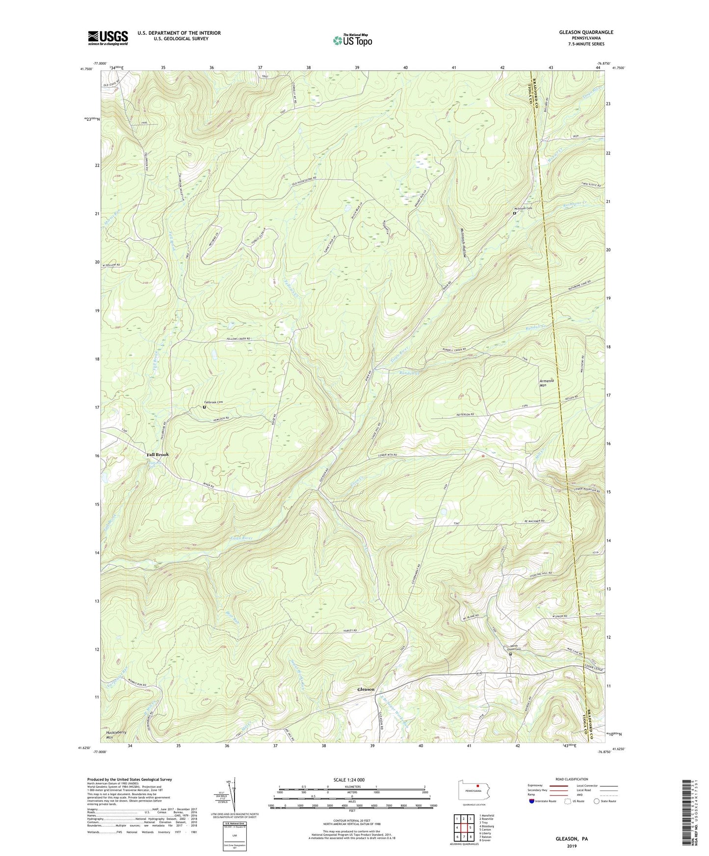
2023 topographic map quadrangle Gleason in the state of Pennsylvania. Scale: 1:24000. Based on the newly updated USGS 7.5' US Topo map series, this map is in the following counties: Tioga, Bradford. The map contains contour data, water features, and other items you are used to seeing on USGS maps, but also has updated roads and other features. This is the next generation of topographic maps. Printed on high-quality waterproof paper with UV fade-resistant inks.
Quads adjacent to this one:
West: Blossburg
Northwest: Mansfield
North: Roseville
Northeast: Troy
East: Canton
Southeast: Grover
South: Ralston
Southwest: Liberty
This map covers the same area as the classic USGS quad with code o41076f8.
Contains the following named places: Armenia Mountain, Bear Run, Borough of Fall Brook, Coon Creek, County Bridge Picnic Area, Fall Brook, Fallbrook Cemetery, Fallbrook Falls, Fellows Creek, Gleason, McIntosh Cemetery, McIntosh Hollow, North Union Cemetery, North Union Church, North Union School, Rathbone Creek, Rundall Creek, South Creek, Township of Ward, Ward School, Webier Creek, WKAD-FM (Canton)