MyTopo
Bodines Pennsylvania US Topo Map
Couldn't load pickup availability
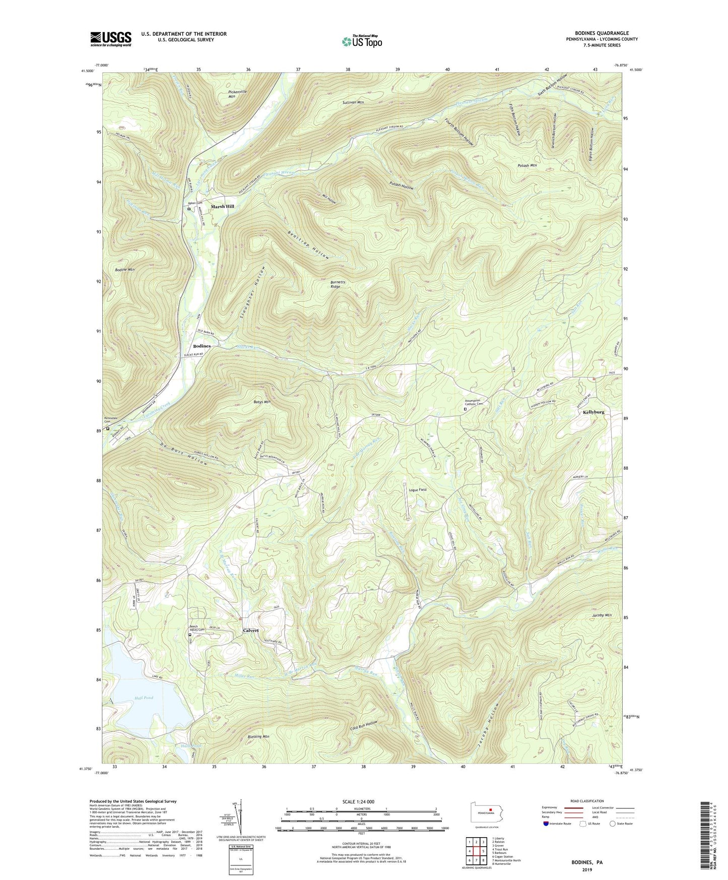
2023 topographic map quadrangle Bodines in the state of Pennsylvania. Scale: 1:24000. Based on the newly updated USGS 7.5' US Topo map series, this map is in the following counties: Lycoming. The map contains contour data, water features, and other items you are used to seeing on USGS maps, but also has updated roads and other features. This is the next generation of topographic maps. Printed on high-quality waterproof paper with UV fade-resistant inks.
Quads adjacent to this one:
West: Trout Run
Northwest: Liberty
North: Ralston
Northeast: Grover
East: Barbours
Southeast: Huntersville
South: Montoursville North
Southwest: Cogan Station
This map covers the same area as the classic USGS quad with code o41076d8.
Contains the following named places: Apker Cemetery, Assumption Catholic Cemetery, Batys Mountain, Beartrap Hollow, Beech Valley Cemetery, Beech Valley School, Blessing Mountain, Bodines, Brewer Run, Burnetts Ridge, Calvert, Church of the Assumption, Cold Run Hollow, Darr Hollow, De Bois Hollow, East Branch Murray Run, Eighth Bottom Hollow, Fifth Bottom Hollow, Fourth Bottom Hollow, Frozen Run, Hall Pond, Halls Pond, Heylmun Run, Hoffman Church, Jacoby Mountain, Joe Gray Run, Kellyburg, Logue Field, Long Run, Marsh Hill, Mill Hollow, Mill Hollow Run, Miller Run, Murray Run, Pennsdale Cemetery, Pickenville Mountain, Pleasant Stream, Potash Hollow, Potash Hollow Run, Potash Mountain, Potash Trail, Roaring Run, Rose Valley Lake Dam, Salt Run, Seventh Bottom Hollow, Sixth Bottom Hollow, Slacks Run, Slaughter Hollow, Township of Cascade, Township of Gamble, West Branch Murray Run