MyTopo
Hartleton Pennsylvania US Topo Map
Couldn't load pickup availability
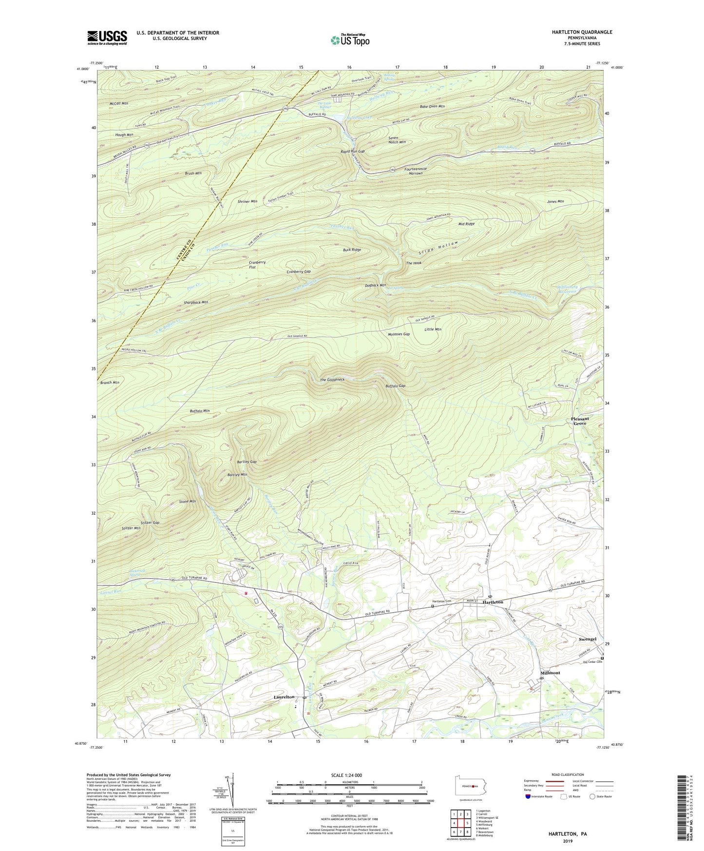
2019 topographic map quadrangle Hartleton in the state of Pennsylvania. Scale: 1:24000. Based on the newly updated USGS 7.5' US Topo map series, this map is in the following counties: Union, Centre. The map contains contour data, water features, and other items you are used to seeing on USGS maps, but also has updated roads and other features. This is the next generation of topographic maps. Printed on high-quality waterproof paper with UV fade-resistant inks.
Quads adjacent to this one:
West: Woodward
Northwest: Loganton
North: Carroll
Northeast: Williamsport SE
East: Mifflinburg
Southeast: Middleburg
South: Beavertown
Southwest: Weikert
Contains the following named places: Bake Oven Mountain, Baker Path, Bartley Gap, Bartley Mountain, Bartley Run, Boiling Spring, Borough of Hartleton, Branch Mountain, Brocher Path, Buck Ridge, Buffalo Gap, Buffalo Path, Cold Run, Cranberry Flat, Cranberry Gap, Dogback Mountain, Douty Mill Trail, Dug Trail, Fourteenmile Narrows, Frederick Gap, Frederick Trail, Fredricks Trail, Halfway Dam, Halfway Lake, Halfway Run, Hartleton, Hartleton Cemetery, Hartleton Post Office, Hayes Mill Trail, Hickernell Spring, Ice Spring, Jones Mountain, Laurelton, Laurelton Census Designated Place, Laurelton Post Office, Laurelton State Village, Laurelton State Village Farms, Lincoln Park, Little Mountain, Lookout Trail, McCall Field, McCall Mountain, Middle Ridge, Middle Ridge Trail, Mifflinburg Reservoir, Millmont, Millmont Post Office, Molasses Gap, Molasses Gap Trail, Mount Luther Camp, Old Cedar Cemetery, Oley Camp Trail, Panther Run, Park Bake Oven Trail, Park Overlook, Pennsylvania Department of Conservation and Natural Resources District 7 Bold Eagle Division, Pleasant Grove, Pleasant Grove Church, Rapid Run Gap, Raymond B Winter State Park, Rock Oak Park, Seven Notch Mountain, Slide Hollow, Spruce Run, Stitzer Gap, Stitzer Mountain, Stone Mountain, Stony Run, Stony Run Dam, Swengel, The Gooseneck, The Hook, The Little Bubbler, Township of Hartley, Township of Lewis, Union Church, Western Area School, Yankee Run, Yankee Run Trail, ZIP Codes: 17829, 17835, 17845