MyTopo
Tipton Pennsylvania US Topo Map
Couldn't load pickup availability
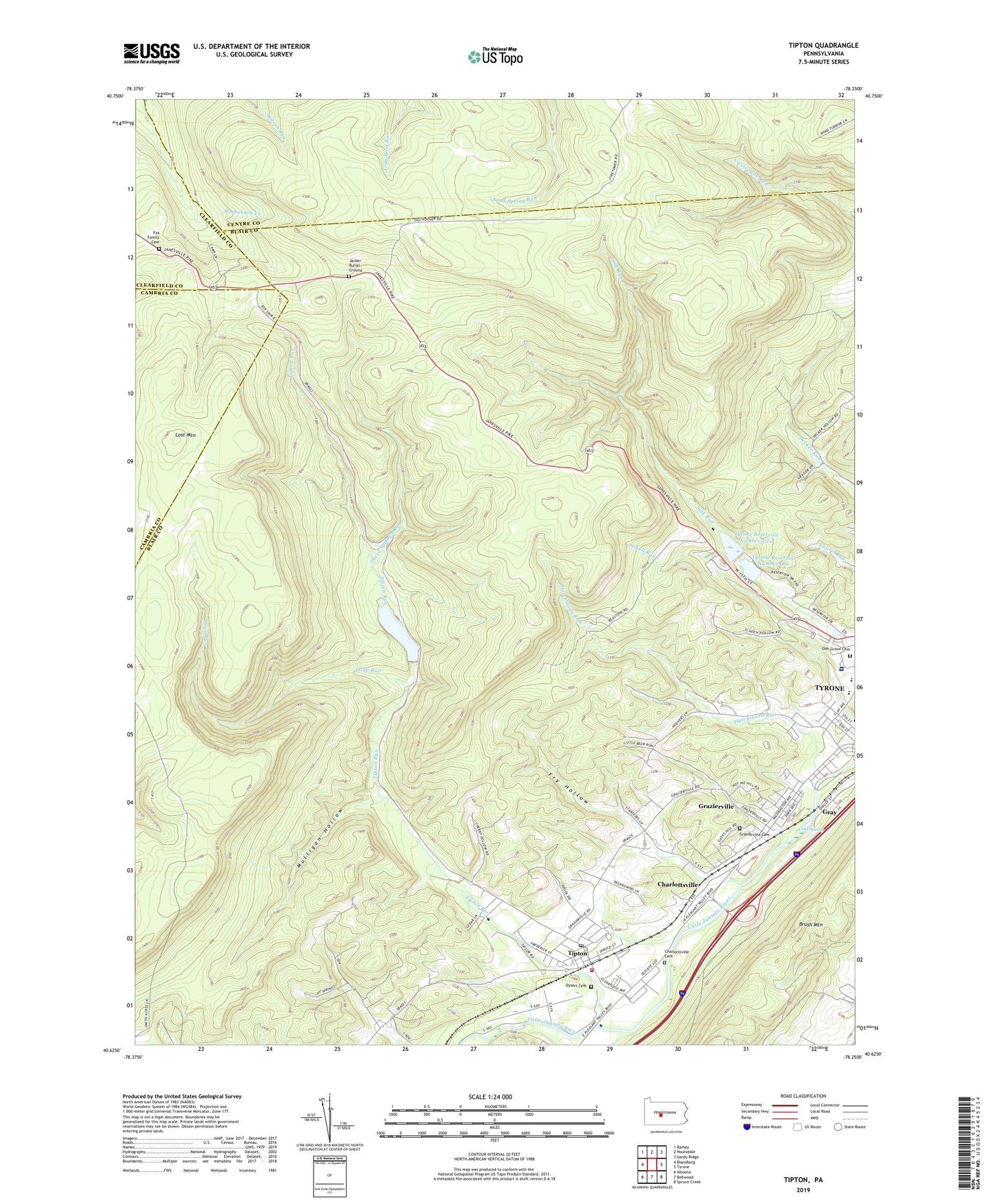
2023 topographic map quadrangle Tipton in the state of Pennsylvania. Scale: 1:24000. Based on the newly updated USGS 7.5' US Topo map series, this map is in the following counties: Blair, Centre, Cambria, Clearfield. The map contains contour data, water features, and other items you are used to seeing on USGS maps, but also has updated roads and other features. This is the next generation of topographic maps. Printed on high-quality waterproof paper with UV fade-resistant inks.
Quads adjacent to this one:
West: Blandburg
Northwest: Ramey
North: Houtzdale
Northeast: Sandy Ridge
East: Tyrone
Southeast: Spruce Creek
South: Bellwood
Southwest: Altoona
This map covers the same area as the classic USGS quad with code o40078f3.
Contains the following named places: Charlottsville, Charlottsville Cemetery, Charlottsville Census Designated Place, Cold Spring, Dysart Cemetery, Fox Family Cemetery, Fry Hollow, Gray, Gray Census Designated Place, Grazierville, Grazierville Cemetery, Grazierville Census Designated Place, Hutchinson Run, Jacker Burial Ground, Lost Mountain, Loup Run, Mountain School, Mulholland School, Mulligan Hollow, Oak Grove Cemetery, Peterson Memorial Field, State Game Lands Number 60, Three Springs Run, Tipton, Tipton - Antis District Volunteer Fire Company Station 21, Tipton Census Designated Place, Tipton Dam, Tipton Post Office, Tipton Reservoir, Tipton Run, Township of Snyder, Tyrone Area Junior Senior High School, Tyrone Dam Number One, Tyrone Hospital, Tyrone Reservoir, Tyrone Reservoir Number One, Tyrone Reservoir Number Two, Wolfgang School, WTRN-AM (Tyrone), ZIP Code: 16686