MyTopo
Sandy Ridge Pennsylvania US Topo Map
Couldn't load pickup availability
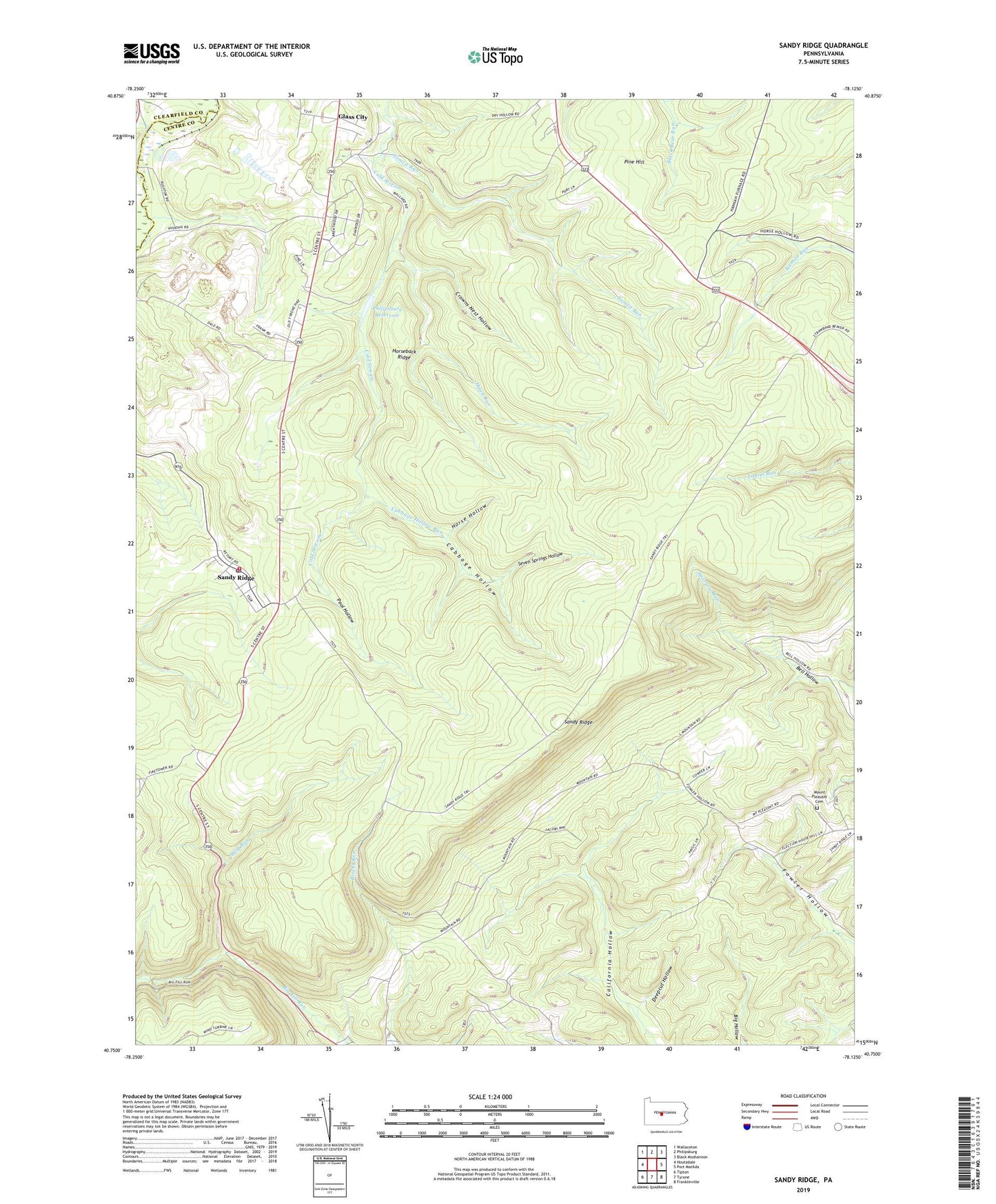
2023 topographic map quadrangle Sandy Ridge in the state of Pennsylvania. Scale: 1:24000. Based on the newly updated USGS 7.5' US Topo map series, this map is in the following counties: Centre, Clearfield. The map contains contour data, water features, and other items you are used to seeing on USGS maps, but also has updated roads and other features. This is the next generation of topographic maps. Printed on high-quality waterproof paper with UV fade-resistant inks.
Quads adjacent to this one:
West: Houtzdale
Northwest: Wallaceton
North: Philipsburg
Northeast: Black Moshannon
East: Port Matilda
Southeast: Franklinville
South: Tyrone
Southwest: Tipton
This map covers the same area as the classic USGS quad with code o40078g2.
Contains the following named places: Cabbage Hollow, Cabbage Hollow Run, Crowns Nest Hollow, Deepcut Hollow, Glass City, Hawk Run, Henderson School, Horse Hollow, Horseback Ridge, Mapleton Junction, Mapleton Junction Station, Mount Pleasant Cemetery, Mount Pleasant Church, Mount Vernon School, Mountain Top Fire Company 13, Philipsburg Reservoir, Pine Hill, Pool Hollow, Powelton, Retort, Rushton Station, Sandy Ridge, Sandy Ridge Census Designated Place, Sandy Ridge Post Office, Seven Springs Hollow, Shimel Run, Slide Hollow Trail, State Game Lands Number 33, Summit, Tomtit Run, Township of Rush, Township of Taylor, Upper Dam, Wolf Run, ZIP Codes: 16677, 16866