MyTopo
Irvona Pennsylvania US Topo Map
Couldn't load pickup availability
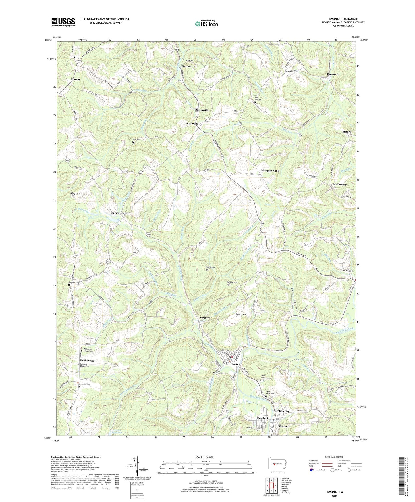
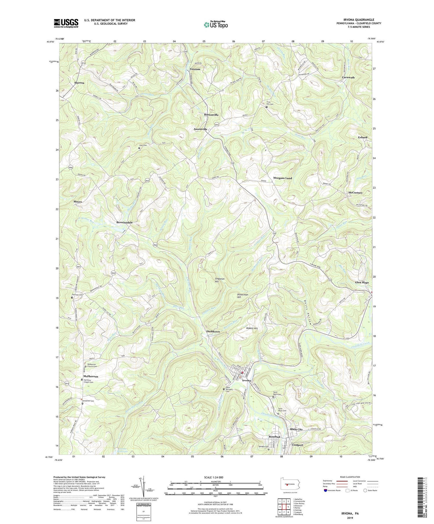
2019 topographic map quadrangle Irvona in the state of Pennsylvania. Scale: 1:24000. Based on the newly updated USGS 7.5' US Topo map series, this map is in the following counties: Clearfield. The map contains contour data, water features, and other items you are used to seeing on USGS maps, but also has updated roads and other features. This is the next generation of topographic maps. Printed on high-quality waterproof paper with UV fade-resistant inks.
Quads adjacent to this one:
West: Westover
Northwest: Mahaffey
North: Curwensville
Northeast: Glen Richey
East: Ramey
Southeast: Blandburg
South: Coalport
Southwest: Hastings
Contains the following named places: Ansonville, Beccaria Mills, Berwinsdale, Blain City, Borough of Irvona, Bretonville, Carnwath, Comfort Run, Davidson Run, DeWitt Hill, DeWitt Run, Dickerman Hill, Diehltown, Dotts Hollow, Erhard, Fairview Cemetery, Fairview Church, Fairview School, Fruit Hill Cemetery, Fruit Hill Church, Gazzam, Glen Hope, Green Run, Green Run School, Harmony Chapel Cemetery, Hazelton School, Hockenberry Run, Holes Run, Hunter Run, Irvona, Irvona Post Office, Irvona Reservoir, Irvona Volunteer Ambulance Service Station 27, Irvona Volunteer Fire Company Station 27, Johnston School, Marron, Mayes, McCartney, McCarvey, McDonald Run, McNeel Run, McPherron, McPherron Church Cemetery, Morgans Land, North Witmer Run, Pine Run, Raccoon Run, Rosebud, Saint Basil Cemetery, Saint Michaels Cemetery, Saint Pauls Cemetery, Singleton Hill, South Witmer Run, Spangle Cemetery, Stony Run, Strong Run, Sucker Run, Township of Beccaria, Township of Jordan, Unnamed Cemetery, Zion Cemetery, Zion Church, ZIP Codes: 16656, 16861