MyTopo
Jackson Center Pennsylvania US Topo Map
Couldn't load pickup availability
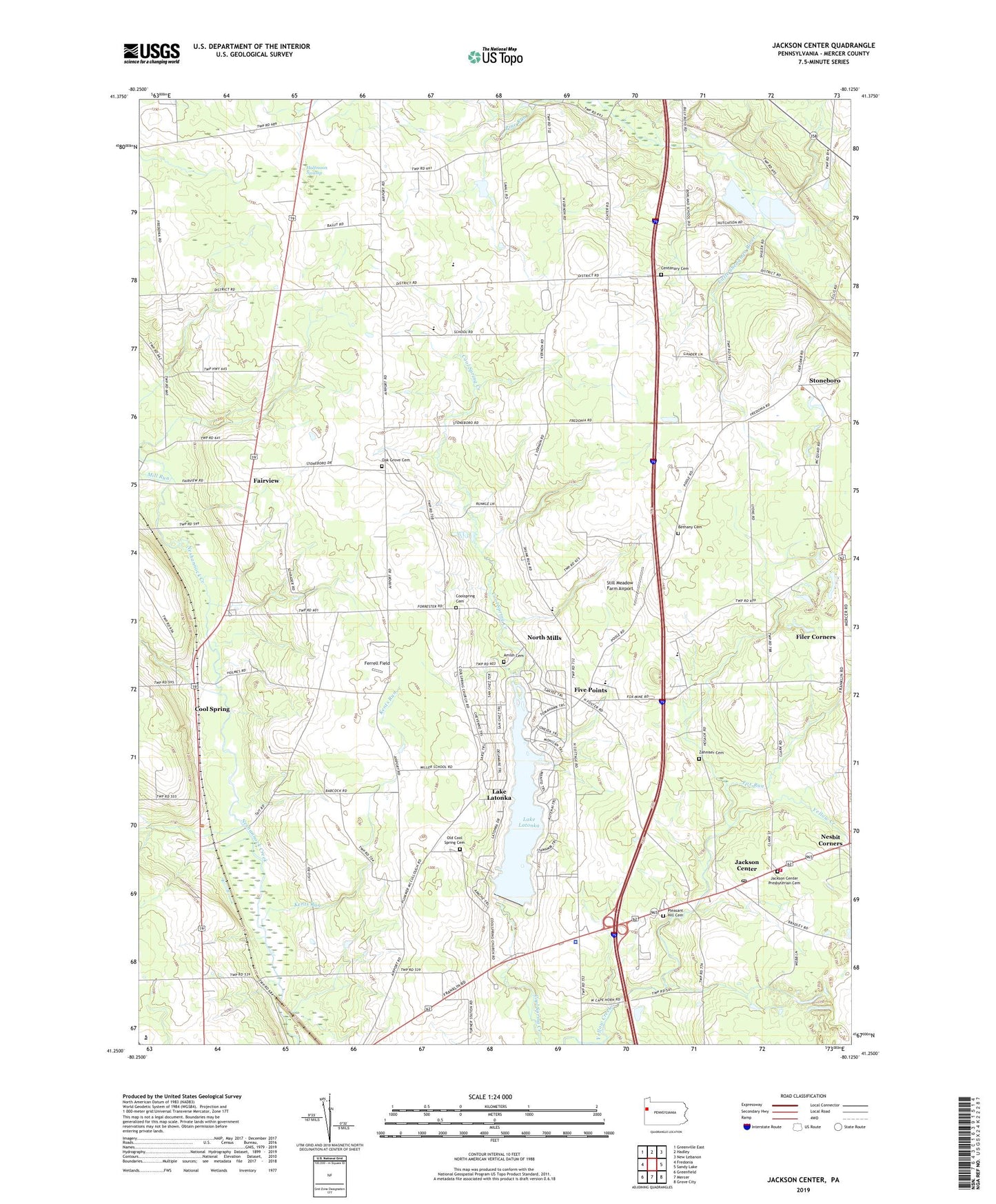
2019 topographic map quadrangle Jackson Center in the state of Pennsylvania. Scale: 1:24000. Based on the newly updated USGS 7.5' US Topo map series, this map is in the following counties: Mercer. The map contains contour data, water features, and other items you are used to seeing on USGS maps, but also has updated roads and other features. This is the next generation of topographic maps. Printed on high-quality waterproof paper with UV fade-resistant inks.
Quads adjacent to this one:
West: Fredonia
Northwest: Greenville East
North: Hadley
Northeast: New Lebanon
East: Sandy Lake
Southeast: Grove City
South: Mercer
Southwest: Greenfield
Contains the following named places: Amish Cemetery, Bethany Cemetery, Borough of Jackson Center, Cape Horn School, Cass School, Centenary Cemetery, Center School, Cool Spring, Cool Spring Church, Coolspring Cemetery, Fairview, Fairview Church, Ferrell Field, Filer Corners, Five Points, Fox Run, Godfrey School, Halfmoon Swamp, Jackson Center, Jackson Center Post Office, Jackson Center Presbyterian Cemetery, Jackson Center Station, Jackson Center Volunteer Fire Department Station 92, Kents Run, Lake Latonka, Lake Latonka Census Designated Place, Lake Latonka Dam, Maple Shade School, Mill Run, Nesbit Corners, North Mills, Oak Grove Cemetery, Oak Grove Church, Oak Hill School, Old Cool Spring Cemetery, Orr School, Paoli School, Pennsylvania State Police Troop D Mercer Station, Pleasant Hill Cemetery, Slater School, State Game Lands Number 294, Still Meadow Farm Airport, Township of Coolspring, Township of Fairview, Township of Jackson, Township of Lake, White School, Zahniser Cemetery, Zahniser School