MyTopo
Kossuth Pennsylvania US Topo Map
Couldn't load pickup availability
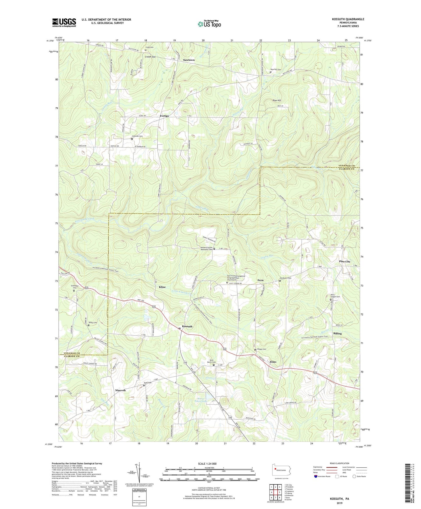
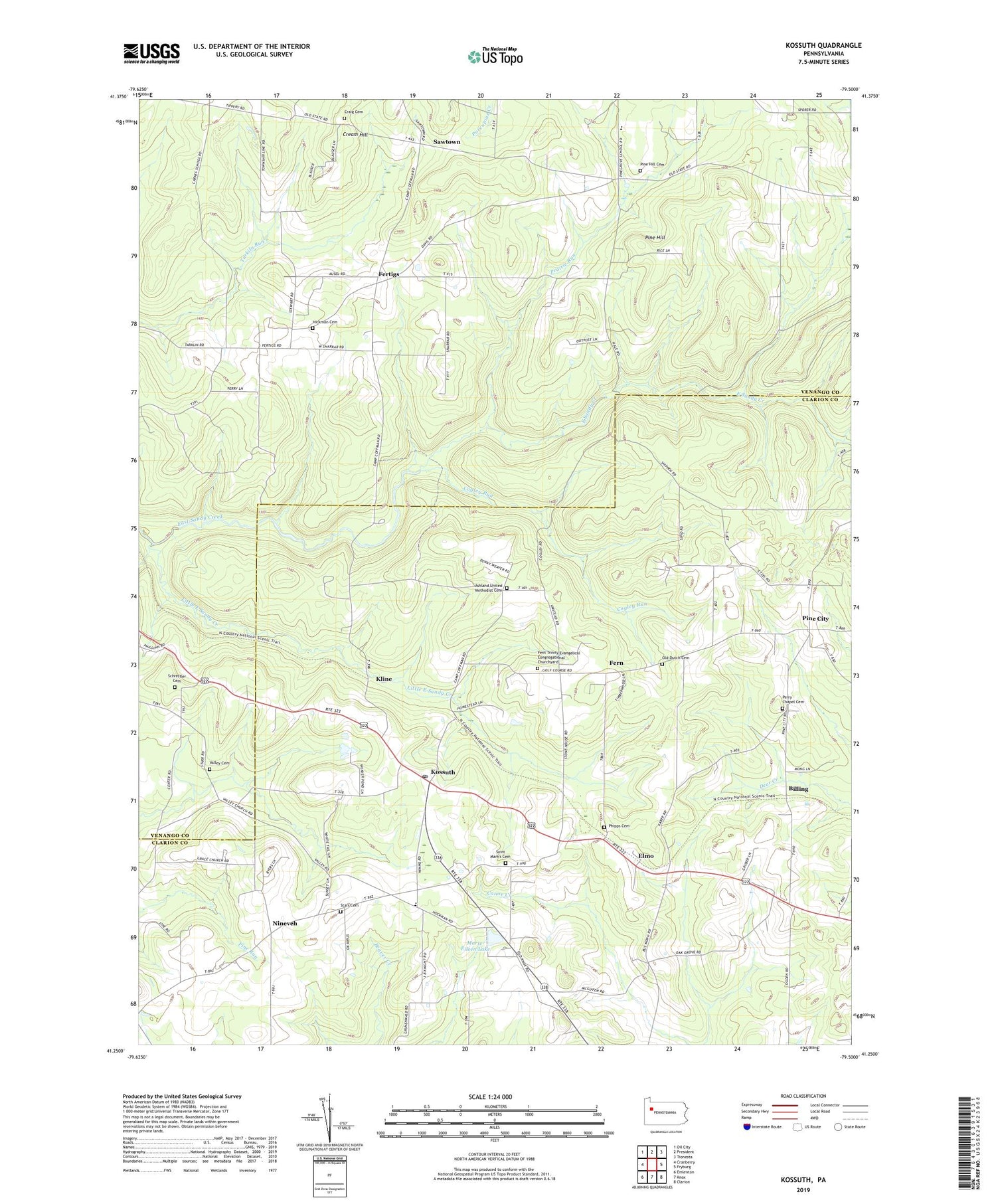
2019 topographic map quadrangle Kossuth in the state of Pennsylvania. Scale: 1:24000. Based on the newly updated USGS 7.5' US Topo map series, this map is in the following counties: Clarion, Venango. The map contains contour data, water features, and other items you are used to seeing on USGS maps, but also has updated roads and other features. This is the next generation of topographic maps. Printed on high-quality waterproof paper with UV fade-resistant inks.
Quads adjacent to this one:
West: Cranberry
Northwest: Oil City
North: President
Northeast: Tionesta
East: Fryburg
Southeast: Clarion
South: Knox
Southwest: Emlenton
Contains the following named places: Altmans Corners, Ashland Church, Ashland School, Ashland United Methodist Cemetery, Billing, Billings Station, Black School, Blauser School, Carnes School, Coffman Camp, Cogley Run, Craig Cemetery, Cream Hill, Elmo, Fern, Fern Trinity Evangelical Congregational Churchyard, Fertigs, Fertigs Gospel Tabernacle, Fertigs Post Office, Goodmans Corners, Grace Church, Hi Level Golf Course, Kapp School, Kline, Kossuth, Kossuth Post Office, Little East Sandy Creek, Marie-Eileen Lake, Nineveh, O B Perry Corners, Old Dutch Cemetery, Perry Cemetery, Perry Chapel Cemetery, Phipps Cemetery, Pine City, Pine Hill, Pine Hill Cemetery, Pine Hill School, Pine School, Powell Corners, Prairie Run, Saint Mark's Cemetery, Saint Marks Church, Sawtown, Schreffler Cemetery, Starr Cemetery, Township of Ashland, Township of Pinegrove, Trinity Church, Valley Cemetery, Wise School, ZIP Codes: 16319, 16331, 16364