MyTopo
Le Raysville Pennsylvania US Topo Map
Couldn't load pickup availability
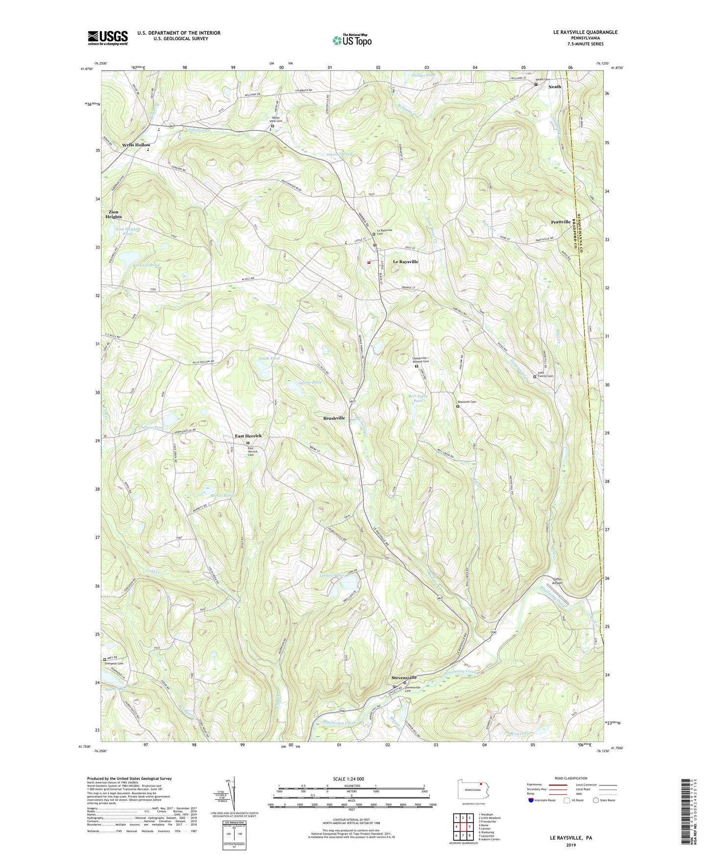
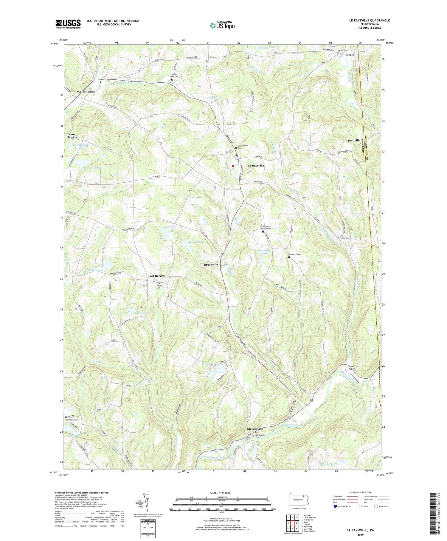
2019 topographic map quadrangle Le Raysville in the state of Pennsylvania. Scale: 1:24000. Based on the newly updated USGS 7.5' US Topo map series, this map is in the following counties: Bradford, Susquehanna. The map contains contour data, water features, and other items you are used to seeing on USGS maps, but also has updated roads and other features. This is the next generation of topographic maps. Printed on high-quality waterproof paper with UV fade-resistant inks.
Quads adjacent to this one:
West: Rome
Northwest: Windham
North: Little Meadows
Northeast: Friendsville
East: Lawton
Southeast: Auburn Center
South: Laceyville
Southwest: Wyalusing
Contains the following named places: Agnew Pond, Atwoods Pond, Beaver Creek, Bert Jayne Pond, Borough of Le Raysville, Bosworth Cemetery, Brushville, Chaffee Corners, Chillson Pond, Concklin Corners, East Herrick, East Herrick Cemetery, Ford Family Cemetery, Ford Street Creek, Giffin Airport, Le Raysville, Le Raysville Cemetery, Le Raysville Post Office, Leisure Lakes, Leraysville - Pike Volunteer Fire Department - Station 6, Maple Grove School, Mill Creek, Neath, Neath Cemetery, Northeast Bradford High School, Overpeck Cemetery, Phillips Pond, Pike Post Office, Prattville, Reeves Pond, Rockwell Creek, Rockwell Pond, Ross Creek, Saint Matthews Church, Smith Pond, Stevens Cemetery, Stevens Corners, Stevensville, Stevensville Cemetery, Stevensville Post Office, Stone House Corner, Totem Lake, Totem Lake Dam, Township of Pike, Township of Stevens, Valley View Cemetery, Wells Hollow, Williams Creek, Wolf Creek, Zion Heights, Zion Heights Pond, ZIP Codes: 18829, 18845