MyTopo
Leroy Pennsylvania US Topo Map
Couldn't load pickup availability
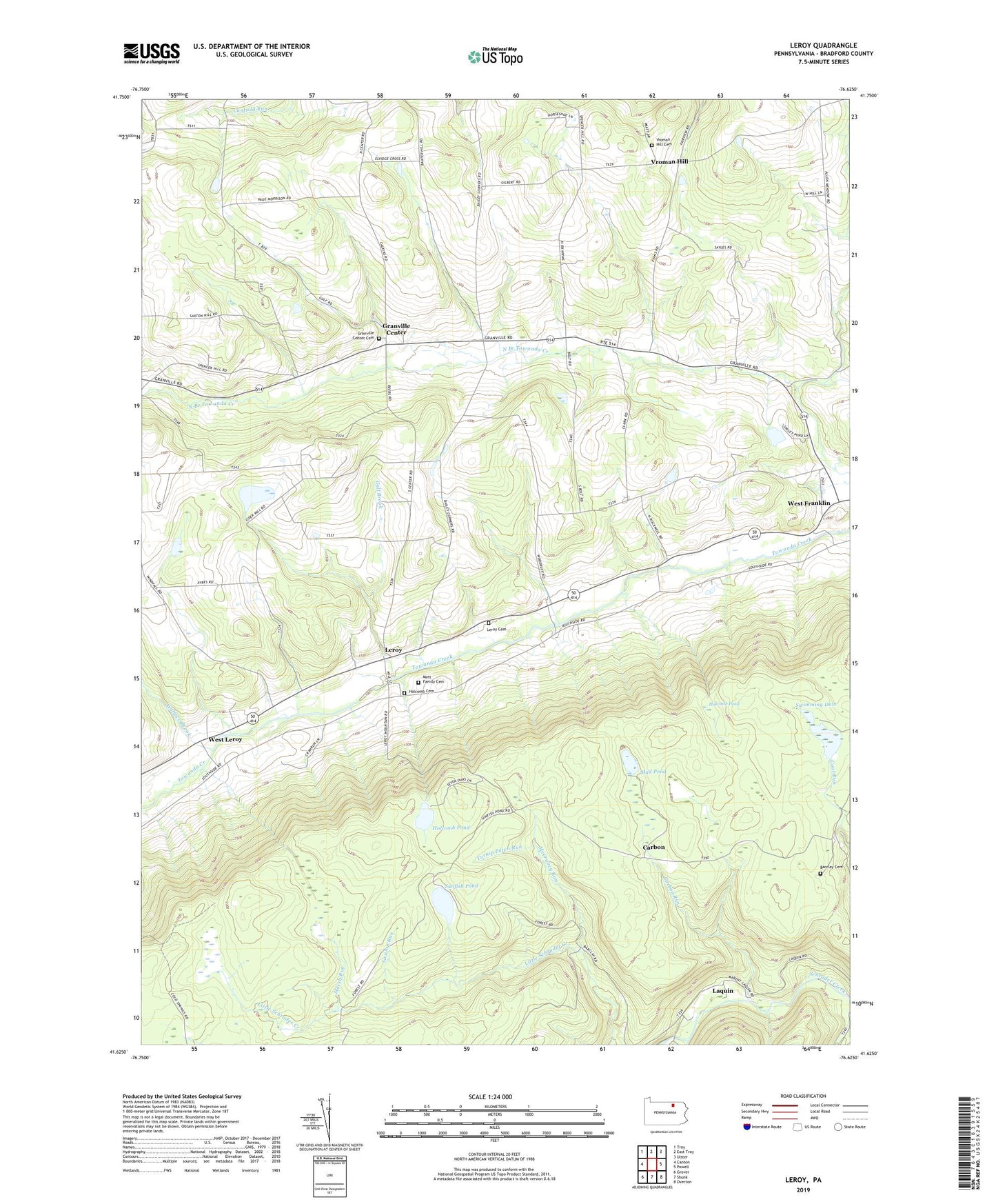
2019 topographic map quadrangle Leroy in the state of Pennsylvania. Scale: 1:24000. Based on the newly updated USGS 7.5' US Topo map series, this map is in the following counties: Bradford. The map contains contour data, water features, and other items you are used to seeing on USGS maps, but also has updated roads and other features. This is the next generation of topographic maps. Printed on high-quality waterproof paper with UV fade-resistant inks.
Quads adjacent to this one:
West: Canton
Northwest: Troy
North: East Troy
Northeast: Ulster
East: Powell
Southeast: Overton
South: Shunk
Southwest: Grover
Contains the following named places: Bailey Corners, Barclay, Barclay Cemetery, Barclay Mountain, Carbon, Carbon Run, Fairview Church, Granville Center, Granville Center Cemetery, Gulf Brook, Holcomb Cemetery, Holcomb Pond, Laquin, Leroy, Leroy Cemetery, Marsh Run, McCraney Run, Mott Family Cemetery, Mud Pond, Mud Pond Dam, Sayees Corners, Sunfish Pond, Swamp Run, Swimming Dam, Township of Granville, Township of Leroy, Turnip Patch Run, Vroman Hill, Vroman Hill Cemetery, Vroman Hill Church, Wallace Brook, West Franklin, West Leroy, Woodruff Corners, ZIP Code: 16926