MyTopo
Jackson Summit Pennsylvania US Topo Map
Couldn't load pickup availability
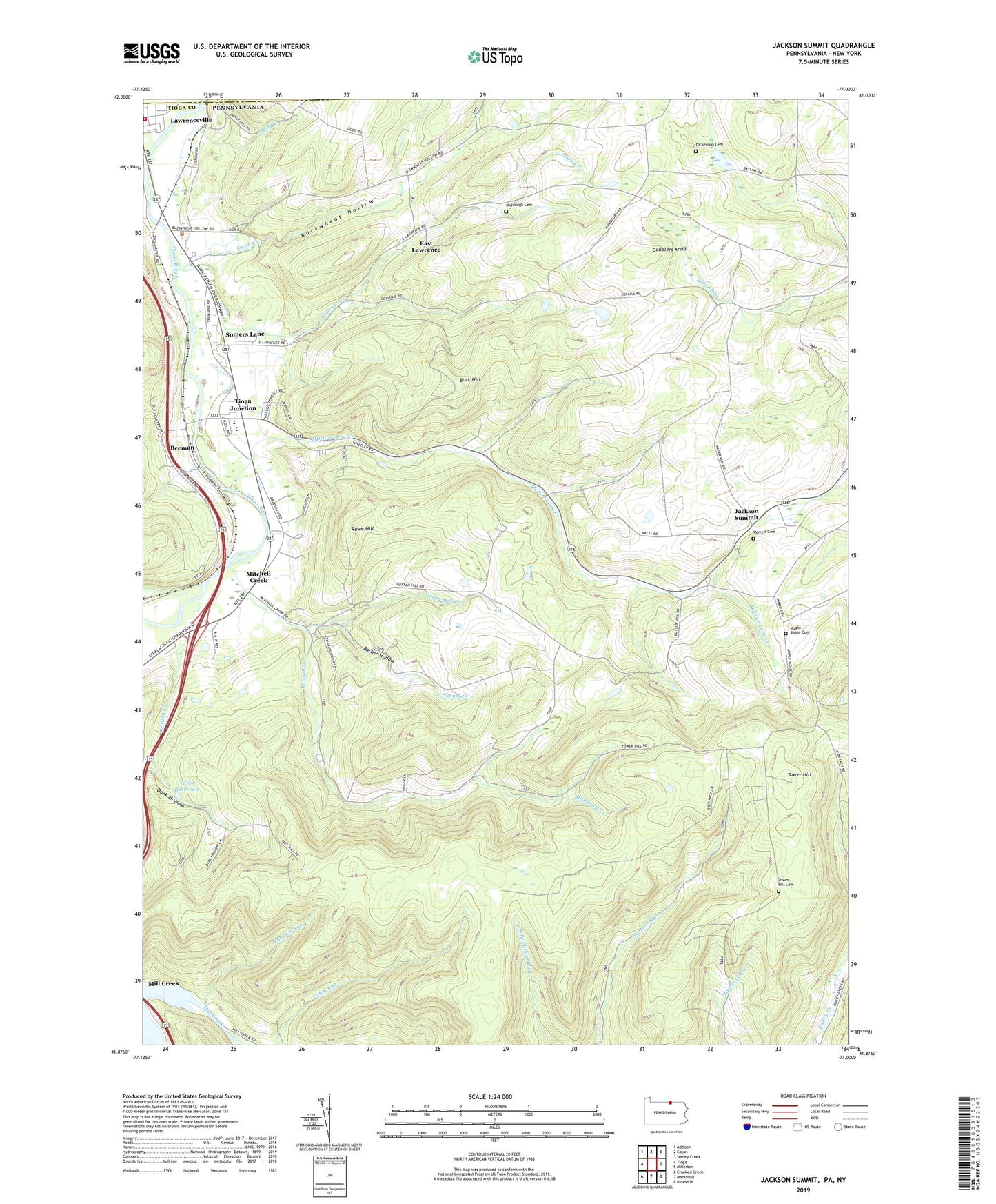
2023 topographic map quadrangle Jackson Summit in the state of Pennsylvania. Scale: 1:24000. Based on the newly updated USGS 7.5' US Topo map series, this map is in the following counties: Tioga, Steuben. The map contains contour data, water features, and other items you are used to seeing on USGS maps, but also has updated roads and other features. This is the next generation of topographic maps. Printed on high-quality waterproof paper with UV fade-resistant inks.
Quads adjacent to this one:
West: Tioga
Northwest: Addison
North: Caton
Northeast: Seeley Creek
East: Millerton
Southeast: Roseville
South: Mansfield
Southwest: Crooked Creek
This map covers the same area as the classic USGS quad with code o41077h1.
Contains the following named places: Barber Hollow, Beeman, Bentley Creek, Buck Hill, Buckwheat Hollow, C V Junction, Daily Creek, Dark Hollow, Dickenson Cemetery, East Lawrence, Gobblers Knob, Harts Creek, Jackson Summit, Lawrence Township Police Department, Lawrenceville Fire Department, Maple Ridge Cemetery, Middaugh Cemetery, Mitchell Creek, Morrell Cemetery, Mount Pleasant Church, Mutton Lane Creek, Phoenix Run, Rising, Rowe Hill, Shanty Creek, Smith Creek, Somers Lane, Steam Mill Creek, Tioga Dam, Tioga Junction, Tioga Reservoir, Tower Hill, Tower Hill Cemetery, Township of Tioga, Williamson Senior High School