MyTopo
Nauvoo Pennsylvania US Topo Map
Couldn't load pickup availability
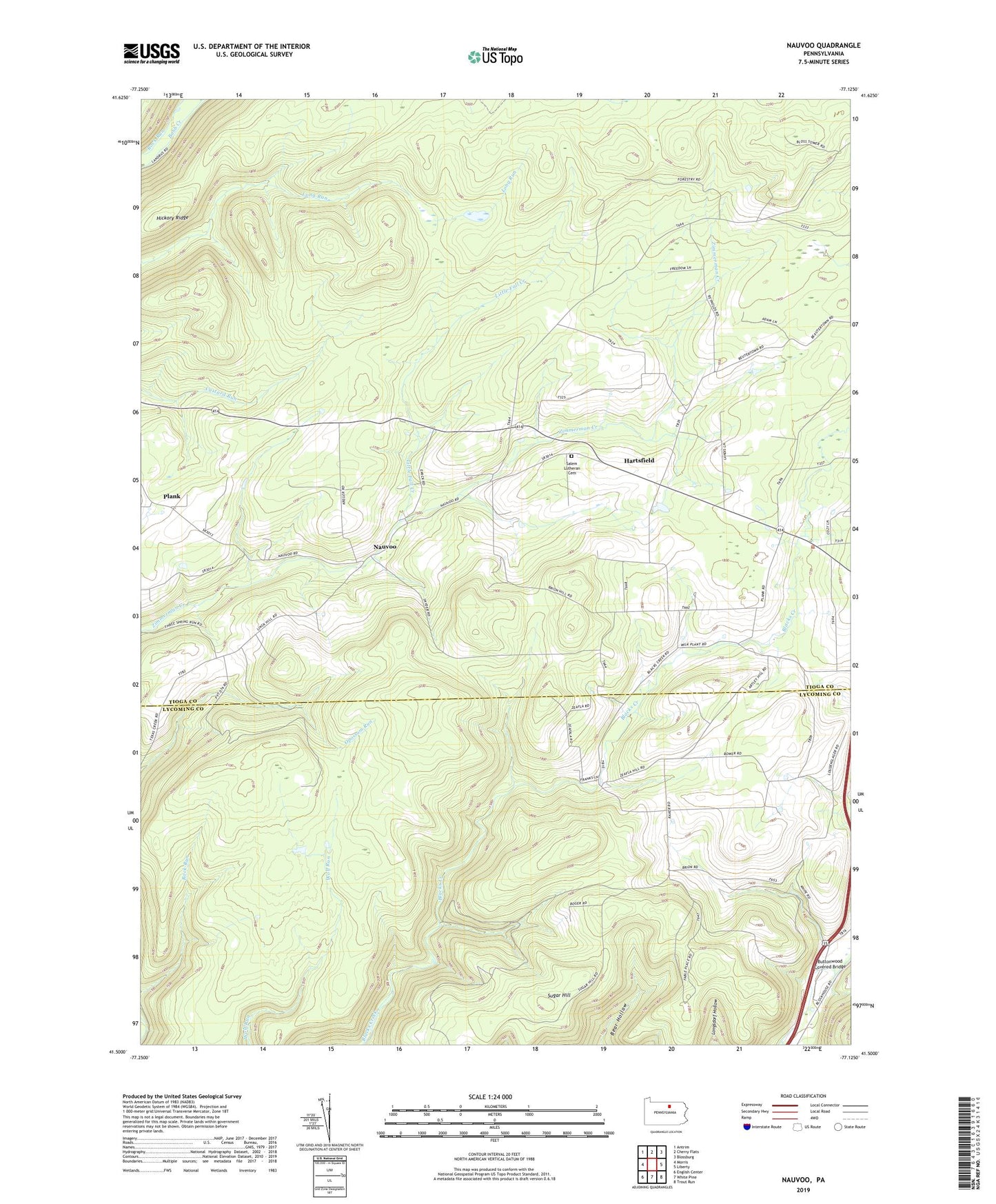
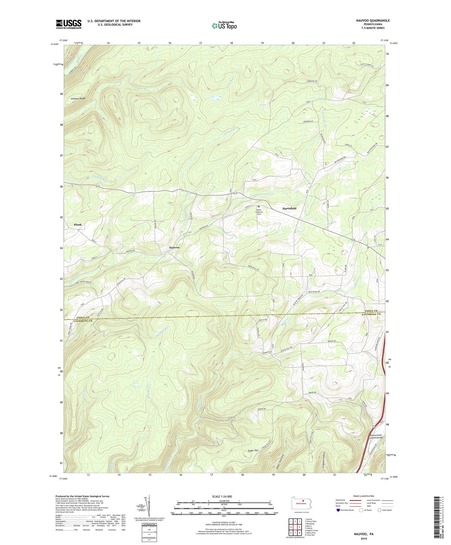
2019 topographic map quadrangle Nauvoo in the state of Pennsylvania. Scale: 1:24000. Based on the newly updated USGS 7.5' US Topo map series, this map is in the following counties: Tioga, Lycoming. The map contains contour data, water features, and other items you are used to seeing on USGS maps, but also has updated roads and other features. This is the next generation of topographic maps. Printed on high-quality waterproof paper with UV fade-resistant inks.
Quads adjacent to this one:
West: Morris
Northwest: Antrim
North: Cherry Flats
Northeast: Blossburg
East: Liberty
Southeast: Trout Run
South: White Pine
Southwest: English Center
Contains the following named places: Beuter School, Beuters Church, Blacks Mill, Bloss Lookout Tower, Bloss Mountain Trail, Buttonwood Covered Bridge, Hartsfield, Hickory Ridge, Hickory Ridge Trail, Link School, Little Fall Creek, Nauvoo, Plank, Plank School, Reed School, Salem Church, Salem Lutheran Cemetery, Schoolhouse Run, Sugar Hill, ZIP Code: 16930