MyTopo
Blossburg Pennsylvania US Topo Map
Couldn't load pickup availability
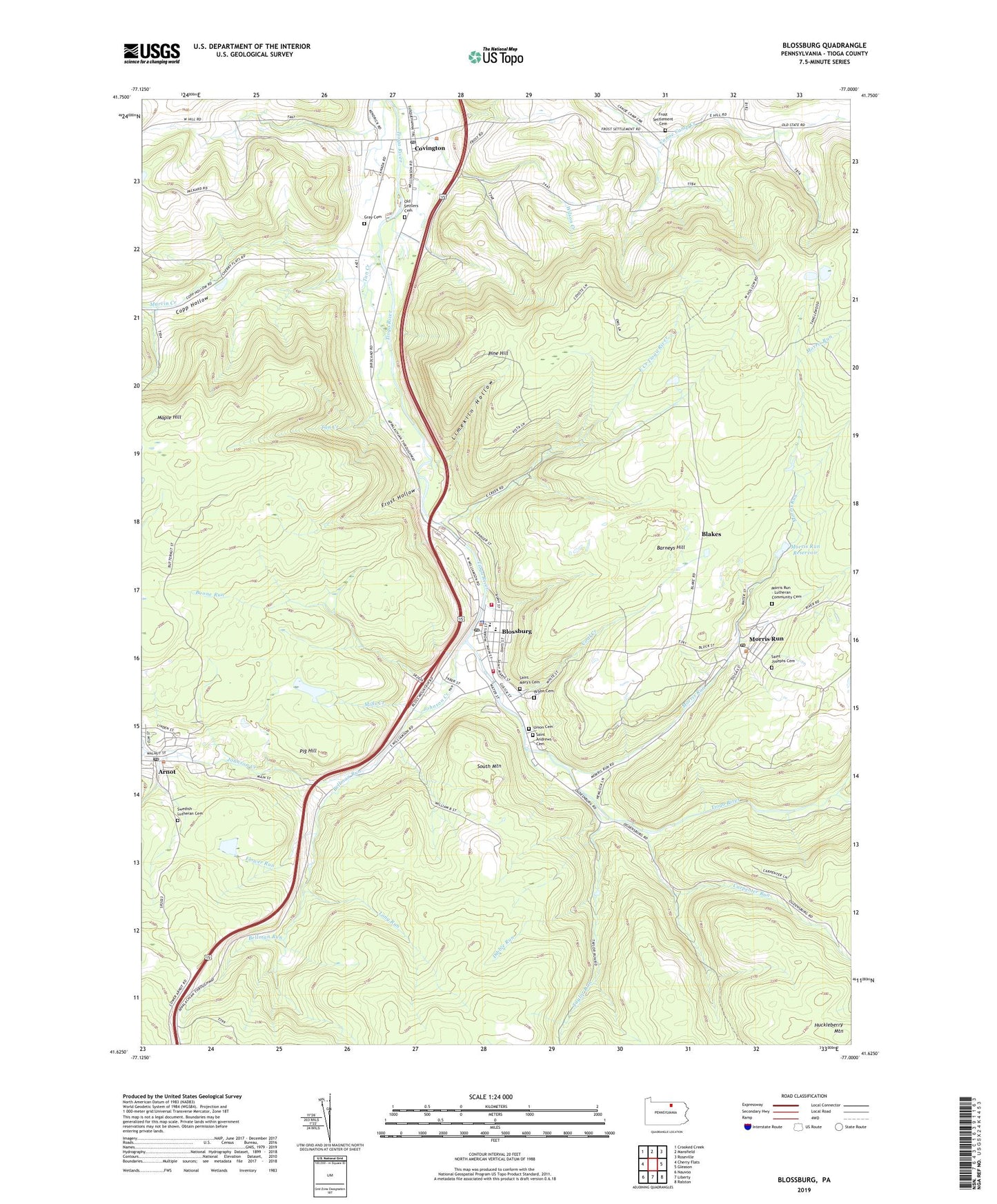
2023 topographic map quadrangle Blossburg in the state of Pennsylvania. Scale: 1:24000. Based on the newly updated USGS 7.5' US Topo map series, this map is in the following counties: Tioga. The map contains contour data, water features, and other items you are used to seeing on USGS maps, but also has updated roads and other features. This is the next generation of topographic maps. Printed on high-quality waterproof paper with UV fade-resistant inks.
Quads adjacent to this one:
West: Cherry Flats
Northwest: Crooked Creek
North: Mansfield
Northeast: Roseville
East: Gleason
Southeast: Ralston
South: Liberty
Southwest: Nauvoo
This map covers the same area as the classic USGS quad with code o41077f1.
Contains the following named places: Arbon Cemetery, Arnot, Arnot Census Designated Place, Arnot Post Office, Baity School, Barneys Hill, Bear Creek, Bellman Run, Blakes, Blossburg, Blossburg City Police Department, Blossburg Firemens Ambulance Association, Blossburg Post Office, Blossburg Volunteer Fire Department, Boone Run, Borough of Blossburg, Carpenter Run, Coal Creek, Copp Hollow, Covington, Covington Post Office, Dibble Run, East Creek Tioga River, Fall Brook, Flower Run, Frost Hollow, Frost Settlement Cemetery, Gray Cemetery, Helen Lutes Softball Field, Huckleberry Mountain, Johnson Creek, Limekiln Hollow, Long Run, Marvin Creek, Mills Creek, Morris Run, Morris Run Cemetery, Morris Run Mine Dam Number Three, Morris Run Post Office, Morris Run Reservoir, Old Settlers Cemetery, Pig Hill, Pig Hill Trail, Pine Hill, President's House - Mansfield University, Saint Andrews Cemetery, Saint Josephs Cemetery, Saint Mary's Cemetery, Sawmill Creek, South Mountain, Swedish Lutheran Cemetery, Tan Creek, Taylor Run, Township of Covington, Township of Hamilton, Township of Putnam, Union Cemetery, Wilson Creek, ZIP Codes: 16912, 16917, 16939