MyTopo
Trout Run Pennsylvania US Topo Map
Couldn't load pickup availability
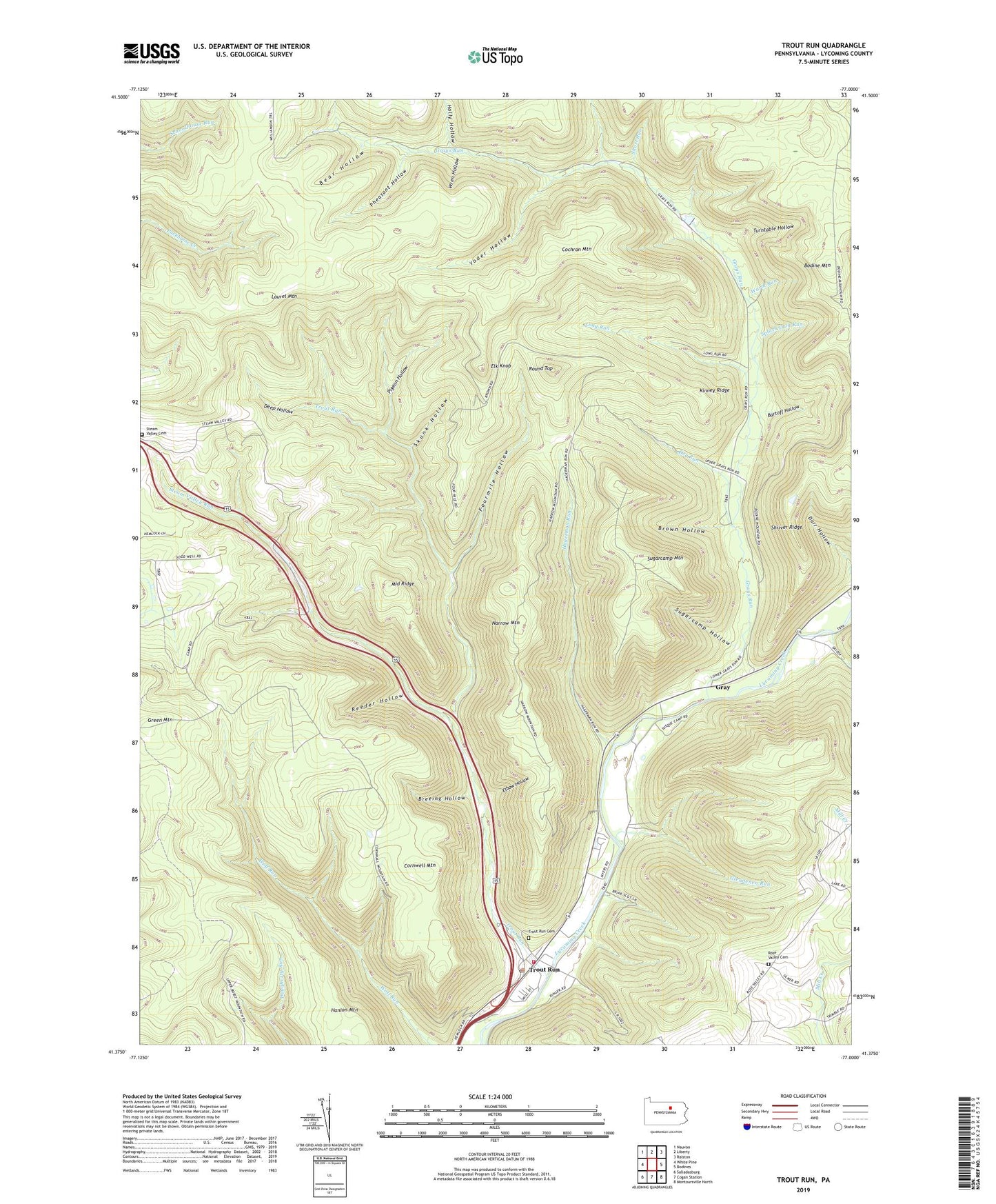
2023 topographic map quadrangle Trout Run in the state of Pennsylvania. Scale: 1:24000. Based on the newly updated USGS 7.5' US Topo map series, this map is in the following counties: Lycoming. The map contains contour data, water features, and other items you are used to seeing on USGS maps, but also has updated roads and other features. This is the next generation of topographic maps. Printed on high-quality waterproof paper with UV fade-resistant inks.
Quads adjacent to this one:
West: White Pine
Northwest: Nauvoo
North: Liberty
Northeast: Ralston
East: Bodines
Southeast: Montoursville North
South: Cogan Station
Southwest: Salladasburg
This map covers the same area as the classic USGS quad with code o41077d1.
Contains the following named places: Bartoff Hollow, Bear Hollow, Bodine Mountain, Bodine Mountain Overlook, Breeing Hollow, Brown Hollow, Caldwell, Cochran Mountain, Cornwell Mountain, Deep Hollow, Dry Run, Elbow Hollow, Elk Knob, Elk Knob Vista, Fields Station, Fourmile Hollow, Glendenen Run, Gray, Grays Run, Green Mountain, Hagerman Run, Holly Hollow, Kinney Ridge, Laurel Mountain, Lewis Township Elementary School, Long Run, Lycoming Club, Middle Ridge, Narrow Mountain, Pheasant Hollow, Pigeon Hollow, Reeder Hollow, Rose Valley Cemetery, Rose Valley Church, Rose Valley School, Round Top, Shoemaker Run, Short Run, Shriver Ridge, Skunk Hollow, Splash Dam Run, State Game Lands Number 133, Steam Valley Cemetery, Steam Valley Church, Steam Valley Run, Sugarcamp Hollow, Sugarcamp Mountain, Township of Lewis, Trout Run, Trout Run Cemetery, Trout Run Post Office, Trout Run Volunteer Fire Company Station 16, Turntable Hollow, Warm Run, Wren Hollow, Yoder Hollow, ZIP Code: 17771