MyTopo
Majorsville West Virginia US Topo Map
Couldn't load pickup availability
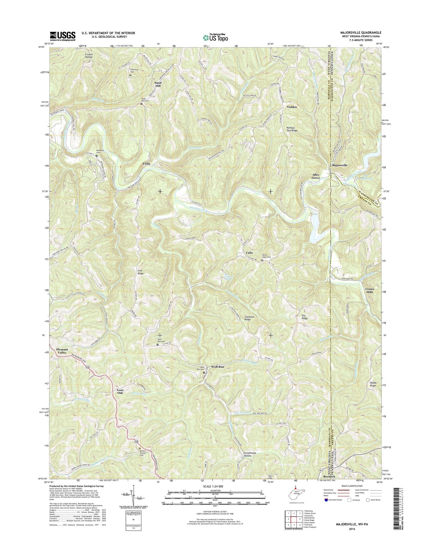
2023 topographic map quadrangle Majorsville in the states of West Virginia, Pennsylvania. Scale: 1:24000. Based on the newly updated USGS 7.5' US Topo map series, this map is in the following counties: Marshall, Greene, Washington. The map contains contour data, water features, and other items you are used to seeing on USGS maps, but also has updated roads and other features. This is the next generation of topographic maps. Printed on high-quality waterproof paper with UV fade-resistant inks.
Quads adjacent to this one:
West: Moundsville
Northwest: Wheeling
North: Valley Grove
Northeast: Claysville
East: Wind Ridge
Southeast: New Freeport
South: Cameron
Southwest: Glen Easton
This map covers the same area as the classic USGS quad with code o39080h5.
Contains the following named places: Alley Grove, Alley-Majorsville School, Bee Tree Run, Beelers Station, Beelers Station Cemetery, Beelers Station Christian Church, Beelers Station School, Big Run, Browns Run, Bruce Run, Burch Run, Burch Run Lake Dam, Calis, Cedar Rock-Pone Ridge School, Chaney Run, Chestnut Ridge, Cross Roads School, Crow Family Cemetery, Crows Mills, District 1, Dodds Ridge, Dreamer Cemetery, Dry Ridge, Dunkard Fork, Earlywine Cemetery, Enlow Fork, Golden, Golden Number 2 School, Granny Run, Greathouse Hollow, Green Point School, Harshs Sugar Camp, Hazel Green School, Howard Run, Irish Ridge, Irish Ridge-Hazel Dell School, Line Run-Dague School, Lone Oak, Lone Oak School, Lower Sand Hill School, Majorsville, McCreary Cemetery, Mount Clair-Chestnut Ridge School, Mount Hope Cemetery, Mount Hope Community Center, Mount Hope School, Mount Hope United Methodist Church, New Vrindaban, Number Two Ridge, Oak Dale School, Pa-647 Dam, Pa-647 Reservoir, Pleasant Valley Community Center, Pleasant Valley School, Ray Williams Spring, Robinson Fork, Rosenberger School, Salem Church, Sand Hill, Sand Hill Cemetery, Sand Hill United Methodist Church, Spottedtail Run, Stone Coal Run, Stony Battle School, Stull Run, Turkey Run, Upper Wolf Run Presbyterian Church, Upper Wolf Run School, Viola, Viola School, Wharton Run, Wheeling Creek Structure 23 Dam, Wheeling Creek Structure 25 Dam, Whetstone Run, Williams Run, Wolf Run, Wolf Run Baptist Church, Wolf Run Cemetery, ZIP Code: 26036