
MyTopo
Orwigsburg Pennsylvania US Topo Map
Couldn't load pickup availability
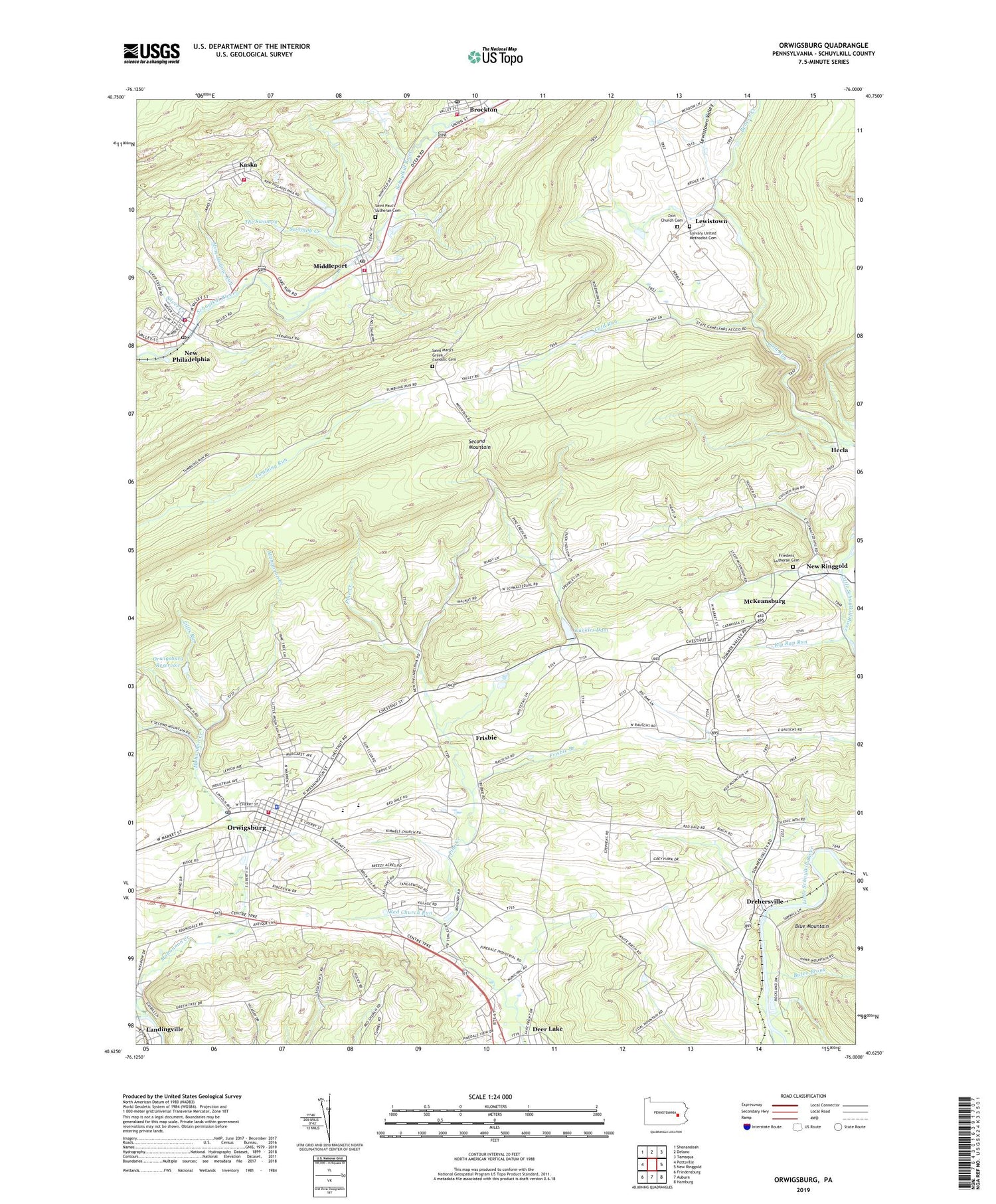
2023 topographic map quadrangle Orwigsburg in the state of Pennsylvania. Scale: 1:24000. Based on the newly updated USGS 7.5' US Topo map series, this map is in the following counties: Schuylkill. The map contains contour data, water features, and other items you are used to seeing on USGS maps, but also has updated roads and other features. This is the next generation of topographic maps. Printed on high-quality waterproof paper with UV fade-resistant inks.
Quads adjacent to this one:
West: Pottsville
Northwest: Shenandoah
North: Delano
Northeast: Tamaqua
East: New Ringgold
Southeast: Hamburg
South: Auburn
Southwest: Friedensburg
This map covers the same area as the classic USGS quad with code o40076f1.
Contains the following named places: Beaver Creek, Bethel Church, Big Creek, Black Run, Blue Mountain East Elementary School, Blue Mountain Middle School, Borough of Landingville, Borough of Middleport, Borough of New Philadelphia, Borough of Orwigsburg, Breiner School, Brockton, Brockton Post Office, Brockton Volunteer Fire Company District 27 Station 1, Buteo Brook, Calvary United Methodist Cemetery, Citizens Fire Company District 51 Station 1, Cold Run, Deer Lake, Drehersville, Ellis Creek, Friedens Lutheran Cemetery, Frisbie, Frisbie Branch, Good Intent Fire Company District 54 Station 1, Hecla, Heisler Egg Farm, Kaska, Kaska Volunteer Fire Company District 2 Station 1, Kunkles Dam, Landingville, Lewistown, Lewistown Valley, Lower Dam, Mahannon Creek, Mahonney Creek, McKeansburg, McKeansburg Census Designated Place, Middleport, Middleport Post Office, Mine Hollow Run, Morgan Run, Neon Airport, New Philadelphia, New Philadelphia Police Department, New Philadelphia Post Office, Orwigsburg, Orwigsburg Borough Police Department, Orwigsburg Fire Department District 56 Station 1, Orwigsburg Post Office, Orwigsburg Reservoir, Pinedale, Pinedale School, Red Church Run, Rip Rap Run, Ruffs Run, Saint Mary's Greek Catholic Cemetery, Saint Paul's Lutheran Cemetery, Schuykill Emergency Medical Services - Orwigsburg, Silfis Run, Silver Creek, State Game Lands Number 222, Stevens School, Swampy Creek, The Swampy, Township of Walker, Township of West Brunswick, Tucker Hill, Yost Dam, Zion Church Cemetery, Zion United Church of Christ, ZIP Codes: 17930, 17961


