MyTopo
Portland Pennsylvania US Topo Map
Couldn't load pickup availability
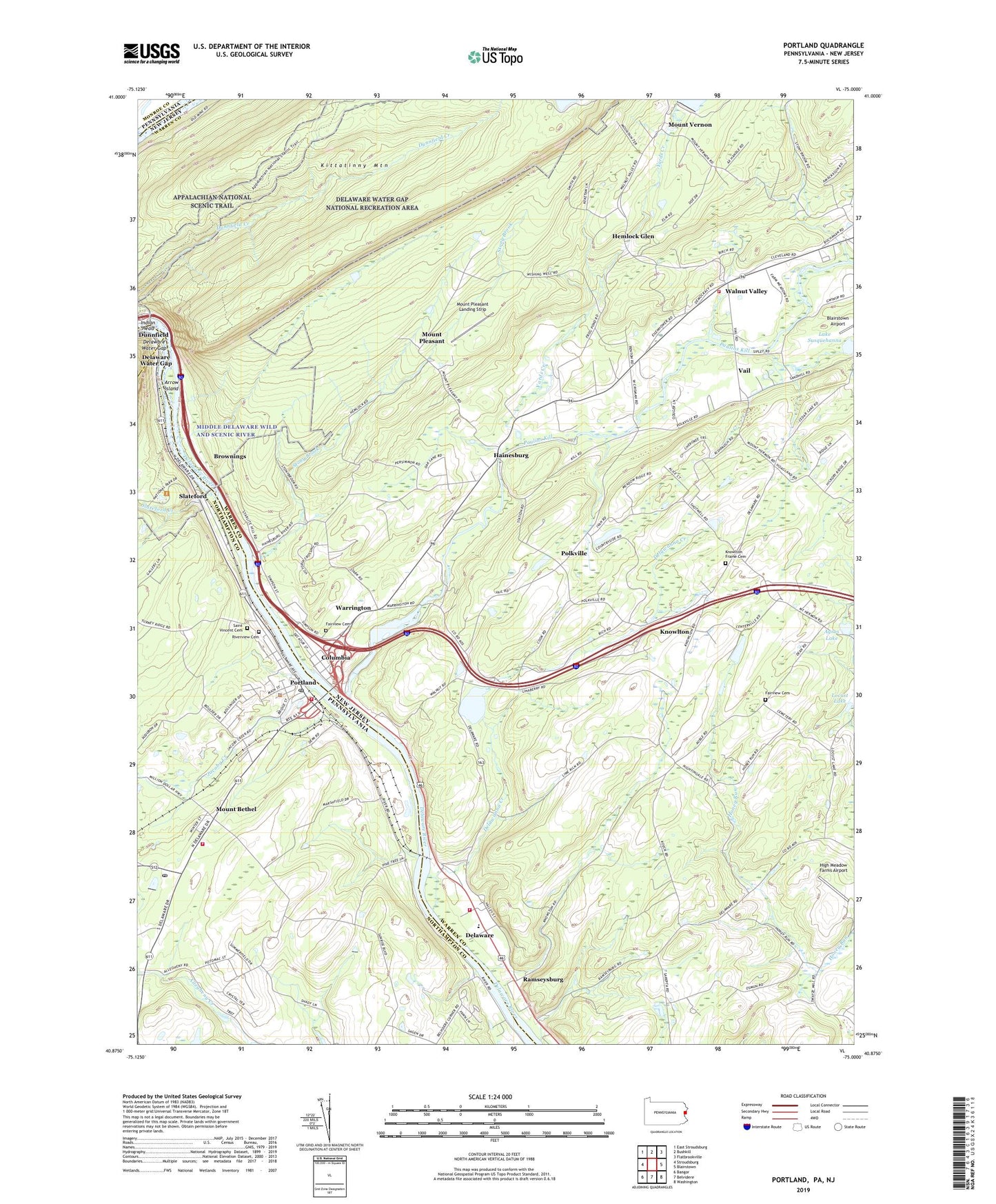
2023 topographic map quadrangle Portland in the states of New Jersey, Pennsylvania. Scale: 1:24000. Based on the newly updated USGS 7.5' US Topo map series, this map is in the following counties: Northampton, Warren, Monroe. The map contains contour data, water features, and other items you are used to seeing on USGS maps, but also has updated roads and other features. This is the next generation of topographic maps. Printed on high-quality waterproof paper with UV fade-resistant inks.
Quads adjacent to this one:
West: Stroudsburg
Northwest: East Stroudsburg
North: Bushkill
Northeast: Flatbrookville
East: Blairstown
Southeast: Washington
South: Belvidere
Southwest: Bangor
This map covers the same area as the classic USGS quad with code o40075h1.
Contains the following named places: Agros Lake, Alice Lake Dam, Arrow Island, Borough of Portland, Brownings, Camp Kimikomuk, Camp Mohican, Camp Weygadt, Columbia, Columbia Census Designated Place, Columbia Dam, Columbia Lake, Columbia Post Office, Deckers Ferry, Delawanna Creek, Delaware, Delaware Census Designated Place, Delaware Lake, Delaware Lake Dam, Delaware Post Office, Delaware Water Gap, Dills Ferry, Dunnfield, Eagle Nest Farm Camp, Fairview Cemetery, Hainesburg, Hainesburg Census Designated Place, Hainesburg Station, Hemlock Glen, High Meadow Farms Airport, Hill Yard, Indian Head, Jacoby Creek, Knowlton, Knowlton Frame Cemetery, Knowlton Township Fire and Rescue Company 1, Locust Lake, Locust Lake Dam, Lower Reservoir Dam, Marshfield Station, Mount Bethel, Mount Bethel Fire Company Station 37, Mount Bethel Post Office, Mount Pleasant, Mount Pleasant Landing Strip, Mount Tammany, Mount Vernon, Myeres Ferry, Paulins Kill, Polkville, Portland, Portland Hook and Ladder Company Station 33, Portland Post Office, Ramseysburg, Riverview Cemetery, Rocco Bunino Dam, Saint James Church, Saint Vincent Cemetery, Slateford, Slateford Creek, Stony Brook, Township of Knowlton, Vail, Vail School, Walnut Valley, Walnut Valley Firehouse, Warrington, Worthington State Forest, Yards Creek, ZIP Codes: 07832, 07833, 18343, 18351


