MyTopo
Pottersdale Pennsylvania US Topo Map
Couldn't load pickup availability
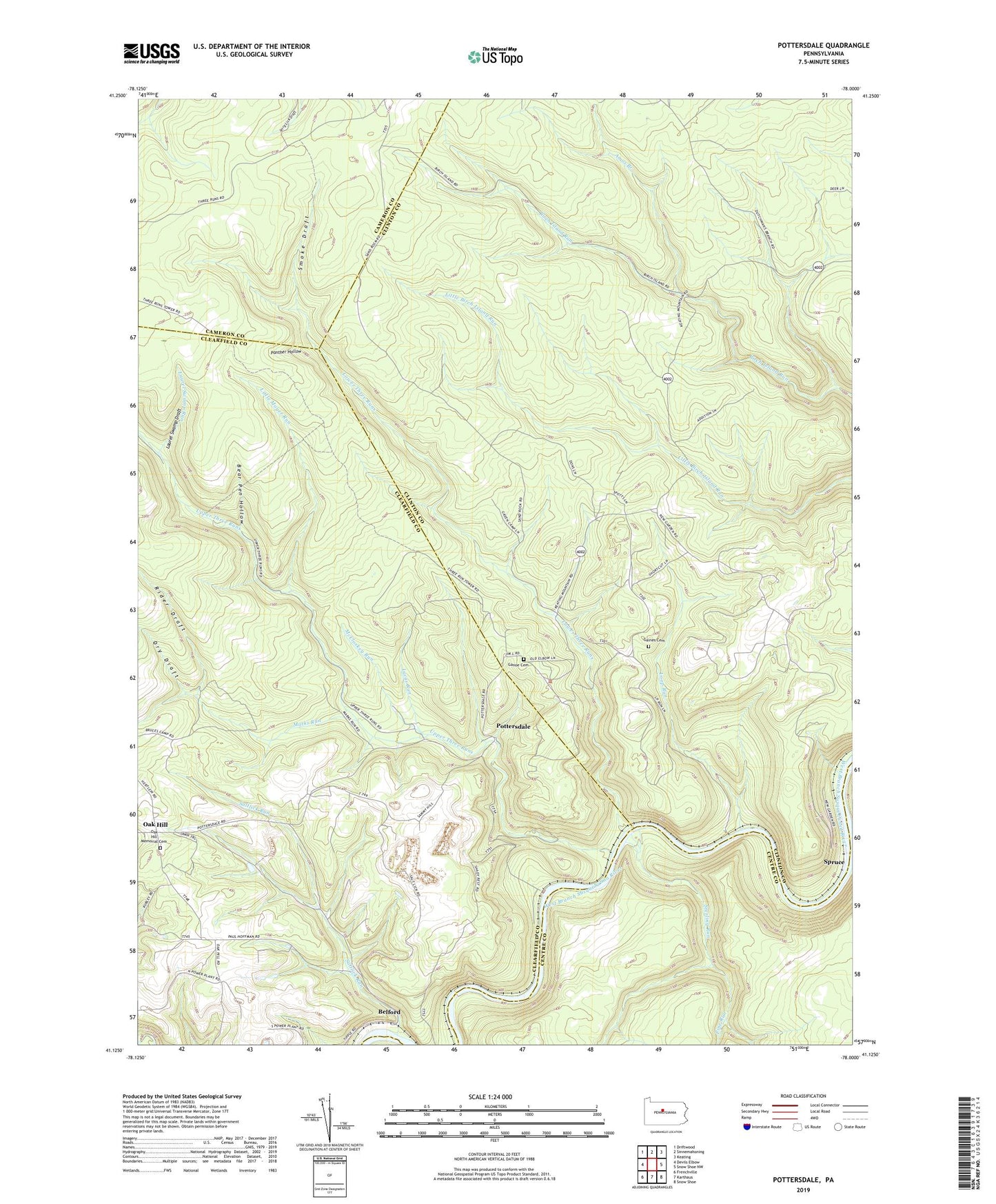
2019 topographic map quadrangle Pottersdale in the state of Pennsylvania. Scale: 1:24000. Based on the newly updated USGS 7.5' US Topo map series, this map is in the following counties: Clinton, Clearfield, Centre, Cameron. The map contains contour data, water features, and other items you are used to seeing on USGS maps, but also has updated roads and other features. This is the next generation of topographic maps. Printed on high-quality waterproof paper with UV fade-resistant inks.
Quads adjacent to this one:
West: Devils Elbow
Northwest: Driftwood
North: Sinnemahoning
Northeast: Keating
East: Snow Shoe NW
Southeast: Snow Shoe
South: Karthaus
Southwest: Frenchville
Contains the following named places: Amos Branch, Amos Branch Trail, Amos Ridge Trail, Bear Pen Hollow, Belford, Brown Trail, Cataract, Cataract School, Chestnut Ridge Camp, Coleman Siding, Cut Off Trail, Dry Draft, Dutchmans Trail, Gaines Cemetery, Ganoe Cemetery, J E Hoffman Number Three Mine Refuse Bank Dam, Juneberry Trail, Laurel Swamp Draft, Laurel Swamp Run, Laurel Swamp Trail, Little Moyer Run, Loop Run, Lower Three Runs, Lucas Run, Marks Run, McCloskey Run, Nelson Trail, New Garden School, Number Three Trail, Oak Hill, Oak Hill Church, Oak Hill Memorial Cemetery, Oak Hill School, Panther Hollow, Perry Moshannon Mine, Pine Run, Pottersdale, Rider Draft, Saltlick Run, Smoke Draft, Spruce, Sterling Run, Three Runs Lookout Tower, Township of Karthaus, Township of West Keating, Upper Three Runs, ZIP Code: 16871