MyTopo
Keating Pennsylvania US Topo Map
Couldn't load pickup availability
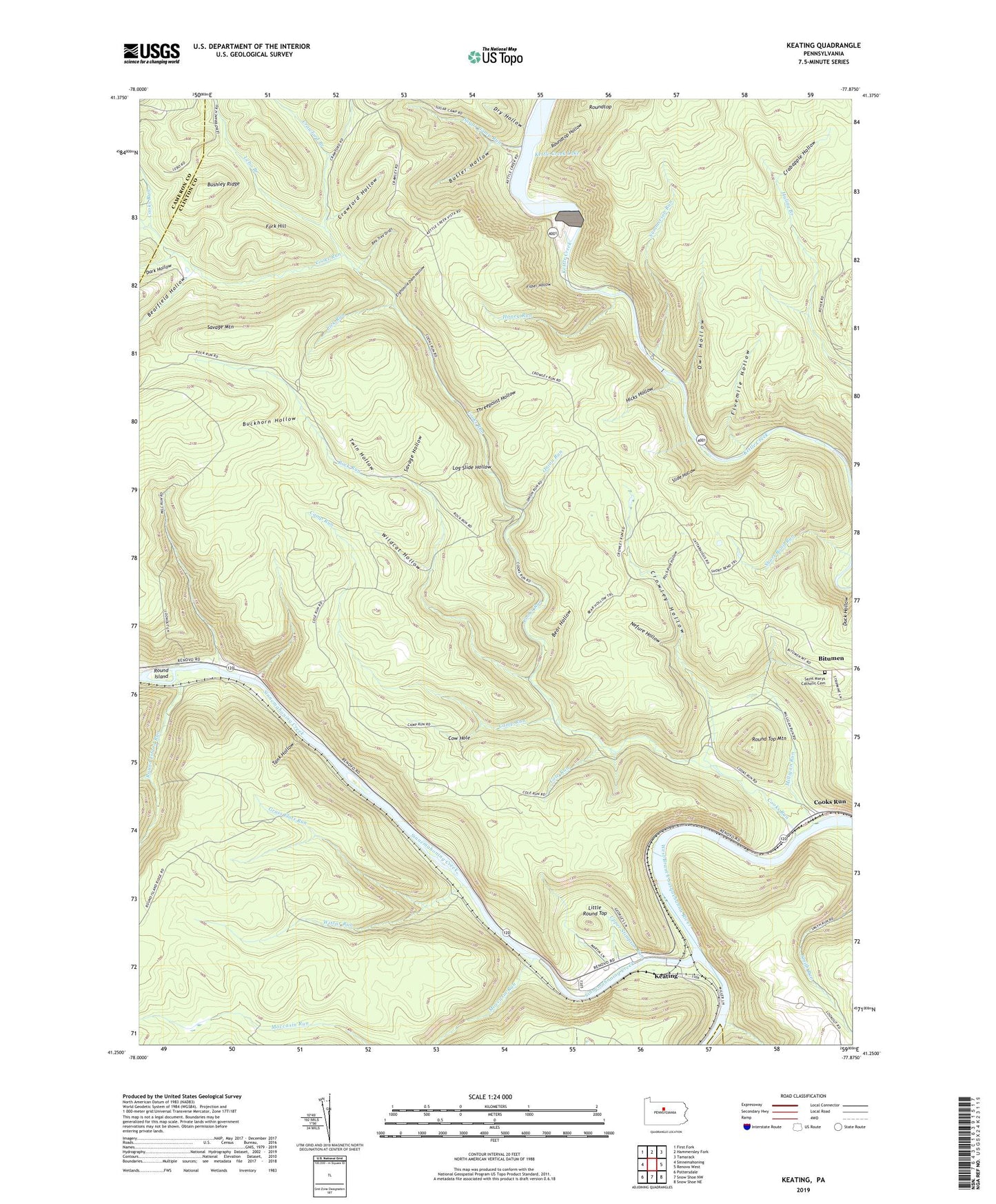
2023 topographic map quadrangle Keating in the state of Pennsylvania. Scale: 1:24000. Based on the newly updated USGS 7.5' US Topo map series, this map is in the following counties: Clinton, Cameron, Centre. The map contains contour data, water features, and other items you are used to seeing on USGS maps, but also has updated roads and other features. This is the next generation of topographic maps. Printed on high-quality waterproof paper with UV fade-resistant inks.
Quads adjacent to this one:
West: Sinnemahoning
Northwest: First Fork
North: Hammersley Fork
Northeast: Tamarack
East: Renovo West
Southeast: Snow Shoe NE
South: Snow Shoe NW
Southwest: Pottersdale
This map covers the same area as the classic USGS quad with code o41077c8.
Contains the following named places: Bear Hollow, Bearfield Hollow, Bechtel Trail, Bee Tree Draft, Beer Hollow Trail, Bitumen, Brink Hollow Trail, Buckhorn Hollow, Buckhorn Trail, Bucktail State Park Natural Area, Bushley Ridge, Butler Hollow, Butler Trail, Camp Run, Cole Run, Commissioner Run Trail, Commissioners Run, Cook Run, Cooks Run, Cooks Run Trail, Cow Hole, Crabapple Hollow, Crawford Branch, Crawford Hollow, Crowley Hollow, Crowley Trail, Dark Hollow, Daugherty Trail, Dry Hollow, Duck Hollow, Eightmile Dam Hollow, Fisher Hollow, Fivemile Hollow, Fork Hill, Grass Flats Run, Hicks Hollow, Honey Run, Huling Ridge Trail, Jacob Hollow, Jews Run, Keating, Kettle Creek Lake, Kettle Creek Lake Dam, Lebo Branch, Lick Run, Lick Run Trail, Little Round Top, Log Slide Hollow, Lookout Trail, Mill Run, Milligan Run, Mitchell Trail, Moccasin Run, Nefure Hollow, Onion Run, Owl Hollow, Owl Hollow Trail, Pitch Pine Hollow, Pitch Pine Trail, Rock Run, Round Island, Round Island Run, Round Top Mountain, Roundtop, Roundtop Hollow, Saint Marys Catholic Cemetery, Savage Hollow, Savage Mountain, Savage Trail, Sinnemahoning Creek, Slide Hollow, Smiths Run Trail, Sugar Camp Run, Summerson Run, Tank Hollow, Threepoint Hollow, Threepoint Hollow Trail, Township of East Keating, Twin Hollow, Upper Stimpson Run, Wildcat Hollow, Wildcat Trail, Wistar Run, ZIP Code: 17778