MyTopo
Prosperity Pennsylvania US Topo Map
Couldn't load pickup availability
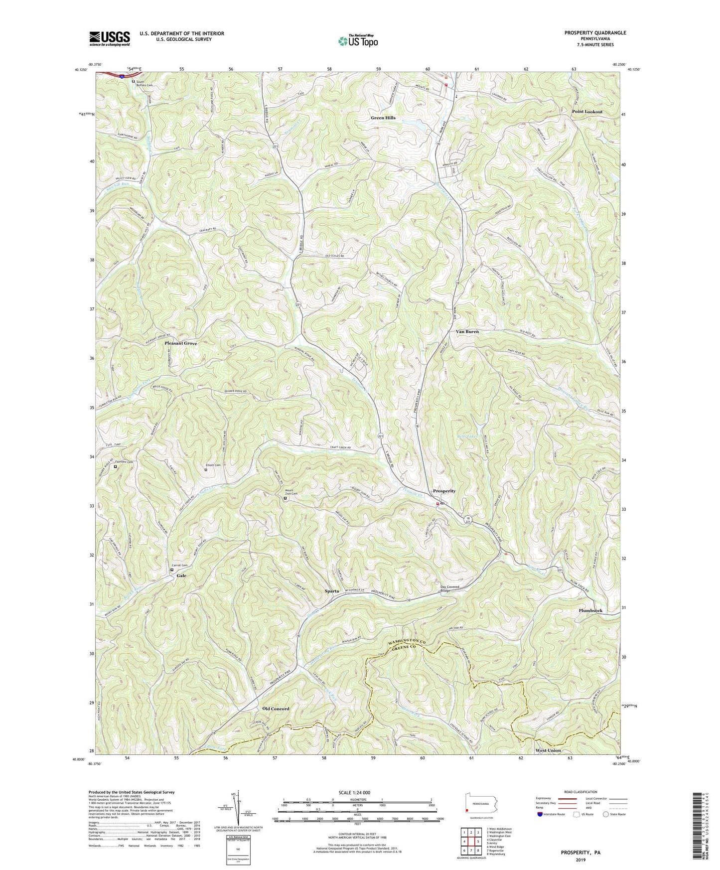
2023 topographic map quadrangle Prosperity in the state of Pennsylvania. Scale: 1:24000. Based on the newly updated USGS 7.5' US Topo map series, this map is in the following counties: Washington, Greene. The map contains contour data, water features, and other items you are used to seeing on USGS maps, but also has updated roads and other features. This is the next generation of topographic maps. Printed on high-quality waterproof paper with UV fade-resistant inks.
Quads adjacent to this one:
West: Claysville
Northwest: West Middletown
North: Washington West
Northeast: Washington East
East: Amity
Southeast: Waynesburg
South: Rogersville
Southwest: Wind Ridge
This map covers the same area as the classic USGS quad with code o40080a3.
Contains the following named places: Bells Lakes, Bethel Church, Borough of Green Hills, Camp Adelawan, Carroll Cemetery, Crafts Creek, Day Covered Bridge, Elliott Cemetery, Enlow Fork Mine, Fairview Cemetery, Gale, Green Hills, Hamestring Run, Jameson Memorial Hospital Heliport, Joint School, Lagonda, Lick Run, Lindley Schoolhouse, Lone Pine Golf Course, Morris Township Volunteer Fire Department Station 42, Mount Zion Cemetery, Neal Dam, Neal Lake, Old Concord, Pleasant Grove, Plumbsock, Point Lookout, Prosperity, Prosperity Post Office, Sawhill Run, Short Creek, South Buffalo Cemetery, South Franklin Township Municipal Building, South Franklin Volunteer Fire Department Station 32, Sparta, Sparta Post Office, Township of Morris, Township of South Franklin, Upper Tenmile Church, Van Buren, Van Buren Post Office, West Union, Wilson Schoolhouse, ZIP Code: 15329