MyTopo
Keating Summit Pennsylvania US Topo Map
Couldn't load pickup availability
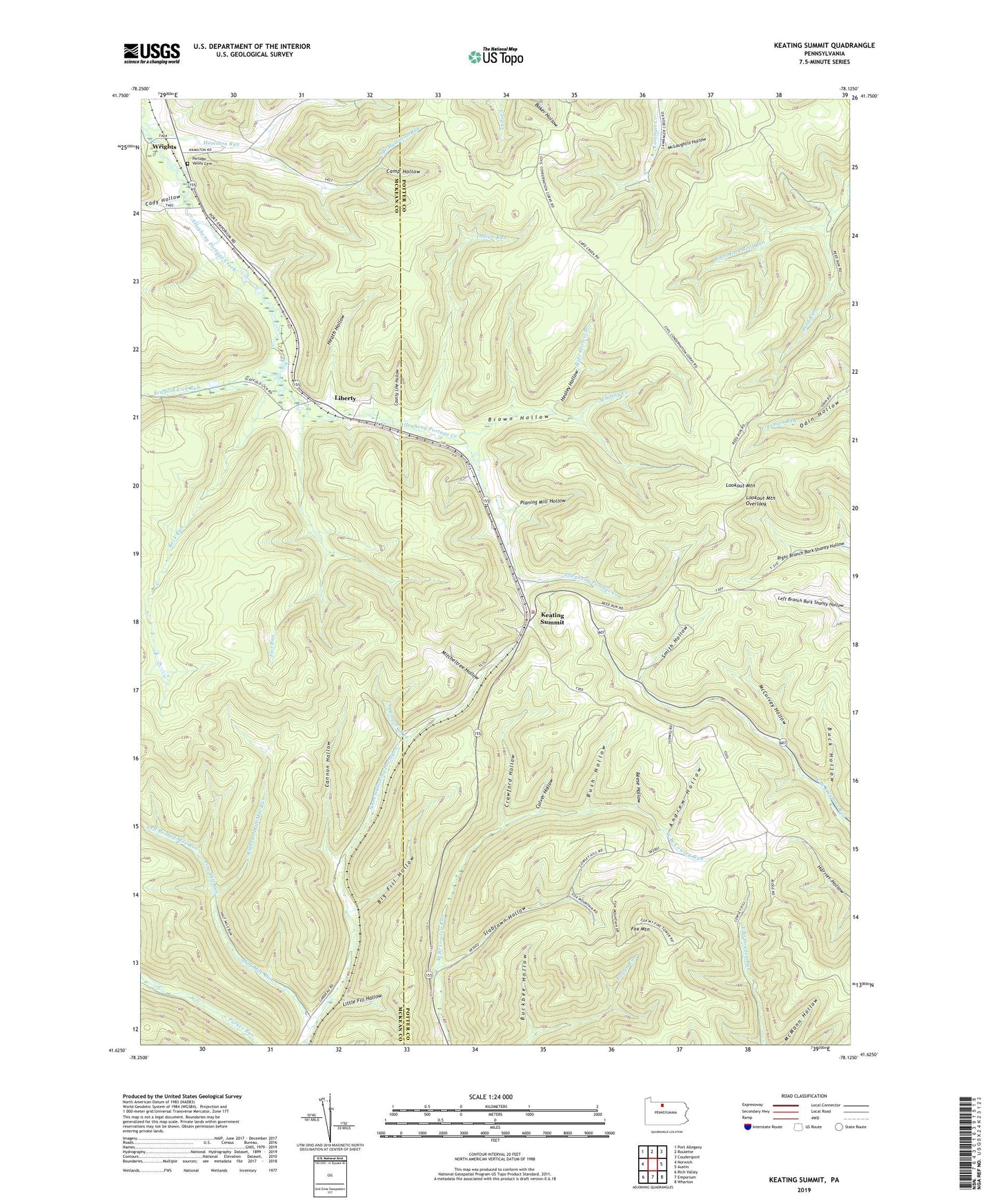
2023 topographic map quadrangle Keating Summit in the state of Pennsylvania. Scale: 1:24000. Based on the newly updated USGS 7.5' US Topo map series, this map is in the following counties: Potter, McKean. The map contains contour data, water features, and other items you are used to seeing on USGS maps, but also has updated roads and other features. This is the next generation of topographic maps. Printed on high-quality waterproof paper with UV fade-resistant inks.
Quads adjacent to this one:
West: Norwich
Northwest: Port Allegany
North: Roulette
Northeast: Coudersport
East: Austin
Southeast: Wharton
South: Emporium
Southwest: Rich Valley
This map covers the same area as the classic USGS quad with code o41078f2.
Contains the following named places: Andrew Hollow, Big Fill Hollow, Brown Hollow, Brown Hollow Number 1 Trail, Brown Hollow Number 2 Trail, Brown Hollow Number 3 Trail, Buck Hollow, Buckbee Hollow, Bush Hollow, Cady Hollow, Camp Hollow, Cannon Hollow, County Line Hollow, Crawford Hollow, Culver Hollow, Dempsey Run, Fair Run, Fox Mountain, Fox Mountain Fire Tower, Half Mile Run, Hamilton Run, Healey Hollow, Heath Hollow, Indian Run, Keating Summit, Left Branch Half Mile Run, Liberty, Little Fill Hollow, Lookout Mountain, Lookout Mountain Overlook, McCurvey Hollow, McLaughlin Hollow, Mitcheltree Hollow, Planing Mill Hollow, Portage Creek, Portage Valley Cemetery, Reese Hollow, Right Branch Half Mile Run, Right Fork Reed Run, Rock Run, Scaffold Lick Run, Slabtown Hollow, Slide Hollow Branch, Smith Hollow, South Branch Hamilton Run, Township of Keating, Whiting Creek, Wrights