MyTopo
Sabula Pennsylvania US Topo Map
Couldn't load pickup availability
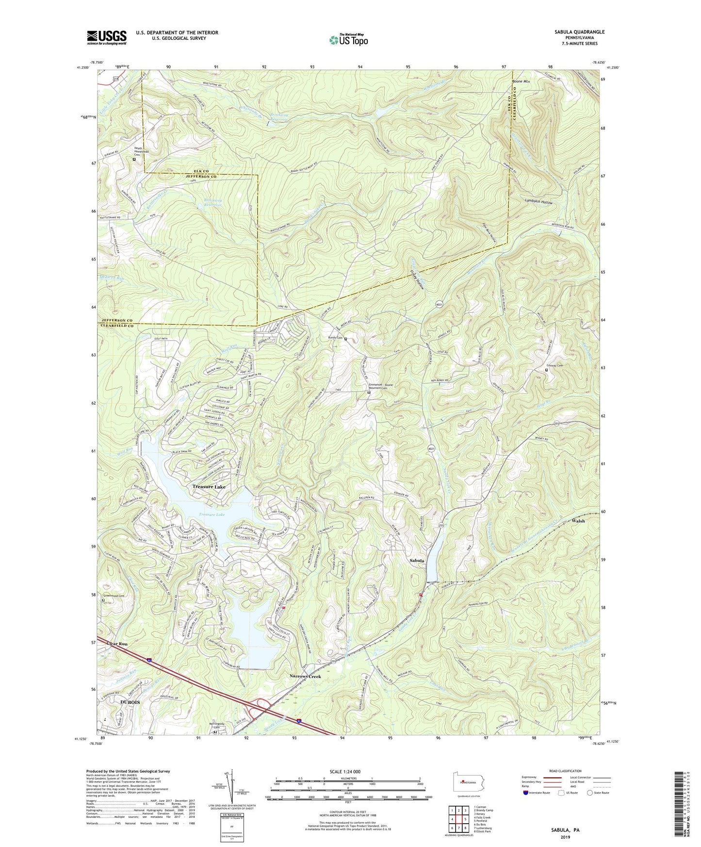
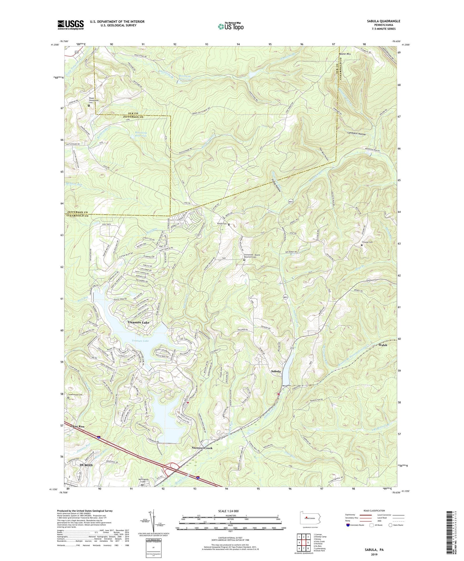
2019 topographic map quadrangle Sabula in the state of Pennsylvania. Scale: 1:24000. Based on the newly updated USGS 7.5' US Topo map series, this map is in the following counties: Clearfield, Elk, Jefferson. The map contains contour data, water features, and other items you are used to seeing on USGS maps, but also has updated roads and other features. This is the next generation of topographic maps. Printed on high-quality waterproof paper with UV fade-resistant inks.
Quads adjacent to this one:
West: Falls Creek
Northwest: Carman
North: Brandy Camp
Northeast: Kersey
East: Penfield
Southeast: Elliott Park
South: Luthersburg
Southwest: Du Bois
Contains the following named places: Boone Mountain, Boone Mountain Fire Tower, Brockway Reservoir, Browns School, Bundy Cemetery, Coal Run, Conway Cemetery, Emmanuel - Boone Mountain Cemetery, Finley Hollow, Free Methodist Church, Gravel Lick Dam, Greenwood Cemetery, Heath Homestead Cemetery, Hickory School, Hoyt Branch, Lake Sabula, Lambskin Hollow, McCracken Run, Morningside Cemetery, Mountain Lick Creek, Muddy Run, Narrows Creek, Pete Buck Hollow, Pine Grove School, Reformed Church, Sabula, Sabula Fire Company Station 39, Storage Dam, Township of Sandy, Treasure Lake, Treasure Lake Census Designated Place, Treasure Lake Volunteer Fire Company Station 35, Walsh, WDBA-FM (Du Bois), Whetstone Branch, ZIP Code: 15801