MyTopo
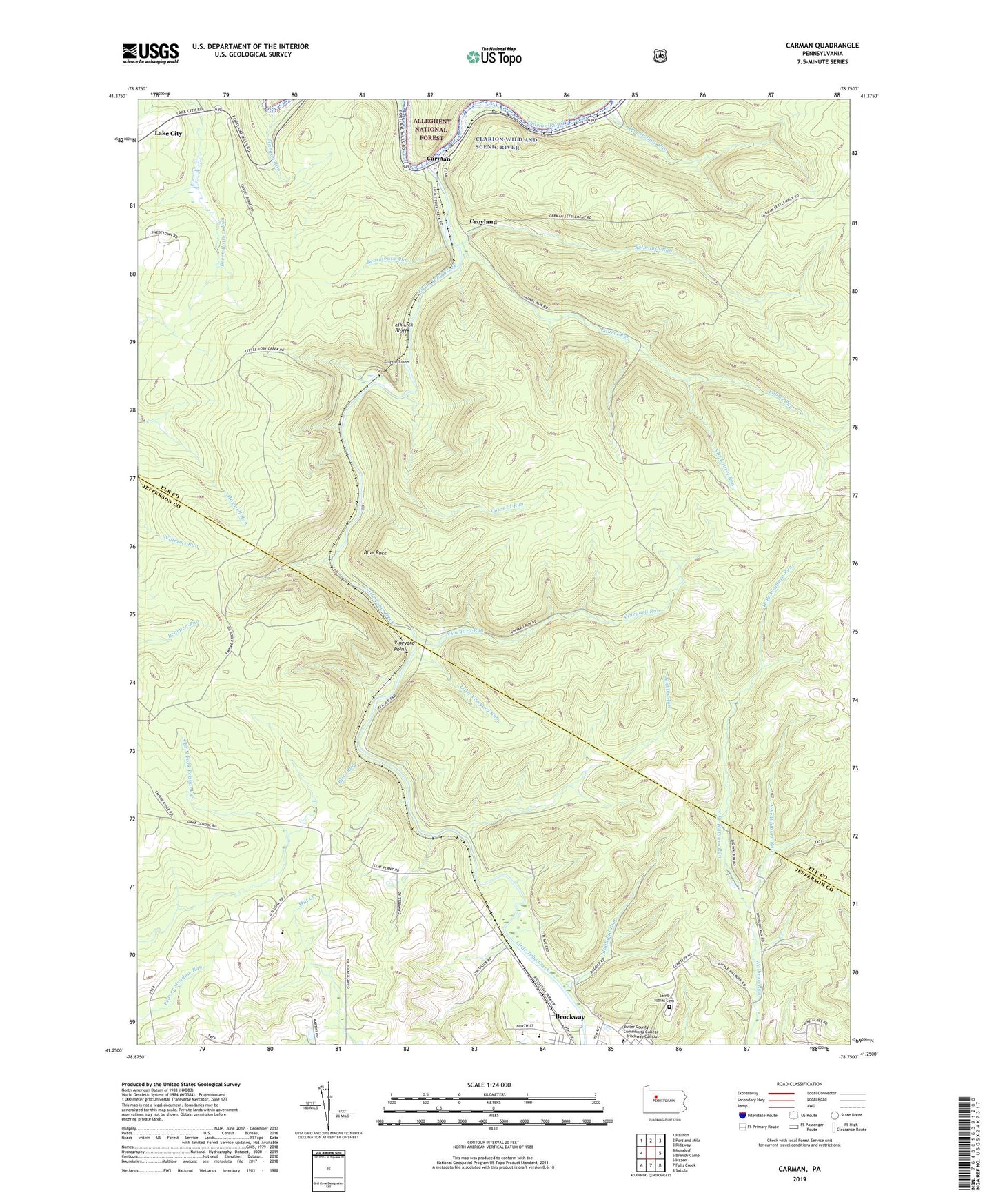
Carman Pennsylvania US Topo Map
Couldn't load pickup availability
Also explore the Carman Forest Service Topo of this same quad for updated USFS data
2023 topographic map quadrangle Carman in the state of Pennsylvania. Scale: 1:24000. Based on the newly updated USGS 7.5' US Topo map series, this map is in the following counties: Elk, Jefferson. The map contains contour data, water features, and other items you are used to seeing on USGS maps, but also has updated roads and other features. This is the next generation of topographic maps. Printed on high-quality waterproof paper with UV fade-resistant inks.
Quads adjacent to this one:
West: Munderf
Northwest: Hallton
North: Portland Mills
Northeast: Ridgway
East: Brandy Camp
Southeast: Sabula
South: Falls Creek
Southwest: Hazen
This map covers the same area as the classic USGS quad with code o41078c7.
Contains the following named places: Baghdad Run, Bearmouth Run, Belmouth Run, Bliss Run, Blue Rock, Carman, CCC Camp, Coward Run, Croyland, Dog Hollow Run, East Branch Walburn Run, Elk Lick Bluff, Empire Tunnel, Gillis Run, Indian Rock Trail, Jenkins Run, Laurel Run, Little Toby Creek, Little Vineyard Run, Mahood Run, Saint Tobias Cemetery, South Branch Laurel Run, State Game Lands Number 44, Tapawingo, Township of Snyder, Vineyard Point, Vineyard Run, West Branch Walburn Run, ZIP Code: 15824