MyTopo
Falls Creek Pennsylvania US Topo Map
Couldn't load pickup availability
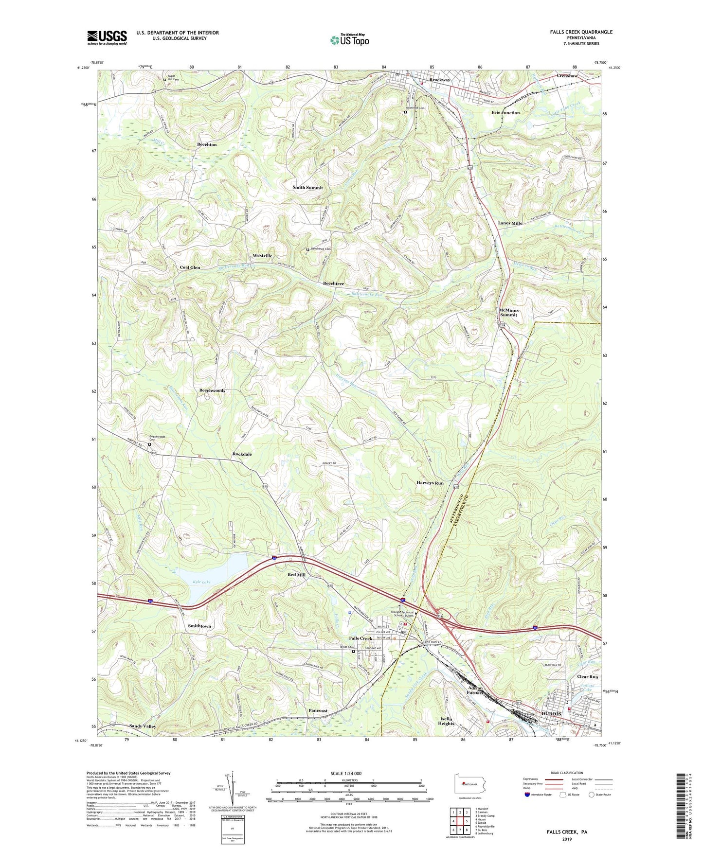
2023 topographic map quadrangle Falls Creek in the state of Pennsylvania. Scale: 1:24000. Based on the newly updated USGS 7.5' US Topo map series, this map is in the following counties: Jefferson, Clearfield. The map contains contour data, water features, and other items you are used to seeing on USGS maps, but also has updated roads and other features. This is the next generation of topographic maps. Printed on high-quality waterproof paper with UV fade-resistant inks.
Quads adjacent to this one:
West: Hazen
Northwest: Munderf
North: Carman
Northeast: Brandy Camp
East: Sabula
Southeast: Luthersburg
South: Du Bois
Southwest: Reynoldsville
This map covers the same area as the classic USGS quad with code o41078b7.
Contains the following named places: Adrian Furnace, Adrian Sandy Fire Company Station 38, Beaver Run, Beaverdam Run, Beechton, Beechtree, Beechtree Cemetery, Beechwoods, Beechwoods Cemetery, Beechwoods Schools, Borough of Brockway, Borough of Falls Creek, Brockway, Brockway Area Ambulance Service Station 10, Brockway Police Department, Brockway Post Office, Brockway Volunteer Hose Company - Station 1, Bywatler Landing Strip, Clear Run, Clear Run School, Coal Glen, Cravens, Crawford School, Crenshaw, Crenshaw Census Designated Place, Curry Run, Curry Run Camp, Detwood, Erie Junction, Falls Creek, Falls Creek Post Office, Falls Creek Volunteer Fire Department Station 4, Frost School, Groves School, Harveys Run, Iselin Heights, Juniata Elementary School, Juniata Lake, Kyle Lake, Kyle Run, Lanes Mills, McEwen Run, McMinns Summit, Miller School, Pancoast, Pennsylvania State Police Troop C DuBois Station, Pennsylvania State University Du Bois Campus, Rattlesnake Creek, Rattlesnake Run, Red Mill, Rockdale, Rockdale School, Sandy Plaza, Serect School, Sherwood Station, Slab Run, Smith Summit, Smithtown, Smithtown School, State Fish Lands, Sugar Hill Cemetery, Sugar Hill School, Taylor Cemetery, Third Ward Hose Company - John Edwards Dubois Hose Company Station 73, Township of Washington, Waite School, Walburn Run, WCED-AM (Du Bois), Westville, Wildwood Cemetery, Wolf Run, ZIP Code: 15840