MyTopo
Port Matilda Pennsylvania US Topo Map
Couldn't load pickup availability
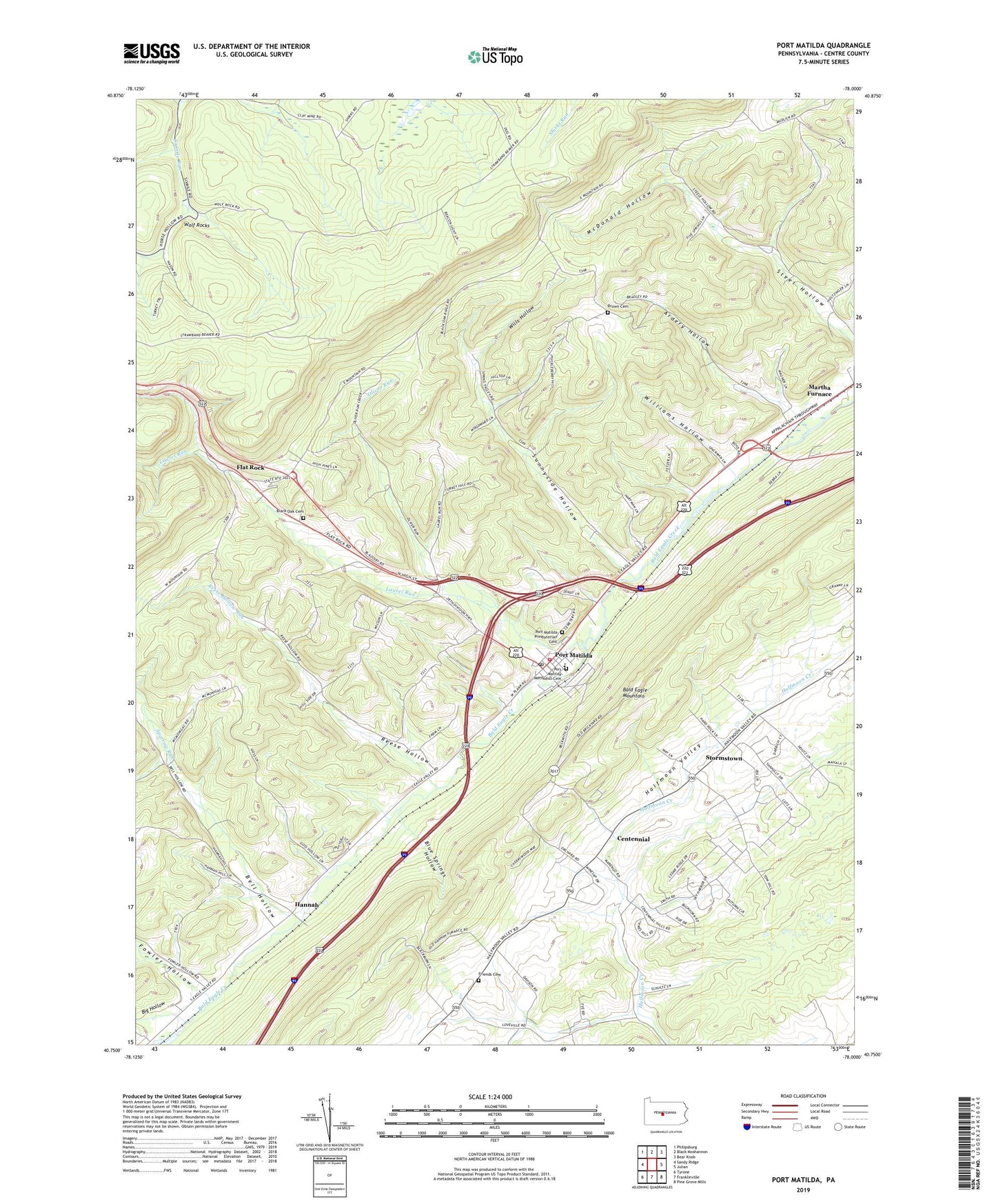
2023 topographic map quadrangle Port Matilda in the state of Pennsylvania. Scale: 1:24000. Based on the newly updated USGS 7.5' US Topo map series, this map is in the following counties: Centre. The map contains contour data, water features, and other items you are used to seeing on USGS maps, but also has updated roads and other features. This is the next generation of topographic maps. Printed on high-quality waterproof paper with UV fade-resistant inks.
Quads adjacent to this one:
West: Sandy Ridge
Northwest: Philipsburg
North: Black Moshannon
Northeast: Bear Knob
East: Julian
Southeast: Pine Grove Mills
South: Franklinville
Southwest: Tyrone
This map covers the same area as the classic USGS quad with code o40078g1.
Contains the following named places: Ardery Hollow, Bell Hollow, Big Hollow, Black Oak Cemetery, Black Oak School, Blackoak Church, Blue Springs Hollow, Borough of Port Matilda, Brown Cemetery, Campfield Trail, Centennial, Centennial School, Dayton Dam, Flat Rock, Fowler Hollow, Friends Cemetery, Halfmoon Valley, Hannah, Laurel Run, Martha Furnace, McDonald Hollow, Oliver Run, Port Matilda, Port Matilda Emergency Medical Services Company 27, Port Matilda Fire Company 15, Port Matilda Methodist Cemetery, Port Matilda Post Office, Port Matilda Presbyterian Cemetery, Reese Hollow, Reese Hollow Run, Sparrow Run, Stormstown, Stormstown Census Designated Place, Sunnyside Hollow, Township of Halfmoon, Township of Worth, Turkey Trail, Williams Hollow, Wills Hollow, Wolf Rocks, WTLR-FM (State College), ZIP Code: 16870