MyTopo
Shinglehouse Pennsylvania US Topo Map
Couldn't load pickup availability
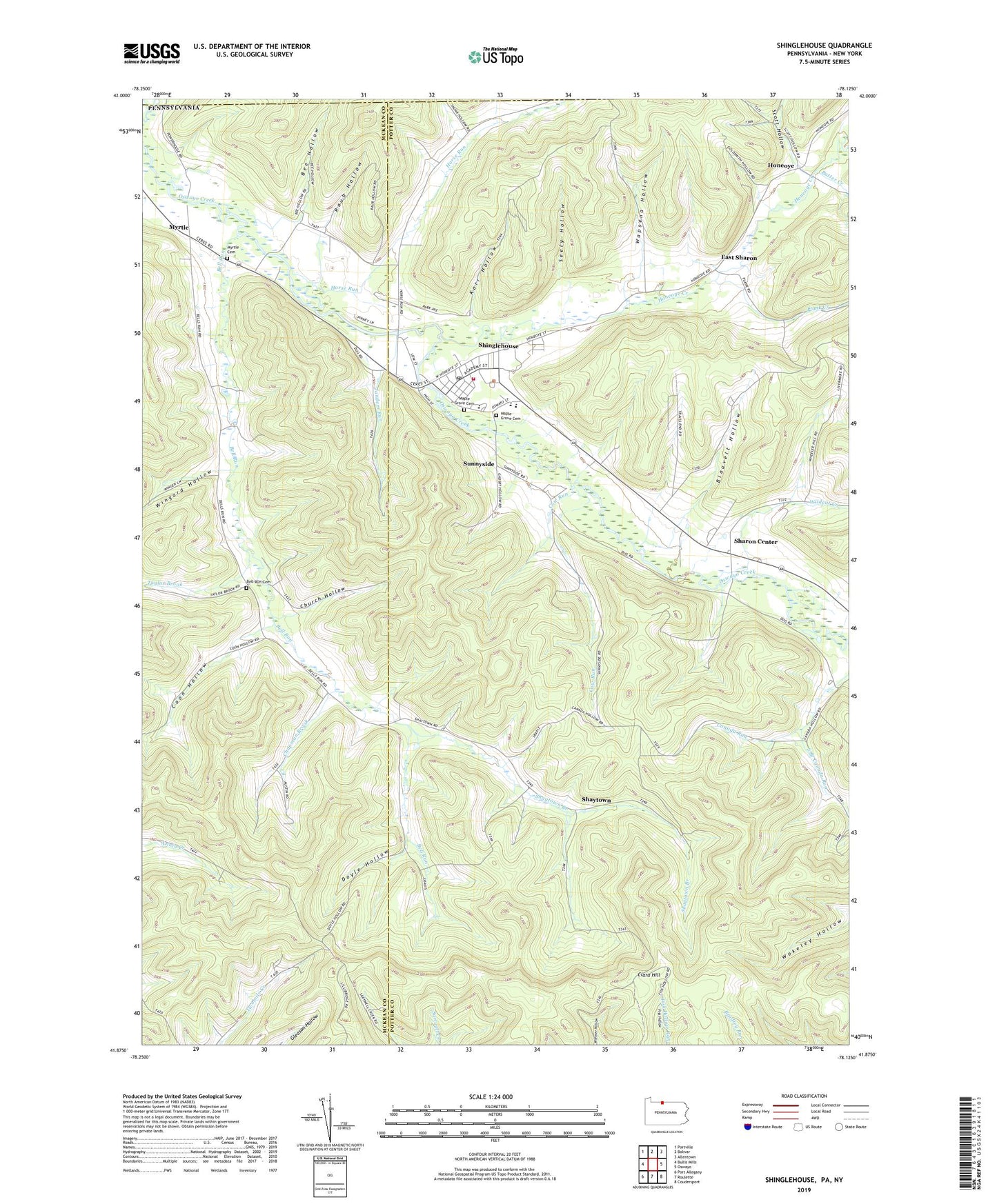
2019 topographic map quadrangle Shinglehouse in the states of Pennsylvania, New York. Scale: 1:24000. Based on the newly updated USGS 7.5' US Topo map series, this map is in the following counties: Potter, McKean, Allegany. The map contains contour data, water features, and other items you are used to seeing on USGS maps, but also has updated roads and other features. This is the next generation of topographic maps. Printed on high-quality waterproof paper with UV fade-resistant inks.
Quads adjacent to this one:
West: Bullis Mills
Northwest: Portville
North: Bolivar
Northeast: Allentown
East: Oswayo
Southeast: Coudersport
South: Roulette
Southwest: Port Allegany
Contains the following named places: Bee Hollow, Bell Run, Bell Run Cemetery, Bell Run School, Bell Run Union Church, Blauvelt Hollow, Borough of Shinglehouse, Butter Creek, Chapman Brook, Church Hollow, Coon Hollow, Cow Run, Cow Run School, Doyle Hollow, East Sharon, Gospel Tabernacle Church, Honeoye, Honeoye Creek, Horse Run, Horse Run School, Janders Run, Karr Hollow, Maple Grove Cemetery, Maple Grove Cemetery - New, Myrtle, Myrtle Cemetery, Oswayo Valley Elementary School, Oswayo Valley High School, Plank Creek, Raub Hollow, Scott Hollow, Seely Hollow, Sharon Center, Shaytown, Shaytown Branch, Shinglehouse, Shinglehouse Post Office, Shinglehouse Volunteer Ambulance Association, Shinglehouse Volunteer Fire Department Station 39, South Branch Canada Run, Sunnyside, Taylor Brook, Township of Sharon, Wapsena Hollow, Wildcat Creek, Wingard Hollow, ZIP Code: 16748