MyTopo
Oswayo Pennsylvania US Topo Map
Couldn't load pickup availability
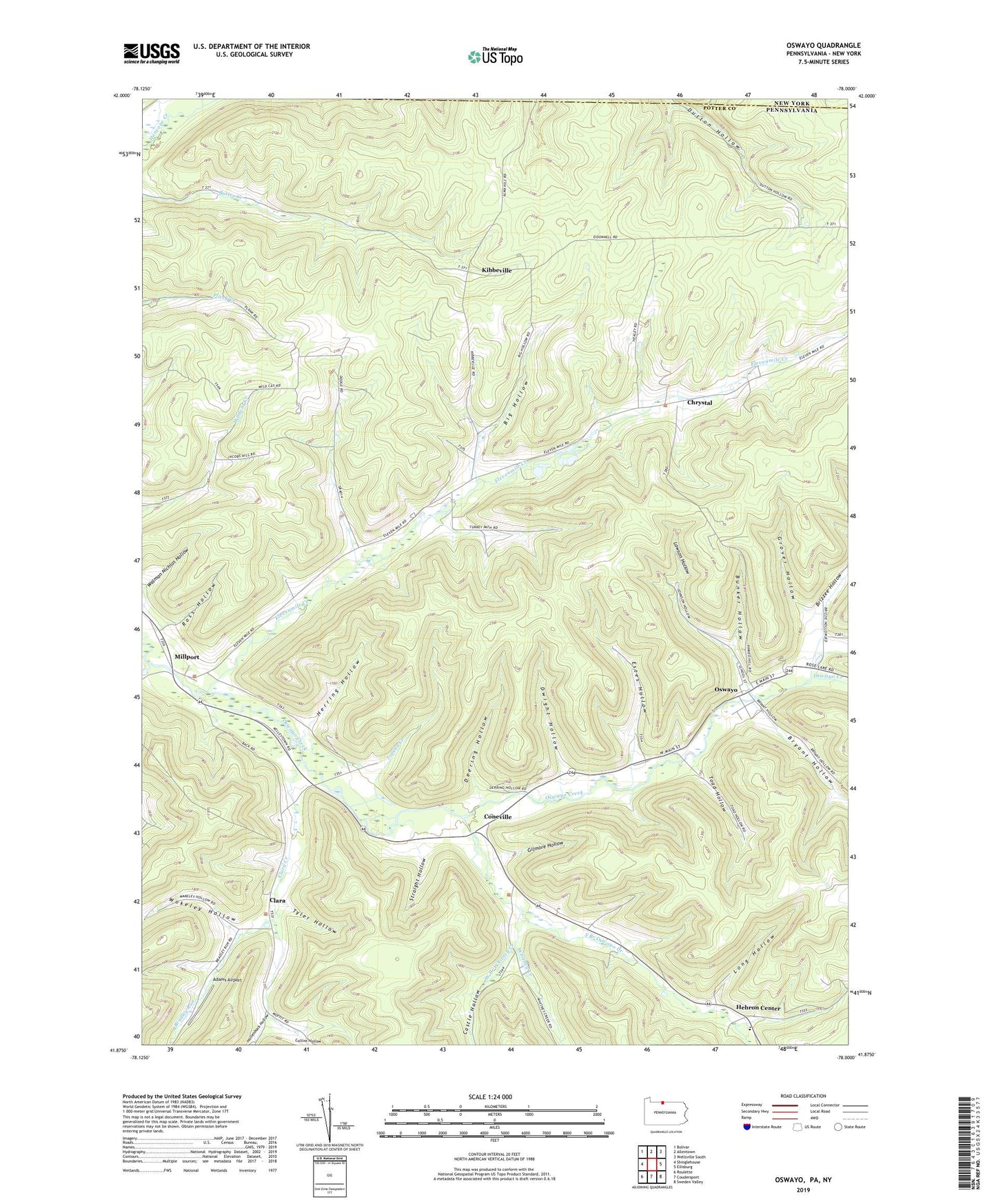
2023 topographic map quadrangle Oswayo in the state of Pennsylvania. Scale: 1:24000. Based on the newly updated USGS 7.5' US Topo map series, this map is in the following counties: Potter, Allegany. The map contains contour data, water features, and other items you are used to seeing on USGS maps, but also has updated roads and other features. This is the next generation of topographic maps. Printed on high-quality waterproof paper with UV fade-resistant inks.
Quads adjacent to this one:
West: Shinglehouse
Northwest: Bolivar
North: Allentown
Northeast: Wellsville South
East: Ellisburg
Southeast: Sweden Valley
South: Coudersport
Southwest: Roulette
This map covers the same area as the classic USGS quad with code o41078h1.
Contains the following named places: Adams Airport, Big Hollow, Borough of Oswayo, Bradley Run, Brizzee Hollow, Bryant Hollow, Bunker Hollow, Canada Run, Castle Hollow, Chrystal, Clara, Clara Creek, Clara School, Collins Hollow, Coneville, Deering Hollow, Dwight Hollow, Elevenmile Creek, Estes Hollow, Gilmore Hollow, Grover Hollow, Hebron Center, Hemlock Hollow Run, Herring Hollow, Hollenback Hollow, Kenyon Hollow, Kenyon School, Kibbeville, Lawson Hollow, Long Hollow, Millport, Oswayo, Plank Road School, Ross Hollow, Sharon Oil and Gas Field, South Branch Oswayo Creek, Straight Hollow, Toad Hollow, Topeka Creek, Township of Oswayo, Tyler Hollow, Walman Nichlos Hollow, West Branch Whitney Creek, Whitney Creek, Wildcat School, Wokeley Hollow