MyTopo
Shumans Pennsylvania US Topo Map
Couldn't load pickup availability
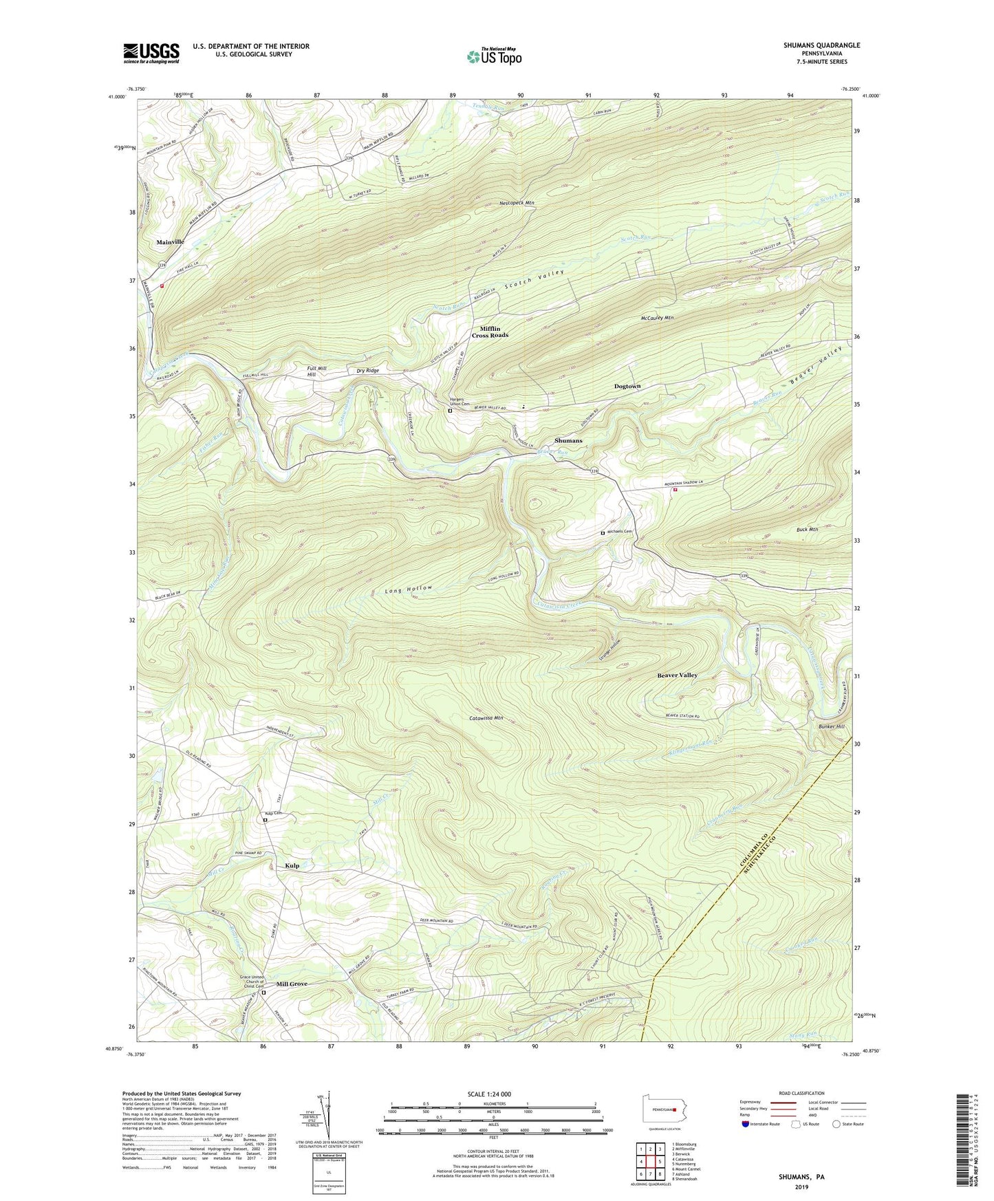
2023 topographic map quadrangle Shumans in the state of Pennsylvania. Scale: 1:24000. Based on the newly updated USGS 7.5' US Topo map series, this map is in the following counties: Columbia, Schuylkill. The map contains contour data, water features, and other items you are used to seeing on USGS maps, but also has updated roads and other features. This is the next generation of topographic maps. Printed on high-quality waterproof paper with UV fade-resistant inks.
Quads adjacent to this one:
West: Catawissa
Northwest: Bloomsburg
North: Mifflinville
Northeast: Berwick
East: Nuremberg
Southeast: Shenandoah
South: Ashland
Southwest: Mount Carmel
This map covers the same area as the classic USGS quad with code o40076h3.
Contains the following named places: Beaver Run, Beaver School, Beaver Township Volunteer Fire Company Station 140, Beaver Valley, Bunker Hill, Catawissa Mountain, Cranberry Run, Dogtown, Dry Ridge, Fish Pond Dam, Fisher Run, Full Mill Hill, Furnace Run, Grace United Church of Christ Cemetery, Hargers Union Cemetery, Klingermans Run, Kulp, Kulp Cemetery, Kulp Church, Long Hollow, Main Township Volunteer Fire Company Station 210, Mainville, Mainville Census Designated Place, McCauley, McCauley Mountain, Michaels Cemetery, Mifflin Cross Roads, Mill Creek, Mill Grove, Mine Gap Run, Nescopeck Mountain, Saint Peter's 'Hargers' Union Church of Christ, Saint Peter's Lutheran Church, Scotch Run, Scotch Valley, Shumans, State Game Lands Number 58, Store Cabin Run, Stranger Hollow, Township of Beaver, Township of Roaring Creek