MyTopo
Mount Carmel Pennsylvania US Topo Map
Couldn't load pickup availability
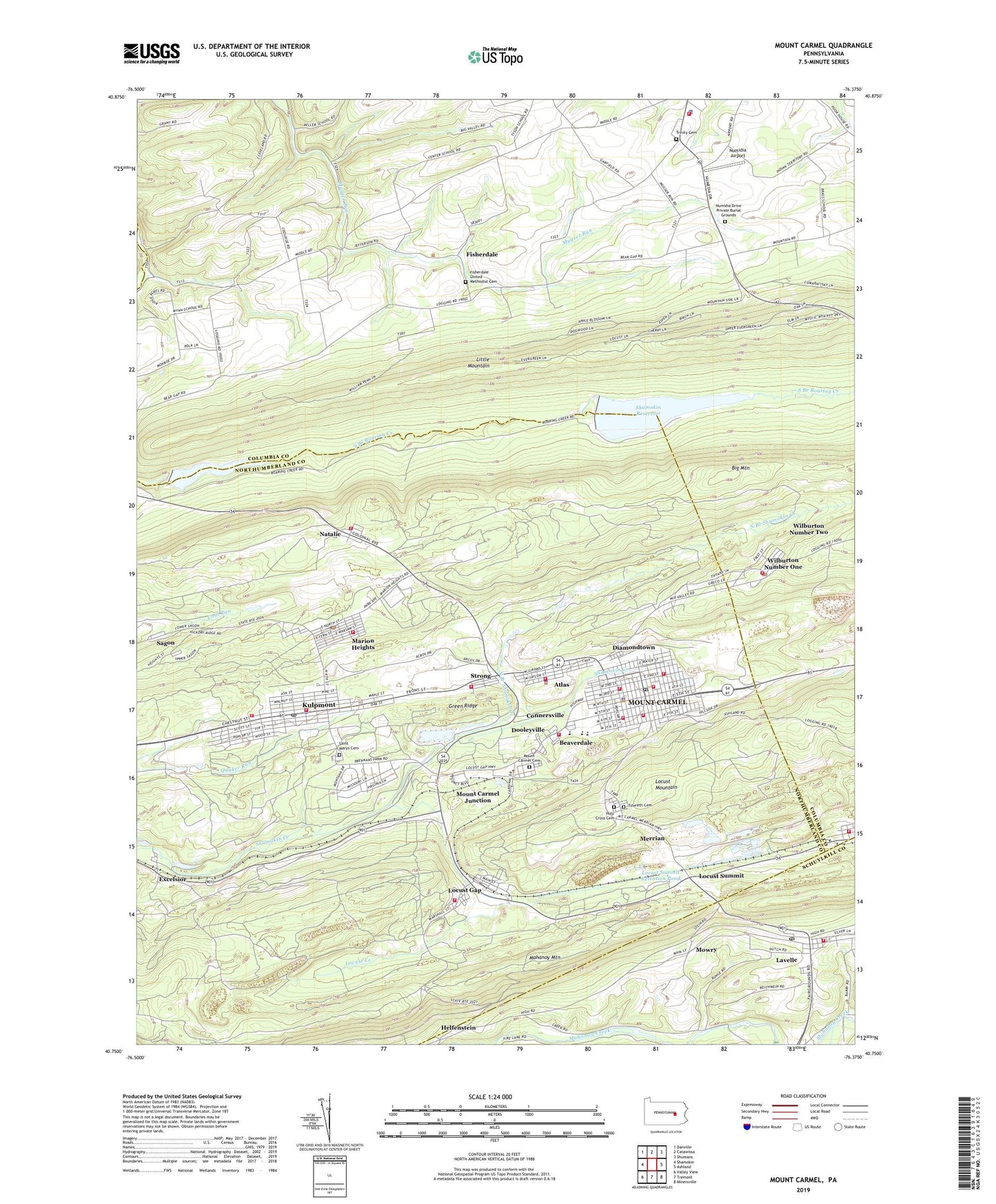
2023 topographic map quadrangle Mount Carmel in the state of Pennsylvania. Scale: 1:24000. Based on the newly updated USGS 7.5' US Topo map series, this map is in the following counties: Columbia, Northumberland, Schuylkill. The map contains contour data, water features, and other items you are used to seeing on USGS maps, but also has updated roads and other features. This is the next generation of topographic maps. Printed on high-quality waterproof paper with UV fade-resistant inks.
Quads adjacent to this one:
West: Shamokin
Northwest: Danville
North: Catawissa
Northeast: Shumans
East: Ashland
Southeast: Minersville
South: Tremont
Southwest: Valley View
This map covers the same area as the classic USGS quad with code o40076g4.
Contains the following named places: Alaska, American Hose and Chemical Fire Company Station 1, Anthracite Steam Fire Company, Atlas, Atlas Census Designated Place, Atlas Colliery Station, Atlas Fire Company Station 21, Bear Gap Number Six Dam, Bear Gap Number Two Dam, Beaverdale, Beaverdale Fire Company Station 22, Big Mountain, Borough of Kulpmont, Borough of Marion Heights, Borough of Mount Carmel, Clover Hose Company Station 3, Connersville, Dam Number Five, Diamondtown, Dooleyville, Excelsior, Fisherdale, Fisherdale United Methodist Cemetery, Gilberton Plant Station, Green Ridge, Holy Cross Cemetery, Immanuel Church, Kulpmont, Kulpmont Fire Department Station 220, Kulpmont Police Department, Kulpmont Post Office, Lavelle, Lavelle Census Designated Place, Lavelle Post Office, Lavelle Volunteer Fire Company District 4 Station 2, Locust Creek, Locust Gap, Locust Gap Fire Company Station 23, Locust Summit, Locust Summit Fines Plant Dam, Locust Summit Retention Pond, Locustdale, Locustdale Volunteer Fire Company District 4 Station 3, Marion Heights, Marion Heights Fire Department Station 70, Marion Heights Post Office, Merrian, Mount Carmel, Mount Carmel Area Rescue Squad Station 5, Mount Carmel Borough Police Department, Mount Carmel Cemetery, Mount Carmel Junction, Mount Carmel Post Office, Mount Carmel Township Police Department, Mowry, Natalie, Natalie Fire Company Station 24, North Branch Shamokin Creek, Numidia Airport, Numidia Drive Private Burial Grounds, Paradise Park, Rolling Meadows Golf Course, Sagon, Saint Marys Cemetery, Shady Acres, Shamokin Reservoir, Storage Reservoir Number Two Dam, Strong, Strong Census Designated Place, Strong Volunteer Fire Company Station 25, Sun Colliery Station, Tifereth Cemetery, Township of Cleveland, Township of Mount Carmel, Trinity Cemetery, Valley Chemical Fire Company Station 270, Weikels Run, West End Fire Company 1, West End Fire Company Station 210, Wilburton Hose Company 1, Wilburton Number One, Wilburton Number One Census Designated Place, Wilburton Number Two Census Designated Place, Wilburton Post Office, WMIM-AM (Mount Carmel), ZIP Codes: 17832, 17834, 17840, 17851, 17888, 17943, 17945