MyTopo
Ashland Pennsylvania US Topo Map
Couldn't load pickup availability
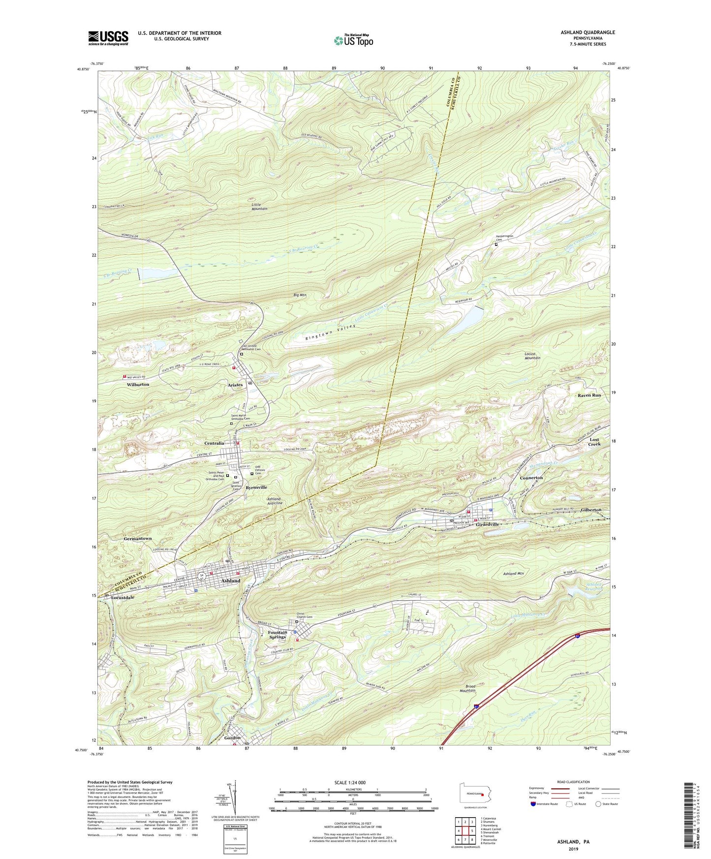
2023 topographic map quadrangle Ashland in the state of Pennsylvania. Scale: 1:24000. Based on the newly updated USGS 7.5' US Topo map series, this map is in the following counties: Schuylkill, Columbia. The map contains contour data, water features, and other items you are used to seeing on USGS maps, but also has updated roads and other features. This is the next generation of topographic maps. Printed on high-quality waterproof paper with UV fade-resistant inks.
Quads adjacent to this one:
West: Mount Carmel
Northwest: Catawissa
North: Shumans
Northeast: Nuremberg
East: Shenandoah
Southeast: Pottsville
South: Minersville
Southwest: Tremont
This map covers the same area as the classic USGS quad with code o40076g3.
Contains the following named places: Aristes, Aristes Census Designated Place, Aristes Fire Company Station 350, Aristes Post Office, Ashland, Ashland Anticline, Ashland Area Elementary School, Ashland Borough Police Department, Ashland Fire Department District 38 Station 1 - American Hose Company, Ashland Fire Department District 38 Station 2 - Washington Fire Company, Ashland Mountain, Ashland Post Office, Ashland Reservoir, Ashland Reservoir Dam, Ashland State General Hospital Heliport, Big Mine Run, Borough of Ashland, Borough of Centralia, Borough of Girardville, Borough of Gordon, Brush Valley Dam, Brush Valley Reservoir, Butler Township Police Department, Byrnsville, Centralia, Centralia Fire Company 1, Centralia Fire Tower, Christ Church Cemetery, Citizens Fire Company District 46 Station 1, Colorado, Connerton, Conyngham Township Police Department, East Branch Big Mine Run, Fountain Springs, Fountain Springs Census Designated Place, Fountain Springs Fire Company District 4 Station 1, Germantown, Girard Hose Company District 45 Station 1, Girardville, Girardville Ambulance Service, Girardville Elementary School, Girardville Police Department, Girardville Post Office, Gordon, Gordon Post Office, Hetherington Cemetery, Immaculate Heart Academy, Little Mahanoy Creek, Little Mine Run, Little Mountain, Locust Run, Locustdale Census Designated Place, Locustdale Post Office, Midvalley Church, North Schuylkill Junior Senior High School, Odd Fellows Cemetery, Preston Hill, Rangers Hose Company District 45 Station 2, Rattling Run, Raven Run, Ringtown Dam Number Six, Ringtown Reservoir Number Six, Saint Catherine Medical Center Fountain Spring, Saint Ignatius Cemetery, Saint Marys Orthodox Cemetery, Saints Peter and Paul Orthodox Cemetery, Shenandoah Creek, Township of Butler, Township of Conyngham, Township of Union, Trexler Run, Washington Fire Company Community Ambulance, Wilburton, Wilburton Hose Company Station 330, Wilburton Number Two, Zion United Methodist Cemetery, ZIP Codes: 17920, 17921, 17935, 17936, 17946