MyTopo
Spring Mills Pennsylvania US Topo Map
Couldn't load pickup availability
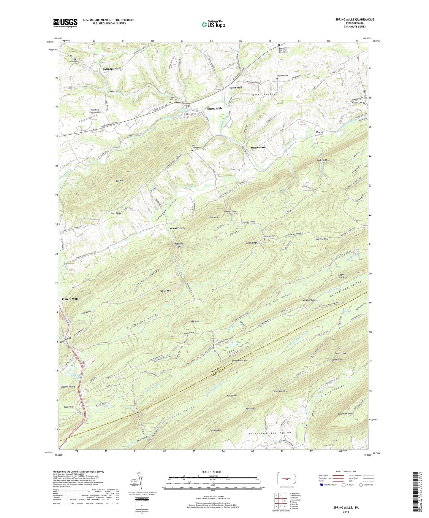
2023 topographic map quadrangle Spring Mills in the state of Pennsylvania. Scale: 1:24000. Based on the newly updated USGS 7.5' US Topo map series, this map is in the following counties: Centre, Mifflin. The map contains contour data, water features, and other items you are used to seeing on USGS maps, but also has updated roads and other features. This is the next generation of topographic maps. Printed on high-quality waterproof paper with UV fade-resistant inks.
Quads adjacent to this one:
West: Centre Hall
Northwest: Mingoville
North: Madisonburg
Northeast: Millheim
East: Coburn
Southeast: Alfarata
South: Burnham
Southwest: Barrville
This map covers the same area as the classic USGS quad with code o40077g5.
Contains the following named places: Barr Gap, Beaverdam, Beaverdam School, Bethesda Church, Big Flat, Big Poe Mountain, Britton Run, Carson Gap, Crissman Gap, Crissman Knob, Decker Path, Decker School, Decker Valley, Devils Hole, Egg Hill, Egg Hill Church, Farmers Mills, Faust Valley, Front Mountain, Gentzel School, Georges Valley, Greens Valley, Greens Valley Stream, Greens Valley Trail, Gregg Township Volunteer Fire Company 7, Ground Oak Trail, Havice Valley, Heckman Cemetery, Holy Cross Cemetery, Holy Cross Church, Illinois Valley, Indian Trail, Kettle Run, Kishacoquillas Valley, Kohler Mountain, Kohler Valley, Krise Valley, Laurel Run, Lingle Stream, Lingle Trail, Locust Grove, Long Mountain, Mountain Cemetery, Muddy Creek, Paradise Cemetery, Penn Hall, Penn Nursery, Penn Nursery Dam, Penn Spring Reservoir, Pennfield Farm Airport, Penns Valley Emergency Medical Services Company 28, Pike School, Poe Valley Fire Tower, Polk Hill School, Ripka Trail, Rising Spring, Rising Spring Station, Rossman Gap, Saint Marks Church, Salem Church, Salem United Church of Christ Cemetery, Sand Mountain, Seven Mountain Camp, Sinking Creek, Spring Mills, Spring Mills Cemetery, Spring Mills Census Designated Place, Spring Mills Post Office, Stillhouse Hollow, Summit Trail, Synagogue Gap, Township of Gregg, Triester Valley, Union Cemetery, Vonada Gap, Wildcat Gap, Wolf Trail, Zerby, Zerby Gap, ZIP Code: 16875