MyTopo
Mingoville Pennsylvania US Topo Map
Couldn't load pickup availability
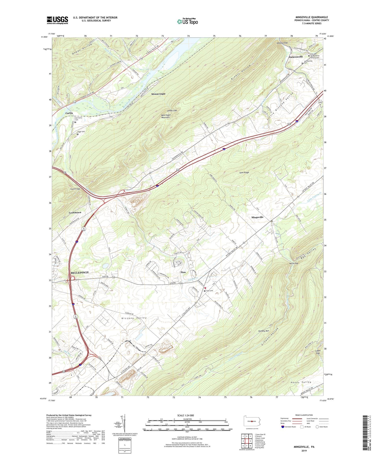
2023 topographic map quadrangle Mingoville in the state of Pennsylvania. Scale: 1:24000. Based on the newly updated USGS 7.5' US Topo map series, this map is in the following counties: Centre. The map contains contour data, water features, and other items you are used to seeing on USGS maps, but also has updated roads and other features. This is the next generation of topographic maps. Printed on high-quality waterproof paper with UV fade-resistant inks.
Quads adjacent to this one:
West: Bellefonte
Northwest: Snow Shoe SE
North: Howard
Northeast: Beech Creek
East: Madisonburg
Southeast: Spring Mills
South: Centre Hall
Southwest: State College
This map covers the same area as the classic USGS quad with code o40077h6.
Contains the following named places: Antis Run, Bald Eagle State Forest, Bierly (Personal Use) Airport, Boy School, Bullit Run, Curtin, Curtin Gap, Curtin Gap Quarry, Diehls Hollow, Dopps Hollow, Eagle Cemetery, Emmanuel Church, Fishing Creek School, Forest, Gentzel School, Greens Valley, Hecla Gap, Hecla Park, Henderson School, Holters Crossing, Holters Crossing Census Designated Place, Howard Dam, Howard Gap, Howard State Nursery, Jacksonville, Jacksonville Cemetery, Jacksonville Census Designated Place, Kennedy Church, Lambs Gap, Lick Run Presbyterian Church Cemetery, Little Nittany Valley, Logan Gap, Logan School, Lyonstown, Mingoville, Mingoville Census Designated Place, Mingoville Post Office, Mount Eagle, Mount Eagle Census Designated Place, Nittany Country Club, Nittany Creek, Nittany Wildland Firefighters, Oak Grove School, Old Curtin Cemetery, Rag Valley, Sand Ridge, Sand Rock Trail, Township of Marion, Township of Spring, Walker Township Volunteer Fire Company 16 Zion Station, Zion, Zion Cemetery, Zion Census Designated Place