MyTopo
Spruce Creek Pennsylvania US Topo Map
Couldn't load pickup availability
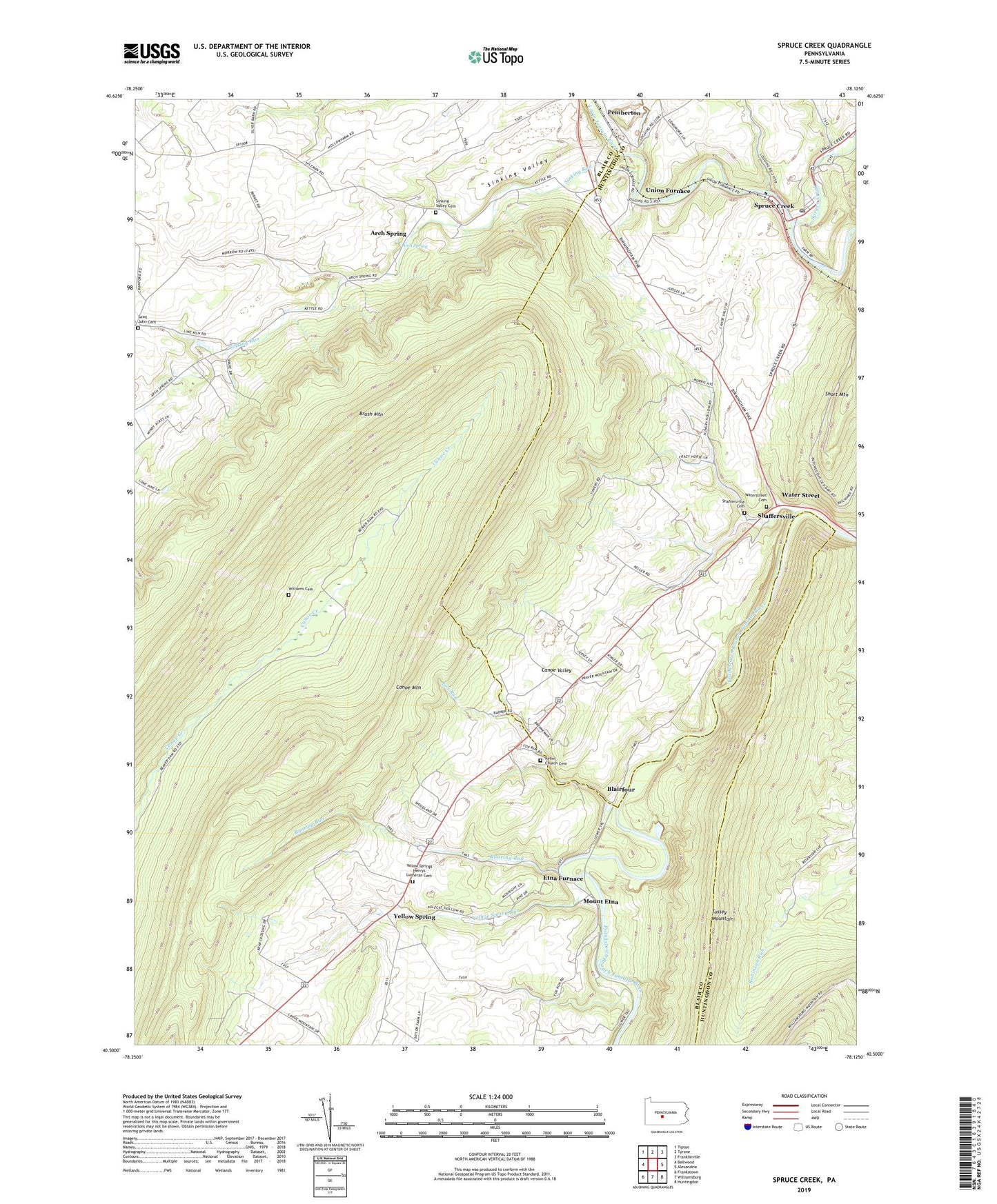
2023 topographic map quadrangle Spruce Creek in the state of Pennsylvania. Scale: 1:24000. Based on the newly updated USGS 7.5' US Topo map series, this map is in the following counties: Blair, Huntingdon. The map contains contour data, water features, and other items you are used to seeing on USGS maps, but also has updated roads and other features. This is the next generation of topographic maps. Printed on high-quality waterproof paper with UV fade-resistant inks.
Quads adjacent to this one:
West: Bellwood
Northwest: Tipton
North: Tyrone
Northeast: Franklinville
East: Alexandria
Southeast: Huntingdon
South: Williamsburg
Southwest: Frankstown
This map covers the same area as the classic USGS quad with code o40078e2.
Contains the following named places: Arch Spring, Blairfour, Canoe Mountain, Canoe Valley, Crossroads School, Eden Hill School, Etna Furnace, Fox Run, Fox Run School, Goodman, Keller Chapel, Keller Church Cemetery, Mount Etna, Oakland School, Pemberton, Roaring Run, Saint Johns Lutheran Cemetery, Shaffersville, Shaffersville Cemetery, Sinking Run, Sinking Valley, Sinking Valley Cemetery, Sinking Valley Church, Spruce Creek, Spruce Creek Post Office, State Game Lands Number 166, Township of Catharine, Township of Morris, Township of Spruce Creek, Union Furnace, Water Street, Waterstreet Cemetery, Williams Cemetery, Yellow Spring Run, Yellow Springs, Yellow Springs Census Designated Place, Yellow Springs Henrys Lutheran Cemetery