MyTopo
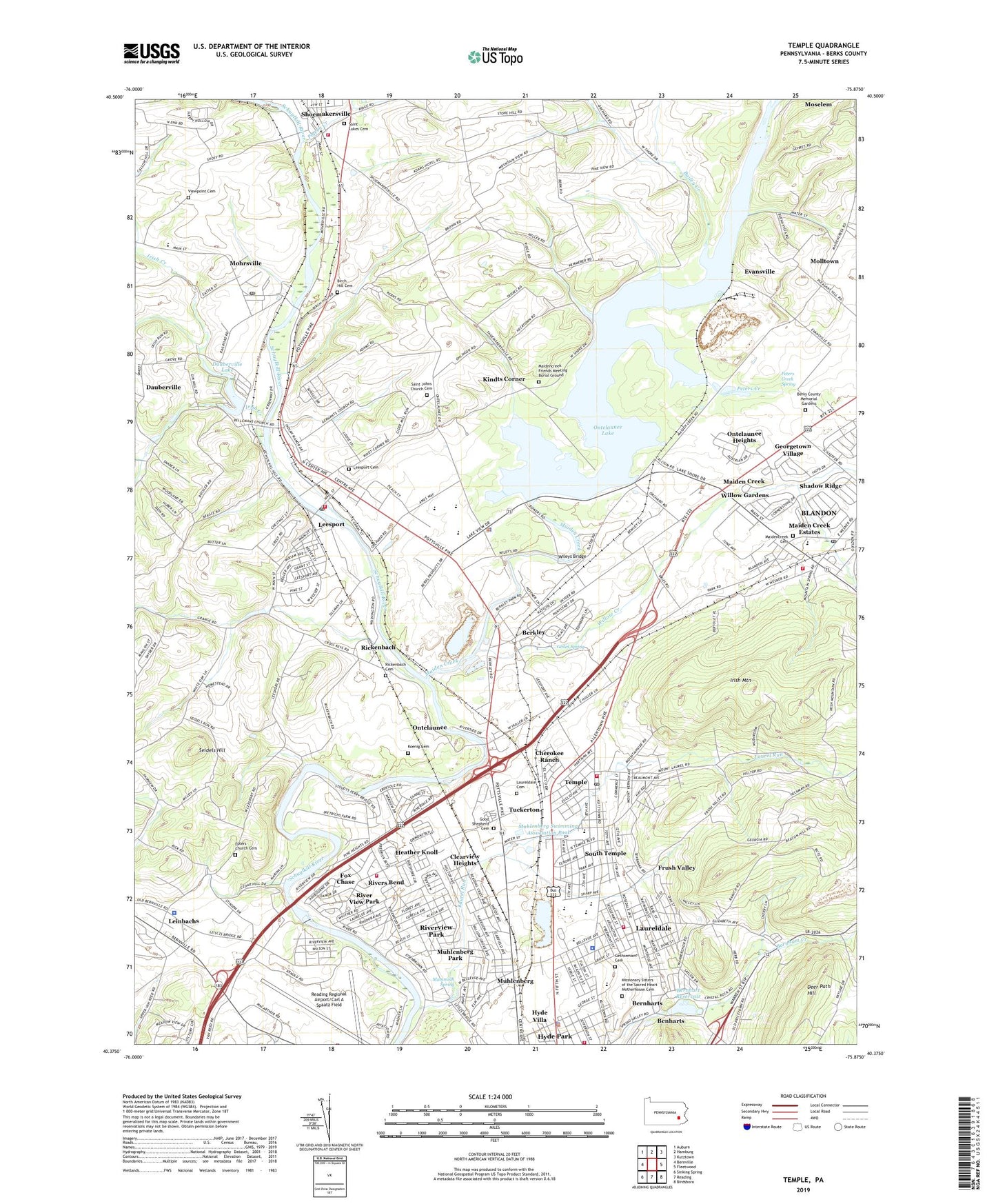
Temple Pennsylvania US Topo Map
Couldn't load pickup availability
2023 topographic map quadrangle Temple in the state of Pennsylvania. Scale: 1:24000. Based on the newly updated USGS 7.5' US Topo map series, this map is in the following counties: Berks. The map contains contour data, water features, and other items you are used to seeing on USGS maps, but also has updated roads and other features. This is the next generation of topographic maps. Printed on high-quality waterproof paper with UV fade-resistant inks.
Quads adjacent to this one:
West: Bernville
Northwest: Auburn
North: Hamburg
Northeast: Kutztown
East: Fleetwood
Southeast: Birdsboro
South: Reading
Southwest: Sinking Spring
This map covers the same area as the classic USGS quad with code o40075d8.
Contains the following named places: Airport Industrial Park South, Airport Industrial Park West, Andrew Maier Elementary School, Bailey Creek, Benharts, Berkley, Berks Airport, Berks County, Berks County Memorial Gardens, Berks County Youth Recreation Facility, Bern Township Municipal Building, Bern Township Police Department, Bernhart Dam, Bernhart Reservoir, Bernhart Tank, Bernharts, Birch Hill Cemetery, Blandon, Blandon Census Designated Place, Blandon Fire Company 1 Station 12, Blandon Mennonite Fellowship Church, Blandon Post Office, Blue Falls Grove, Borough of Laureldale, Borough of Leesport, Borough of Temple, Borough of West Leesport, Calcium Post Office, Calvary Church of the Nazarene, Calvary Lutheran Church, Central Fire Company 1 Laureldale Station 13, Cherokee Ranch, Cherokee Ranch Playground, Christ Evangelical Reformed Church, Church of Jesus Christ of Latter Day Saints, Clearview Heights, Dauberville, Dauberville Census Designated Place, Dauberville Lake, Dauberville Lake Dam, Deer Path Hill, Emmanuel Fellowship Church, Epler Boat Launch, Epler School, Eplers Church, Eplers Church Cemetery, Eplers Landing, Evansville, Evansville Station, Excelsior Industrial Park, Fairgrounds Square Mall, Felix Dam, Felix Dam Park, Fox Chase, Fox Chase Census Designated Place, Freedom Trail, Frush Valley, Frush Valley Tank, Geiles Spring, Georgetown Village, Gethsemane Cemetery, Glen Gery Dam, Good Shepherd Cemetery, Good Shepherd Evangelical Lutheran Church, Goodwill Fire Company Hyde Park Station 10, Goodwill Fire Company Riverview Park Station 10, Grube Airport, Hamburg Station, Hartman Open Space, Heather Knoll, Hecktown School, Holy Guardian Angels Roman Catholic Church, Hyde Park, Hyde Park Census Designated Place, Hyde Park Playground, Hyde Villa, Irish Creek, Irish Mountain, Jim Dietrich Park, Jones Heliport, KidsPeace Berks Campus, Kindts Corner, Koenig Cemetery, Lake Ontelaunee Dam, Laurel Commons Community Building, Laurel Commons Mobile Home Park, Laurel Run, Laurel Run Park, Laurel Run Swimming Association Pool, Laurelain Playground, Laureldale, Laureldale Cemetery, Laureldale Municipal Park, Laureldale Playground, Laureldale Police Department, Leader-Laureldale Nursing Home, Leesport, Leesport Borough Hall, Leesport Cemetery, Leesport Farmers Market, Leesport Lock House, Leesport Playground, Leesport Post Office, Leinbachs, Leizes Bridge, Lincoln School, Madeira Shopping Center, Maiden Creek, Maiden Creek Church, Maiden Creek Estates, Maiden Creek School, Maiden Creek Station, Maidencreek Cemetery, Maidencreek Church, Maidencreek Filter Plant, Maidencreek Friends Meeting Burial Ground, Maidencreek Pumping Station, Maidencreek Township Building, Mammoth Spring, Mannerchor Tank, Metropolitan Edison Heliport, Mid-Atlantic Air Museum, Mighty Mite Field, Mohrsville, Mohrsville Census Designated Place, Mohrsville Playground, Mohrsville Post Office, Molltown, Muhlenberg, Muhlenberg Area Ambulance, Muhlenberg Elementary Center, Muhlenberg High School, Muhlenberg Middle School, Muhlenberg Park, Muhlenberg Park Census Designated Place, Muhlenberg Rail Trail, Muhlenberg Square Shopping Center, Muhlenberg Station, Muhlenberg Swimming Association Pool, Muhlenberg Township Municipal Building, Muhlenberg Township Police Department, Muhlenberg Township Water Authority, Northern Berks Regional Police Department, Northfield Business Center, Old Airport Industrial Park, Ontelaunee, Ontelaunee Heights, Ontelaunee Lake, Ontelaunee Township Building, Penn Plaza Shopping Center, Perry Elementary School, Peters Creek, Peters Creek Spring, Pigeon Creek, Pleasant Hill Golf Course, Pocono Beagle Club, Reading Army Air Field, Reading Crest Park, Reading Flite Academy, Reading Hospital at Muhlenberg, Reading Regional Airport/Carl A Spaatz Field, Rich Maiden Golf Course, Rickenbach, Rickenbach Cemetery, Rieser Mill Dam, River View Park, Riverdale Meadows Park, Rivers Bend, Rivers Chase Business Park, Riverside Basin Park, Riverview Park Census Designated Place, Riverview Park Tank, Rosedale Grove, Sacred Heart Villa, Saint Johns Church, Saint Johns Church Cemetery, Saint Lukes Cemetery, Saint Michael Convent, Saint Michaels Convent Cemetery, Schellhammer Speedway, Schlemville, Schuylkill River Water Trail, Schuylkill Valley Community Library, Schuylkill Valley Elementary School, Schuylkill Valley Emergency Medical Services, Schuylkill Valley High School, Schuylkill Valley Middle School, Seidels Hill, Shadow Ridge, Shoemakersville Borough Hall, Shoemakersville Fire Company 1 Station 40, South Temple, South Temple Census Designated Place, South Temple Playground, Spring Valley Church of God, State Police Hangar, Stoudts Bridge, Stoudts Ferry Bridge Playground, Temple, Temple Census Designated Place, Temple Fire Company 1 Station 11, Temple Playground, Temple Post Office, Temple Station, The King's Academy, Township of Bern, Township of Maidencreek, Township of Muhlenberg, Township of Ontelaunee, Trinity Bible Fellowship Church, Trinity United Church of Christ, Tuckerton, Tuckerton Commerce Center, Union Fire Company 1 Station 37, Union School, Unity Church of Reading, Urban Acres Trailer Park, Victory Baptist Church, Viewpoint Cemetery, West Leesport, West Shore Airport, Wileys Bridge, Willow Creek, Willow Gardens, ZIP Codes: 19510, 19533, 19555, 19560, 19605


