MyTopo
Mosgrove Pennsylvania US Topo Map
Couldn't load pickup availability
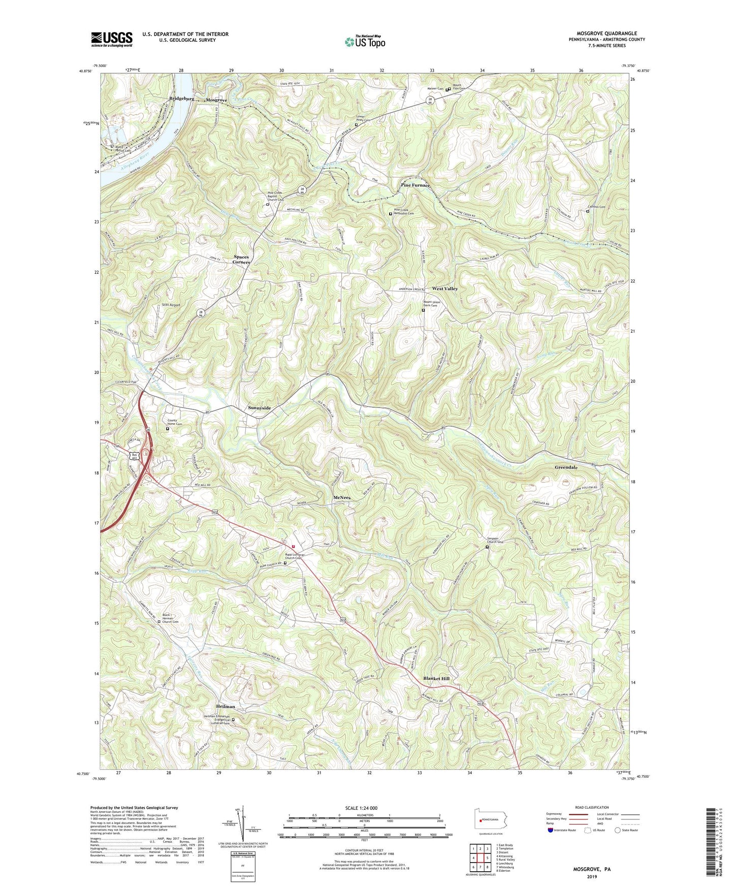
2023 topographic map quadrangle Mosgrove in the state of Pennsylvania. Scale: 1:24000. Based on the newly updated USGS 7.5' US Topo map series, this map is in the following counties: Armstrong. The map contains contour data, water features, and other items you are used to seeing on USGS maps, but also has updated roads and other features. This is the next generation of topographic maps. Printed on high-quality waterproof paper with UV fade-resistant inks.
Quads adjacent to this one:
West: Kittanning
Northwest: East Brady
North: Templeton
Northeast: Distant
East: Rural Valley
Southeast: Elderton
South: Whitesburg
Southwest: Leechburg
This map covers the same area as the classic USGS quad with code o40079g4.
Contains the following named places: Armstrong County, Black Cemetery, Blanket Hill, Blanket Hill Post Office, Bridgeburg, Bridgeburg Station, Calhoun Cemetery, Christ Church, County Home Cemetery, Cowanshannock, Deaver Run, Dunbar Airport, Green Acres, Greendale, Hays Run, Heilman, Heilman Emmanuel Evangelical Lutheran Cemetery, Kittanning Township Elementary School, Kittanning Township Volunteer Fire Department Station 310, Laurel Run, Long Run, Lower Piney Cemetery, Mateer Cemetery, McNees, Mill Run, Mosgrove, Mount Union Church, Mount Union Davis Cemetery, Mount Zion Cemetery, Mount Zion Church, Myers - Patton Cemetery, North Fork Pine Creek, Nultons House, Pine Creek, Pine Creek Baptist Church Cemetery, Pine Creek Church, Pine Creek Methodist Cemetery, Pine Furnace, Pine Furnace Station, Rupp Lutheran Church Cemetery, Rupp Run, Simpson Church, Simpson Church Cemetery, South Fork Pine Creek, Spaces Corners, Spra Run, Stitt Airport, Stone House, Sunnyside, Township of Kittanning, Township of Rayburn, Township of Valley, West Valley, ZIP Code: 16201