MyTopo
Mather Pennsylvania US Topo Map
Couldn't load pickup availability
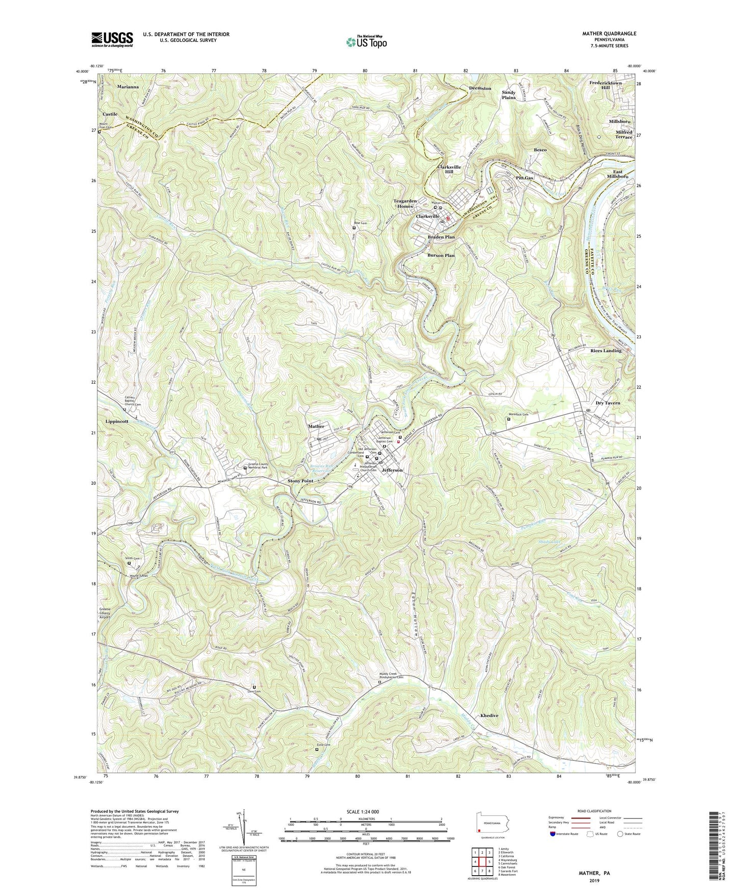
2023 topographic map quadrangle Mather in the state of Pennsylvania. Scale: 1:24000. Based on the newly updated USGS 7.5' US Topo map series, this map is in the following counties: Greene, Washington, Fayette. The map contains contour data, water features, and other items you are used to seeing on USGS maps, but also has updated roads and other features. This is the next generation of topographic maps. Printed on high-quality waterproof paper with UV fade-resistant inks.
Quads adjacent to this one:
West: Waynesburg
Northwest: Amity
North: Ellsworth
Northeast: California
East: Carmichaels
Southeast: Masontown
South: Garards Fort
Southwest: Oak Forest
This map covers the same area as the classic USGS quad with code o39080h1.
Contains the following named places: Bacon Run, Bates Run, Besco, Black Dog Hollow, Borough of Clarksville, Borough of Jefferson, Braden Plan, Browns Run, Browns Run Dam, Browns Run Portal, Browns Run Reservoir, Burson Plan, Calvary Baptist Church Cemetery, Calvary Church, Castile Run, Central School, Chartiers, Clarksville, Clarksville Hill, Clarksville Post Office, Clarksville Presbyterian Church Cemetery, Clarksville Volunteer Fire Department Company 19, Clyde 3 Portal, Coal Lick Run, Cumberland Cemetery, Douglass Greenhouse, Dry Tavern, Dry Tavern Census Designated Place, Eaton Hollow, Edwards Shaft Portal, Emerald Mine, Estle Cemetery, Fredericktown-Millsboro Census Designated Place, Greene County Home, Greene County Memorial Park, Greene County Museum, Grimes Run, Jefferson, Jefferson Baptist Cemetery, Jefferson Cemetery, Jefferson Post Office, Jefferson Presbyterian Church Cemetery, Jefferson Volunteer Fire Department Company 20, Jefferson-Morgan High School, Khedive, Lippincott, Love Cemetery, Mather, Mather Census Designated Place, Mather Post Office, Milfred Terrace, Millsboro Census Designated Place, Moredock Cemetery, Mount Zion Cemetery, Muddy Creek Church, Muddy Creek Presbyterian Cemetery, Old Jefferson Cemetery, Pitt Gas, Pumpkin Run County Park, Rices Landing Post Office, Rohannas Golf Course, Rose Cemetery, Ruff Creek, Rush Run, Sandy Plains, Shady Lake, Smith Cemetery I, South Branch Muddy Creek, South Fork Tenmile Creek, Stony Point, Teagarden Homes, Township of East Bethlehem, Township of Jefferson, Township of Morgan, Walton Cemetery, Wayne Tunnel, Williamstown, Winnett Church, Youth Development Center, ZIP Codes: 15322, 15344, 15346