MyTopo
Isla De Vieques Central Puerto Rico US Topo Map
Couldn't load pickup availability
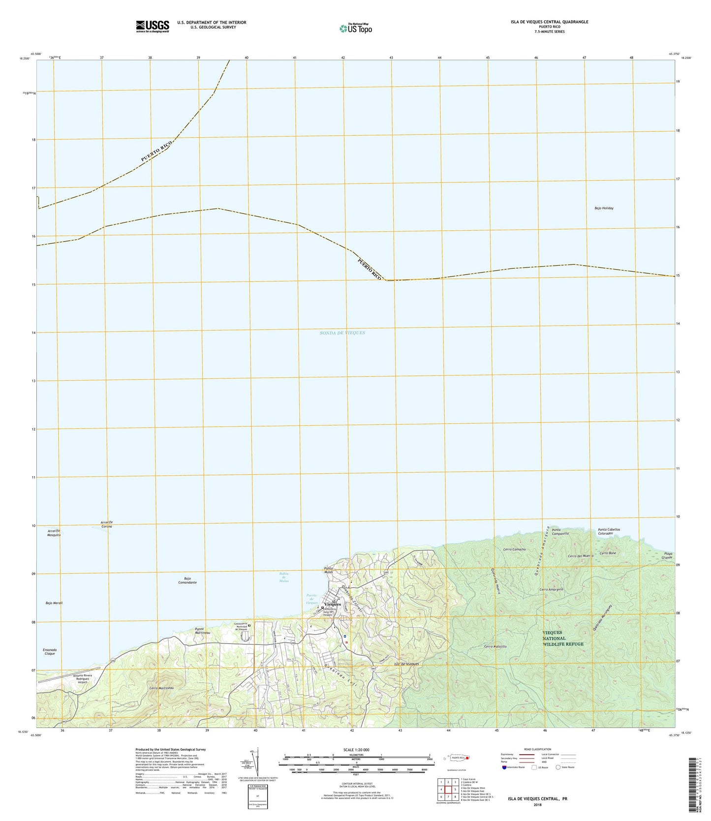
2024 topographic map quadrangle Isla De Vieques Central in the state of Puerto Rico. Scale: 1:20000. Based on the newly updated USGS 7.5' US Topo map series, this map is in the following counties: Humacao, Vieques, Ceiba. The map contains contour data, water features, and other items you are used to seeing on USGS maps, but also has updated roads and other features. This is the next generation of topographic maps. Printed on high-quality waterproof paper with UV fade-resistant inks.
Quads adjacent to this one:
West: Isla De Vieques West
Northwest: Cayo Icacos
North: Culebra OE W
Northeast: Culebra
East: Isla De Vieques East
Southeast: Isla De Vieques East OE S
South: Isla De Vieques Central OE S
Southwest: Isla De Vieques West OE S
Contains the following named places: Antonio Rivera Rodriguez Airport, Arrecife Corona, Arrecife Mosquito, Bahia de Mulas, Bajo Comandante, Bajo Holiday, Bajo Merail, Barriada Monte Santo, Camposilo, Casa Alcaldia de Vieques, Cementerio Municipal de Vieques, Cementerio Viejo de Vieques, Cerro Amargura, Cerro Bone, Cerro Camacho, Cerro del Muerto, Cerro Malojillo, Cerro Martineau, Conde de Mirasol Museum, Destino, El Faro de Punta Mulas, Ensanada Claque, Florida Barrio, Galeria Isabela Shopping Center, Isabel II Barrio-Pueblo, Isabel Segunda, Isabel Segunda Fort, Moscou, Municipio de Vieques, Munoz Rivera Plaza, Proyecto Barracon, Puerto de Vieques, Puerto Rican Port Authority Office, Punta Cabellos Colorados, Punta Campanilla, Punta Martineau, Punta Mulas, Quebrada Amargura, Quebrada Cofi, Quebrada Cofresi, Quebrada Hueca, Quebrada Marunguey, Santa Maria, Vieques, Vieques Municipio, Vieques National Wildlife Refuge, Vieques Post Office, Vieques Zona Urbana, ZIP Code: 00765


