MyTopo
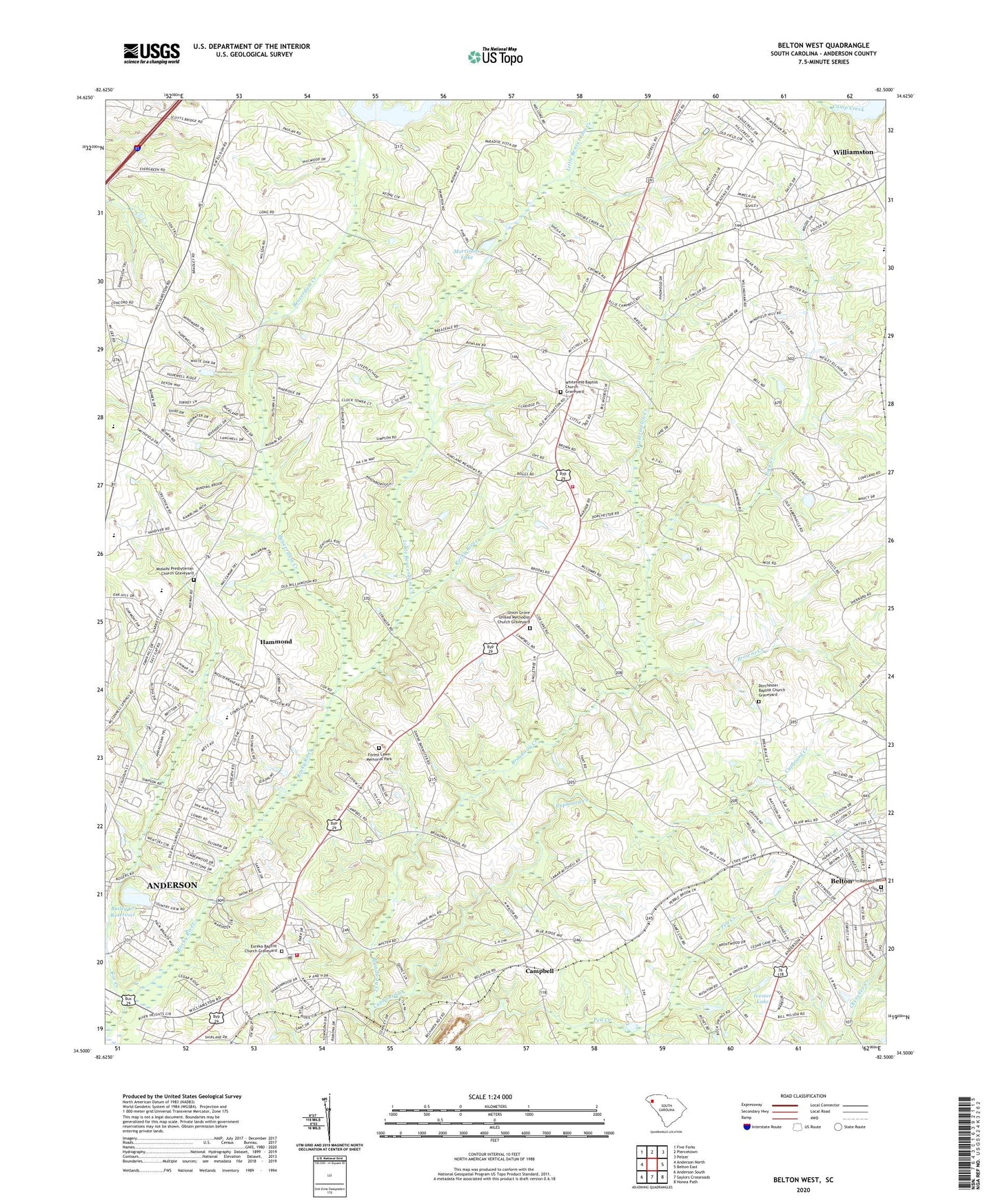
Belton West South Carolina US Topo Map
Couldn't load pickup availability
2024 topographic map quadrangle Belton West in the state of South Carolina. Scale: 1:24000. Based on the newly updated USGS 7.5' US Topo map series, this map is in the following counties: Anderson. The map contains contour data, water features, and other items you are used to seeing on USGS maps, but also has updated roads and other features. This is the next generation of topographic maps. Printed on high-quality waterproof paper with UV fade-resistant inks.
Quads adjacent to this one:
West: Anderson North
Northwest: Five Forks
North: Piercetown
Northeast: Pelzer
East: Belton East
Southeast: Honea Path
South: Saylors Crossroads
Southwest: Anderson South
This map covers the same area as the classic USGS quad with code o34082e5.
Contains the following named places: Aaron Post Office, Anderson County Fire Department Broadway Station 8, Anderson County Fire Department Whitefield Station 22, Anderson Reservoir, Bailey Creek Reservoir, Bailey Creek Reservoir Dam D-3125, Bearwood Ambulatory Surgery Center, Beaver Creek, Beaverdam Creek, Belton Cemetery, Briarcliff, Broadway School, Browns Creek, Campbell, Cedar Acres, Cedar Springs Tabernacle, Church of God, Cobbs Glen, Cobbs Glen Country Club, Cool Spring School, Country Acres, Country Estates, Country Place, Cox Creek, Creekwood Hills, Cross Roads School, Cupboard Creek, Devonshire, Dobbins Estates, Dorchester Baptist Church, Dorchester Baptist Church Graveyard, East Park Speedway, Erskine Estates, Eureka Baptist Church, Eureka Baptist Church Graveyard, Evergreen Baptist Church, Evergreen Baptist Church Cemetery, Evergreen School, Forest Lawn Memorial Park, Fox Valley, Geer School, Hammond, Hammond School, Hampton Acres, Haven of Rest Pond Dam D-3133, Heather Heights, Highland Acres, Hopewell Baptist Church, Ivester Lake, Keystone Acres, Little Beaverdam Creek, Lollis Pond Dam D-3140, Long Meadows, Marilyn Acres, Marshall School, Midway Church, Midway Presbyterian Church Graveyard, Morrisons Lake, New Hopewell Church, Parkwood Lake Dam D-3115, Pinecrest, Rock Creek, Salem Baptist Church, Sweet Springs School, Triangle Church, Union Grove Church, Union Grove United Methodist Church Graveyard, Union High School, Union School, WAIM-AM (Anderson), Watermelon Creek, White Oaks, Whitefield Baptist Church, Whitefield Baptist Church Graveyard, Williamston-Pelzer Division, Windward Trail, Wrights Mill, ZIP Code: 29621