MyTopo
Saylors Crossroads South Carolina US Topo Map
Couldn't load pickup availability
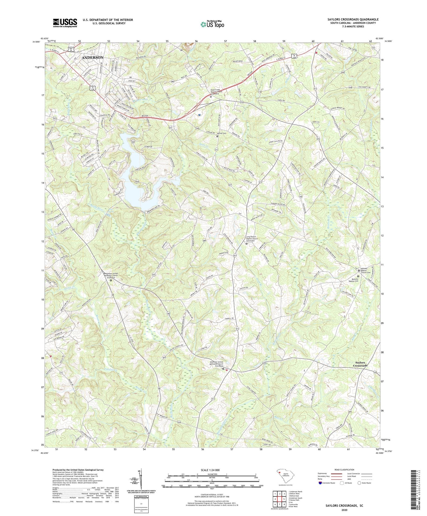
2024 topographic map quadrangle Saylors Crossroads in the state of South Carolina. Scale: 1:24000. Based on the newly updated USGS 7.5' US Topo map series, this map is in the following counties: Anderson. The map contains contour data, water features, and other items you are used to seeing on USGS maps, but also has updated roads and other features. This is the next generation of topographic maps. Printed on high-quality waterproof paper with UV fade-resistant inks.
Quads adjacent to this one:
West: Anderson South
Northwest: Anderson North
North: Belton West
Northeast: Belton East
East: Honea Path
Southeast: Due West
South: Antreville
Southwest: Iva
This map covers the same area as the classic USGS quad with code o34082d5.
Contains the following named places: Allen Park, Anderson County Fire Department Ebenezer Station 23, Anderson County Fire Department Flat Rock Bowen Station, Anderson County Fire Department Rock Springs Station 1, Anderson Gardens, Beaver Creek, Belton Division, Bethany Baptist Cemetery, Bethany Baptist Church, Bethany Baptist Church Cemetery, Bethany School, Bethlehem Church, Bethlehem School, Bethlehem United Methodist Church Graveyard, Broadview Estates, Broadway Creek, Broadway Lake, Clinkscales Pond Dam D-3134, Cooper Veterans Cemetery, Cross Roads School, Depot Creek, Ebenezer Baptist Church, Ebenezer School, Ebenezer United Methodist Church Graveyard, Fairfield Acres, Forest Hill Baptist Church, Fork Grove School, Hanks Shopping Center, Harris Psychiatric Hospital, Hayes Pond Dam D-3118, High Schoals, High Shoals Power House, JNH Pond Dam D-3135, Lakeview Church, Lone Oak Estates, Long Branch, Long Branch Baptist Church, Long Branch Baptist Church Graveyard, Long Branch School, Marvin Post Office, Mayfield School, McFall Cemetery, Meadow Brook, Mount Bethel Baptist Church, Muldrow Park, Neal Post Office, Neals Creek, Neals Creek Baptist Church, Neals Creek Baptist Church Graveyard, Nesbit Creek, Nevitt Forest, Nevitt Forest Elementary School, Nevitt Pines, Nevitt Woods, New Mount Pleasant Church, New Mount Pleasant School, Normandy Park, Normandy Park Junior, Pea Creek, Pine Lake Golf Club, Pleasant Hill Baptist Church, Pleasant Hill Baptist Church Graveyard, Pleasant Hill School, Rice Cemetery, Rice Ford Bridge, Rocky River Church, Rocky River School, Saylors Crossroads, Shiloh Baptist Church, Shirleys Store, Snow Hill School, South Carolina Noname 04001 Dam, Tugaloo Creek, Varennes, Varennes Post Office, Welfare Baptist Church, Welfare School, Wright Elementary School, WRIX-FM (Honea Path), ZIP Code: 29624