MyTopo
Grays South Carolina US Topo Map
Couldn't load pickup availability
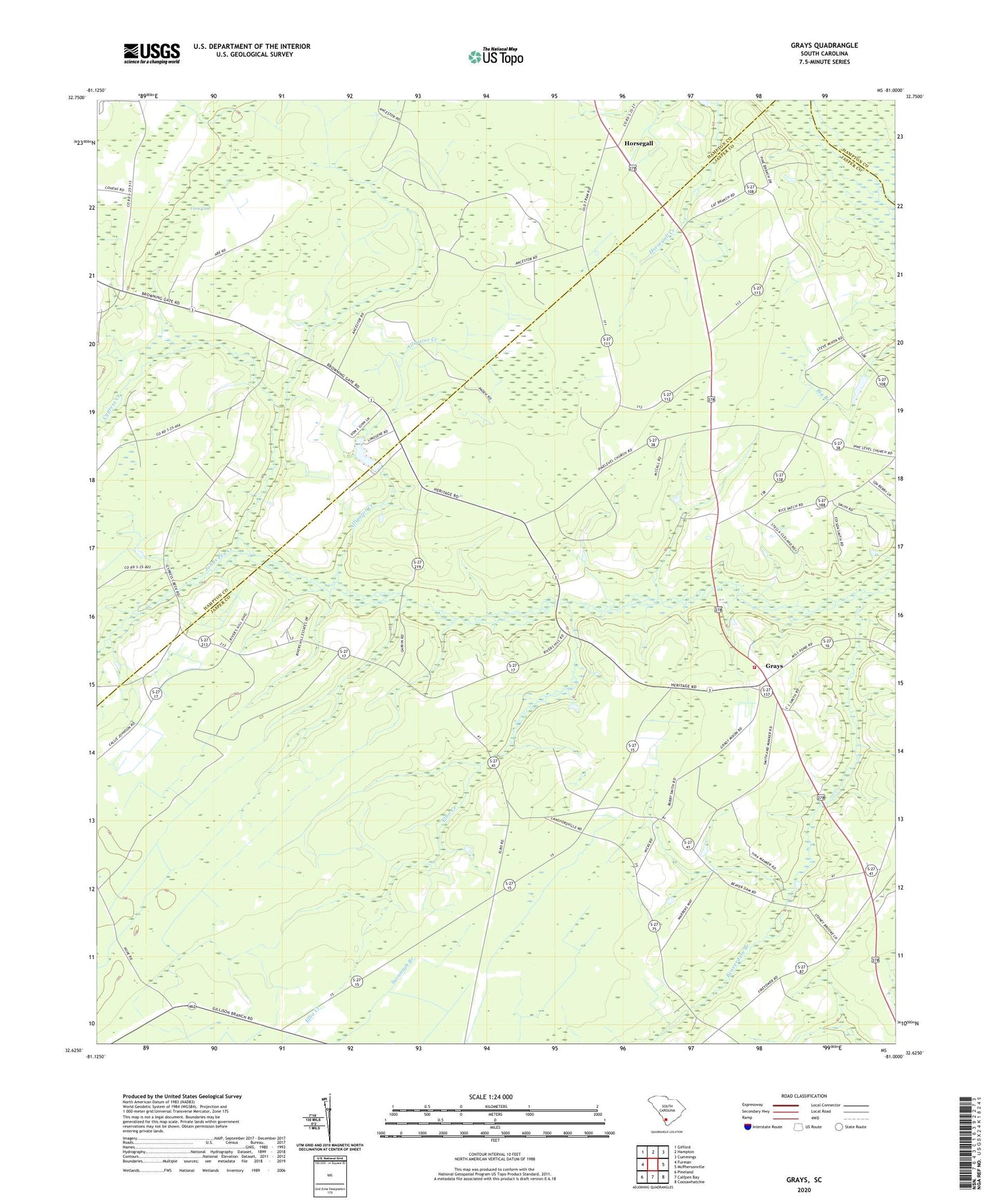
2024 topographic map quadrangle Grays in the state of South Carolina. Scale: 1:24000. Based on the newly updated USGS 7.5' US Topo map series, this map is in the following counties: Jasper, Hampton. The map contains contour data, water features, and other items you are used to seeing on USGS maps, but also has updated roads and other features. This is the next generation of topographic maps. Printed on high-quality waterproof paper with UV fade-resistant inks.
Quads adjacent to this one:
West: Furman
Northwest: Gifford
North: Hampton
Northeast: Cummings
East: McPhersonville
Southeast: Coosawhatchie
South: Calfpen Bay
Southwest: Pineland
This map covers the same area as the classic USGS quad with code o32081f1.
Contains the following named places: Alligator Creek, Beaver Dam Church, Bonnett Pond School, Cane Gall, Cypress Creek, Cypress Creek Church, Elbo Creek, Grays, Grays School, Horsegall, Horsegall School, Jasper Fire Department Station 45, Johns Pen Creek, Lawtor Bay School, Mixons Pond Dam D-2580, Mount Carmel Church, Mount Carmel School, New Castle Church, Newcastle School, Oak Grove Church, Oak Grove School, Philipsville School, Pine Level Baptist Church, Pine Level School, Sand Hill School, Smiths Pond, South Carolina Noname 25015 D-2605 Dam, South Carolina Noname 25017 D-2601 Dam, Thankfull Church, Thomas Pond