
MyTopo
Canadys South Carolina US Topo Map
Couldn't load pickup availability
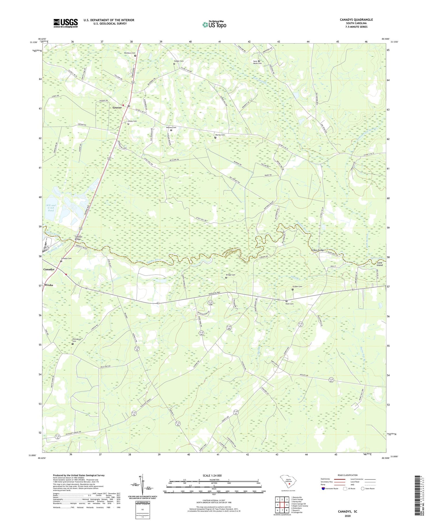
2020 topographic map quadrangle Canadys in the state of South Carolina. Scale: 1:24000. Based on the newly updated USGS 7.5' US Topo map series, this map is in the following counties: Dorchester, Colleton. The map contains contour data, water features, and other items you are used to seeing on USGS maps, but also has updated roads and other features. This is the next generation of topographic maps. Printed on high-quality waterproof paper with UV fade-resistant inks.
Quads adjacent to this one:
West: Saint George SW
Northwest: Reevesville
North: Saint George
Northeast: Harleyville
East: Maple Cane Swamp
Southeast: Cottageville
South: Round O
Southwest: Walterboro
Contains the following named places: Bethany Church, Bethel Church, Bridge Cemetery, Canadys, Canadys Bridge, Canadys Cemetery, Canadys Post Office, Canadys Steam Electric Generating Plant, Cane Island, Colleton County Fire Department Station 5, Colleton State Park, Grover, Grover Census Designated Place, Grover Fire Department, Grover Methodist Episcopal Church South, Grover Post Office, Gruber Cemetery, Hiott Cemetery, Indian Field Swamp, Jenkins Swamp School, Jerusalem Church, Johnstons Mill, Lee Branch, Lower Grover School, Maple Cane School, Mission School, Murray Cemetery, Oak Grove Church, Oak Grove School, Polk Swamp, Providence Cemetery, Providence Church, Providence School, Redbank Drain, Redbank School, Saint Luke School, Saint Lukes Church, Saint Marks Cemetery, Saint Matthews Church, SCE and G Ash Pond, SCE and G Ash Pond Dam D-2555, Seigler Cemetery, Skull Branch, Skull Branch School, Stokes Bridge, Utsey Cemetery, Wallace Cemetery, Westbury Cemetery


