MyTopo
Reevesville South Carolina US Topo Map
Couldn't load pickup availability
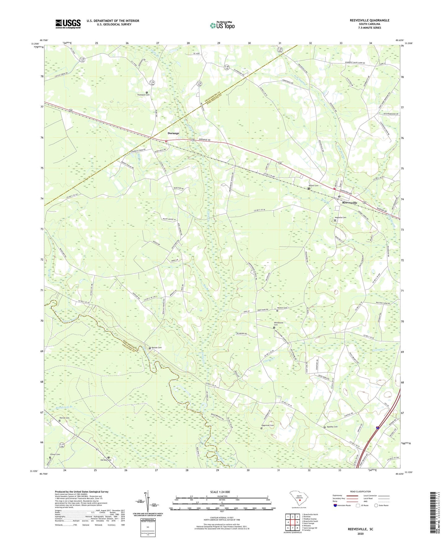
2024 topographic map quadrangle Reevesville in the state of South Carolina. Scale: 1:24000. Based on the newly updated USGS 7.5' US Topo map series, this map is in the following counties: Dorchester, Orangeburg, Colleton. The map contains contour data, water features, and other items you are used to seeing on USGS maps, but also has updated roads and other features. This is the next generation of topographic maps. Printed on high-quality waterproof paper with UV fade-resistant inks.
Quads adjacent to this one:
West: Branchville South
Northwest: Branchville North
North: Bowman
Northeast: Wadboo Swamp
East: Saint George
Southeast: Canadys
South: Saint George SW
Southwest: Williams
This map covers the same area as the classic USGS quad with code o33080b6.
Contains the following named places: Appleby Cemetery, Appleby Church, Bear Branch, Bethel Cemetery, Bethel Church, Beulah Cemetery, Beulah Church, Big Branch, Box Branch, Cat Hole, Cattle Creek, Cattle Creek Fire Department Station 1, Cattle Creek School, Connor Cemetery, Dorange, Dorange School, Edisto School, Greenville Church, Greenville School, Hagerman Cemetery, Harver Chapel, Heaton Cemetery, Huggins Oak School, Independence School, Independent School, Jericho Church, Joint School, Kelley School, Magnolia Cemetery, Mill Branch, Mount Pisgah Church, Murray Branch, Oak Villa Church, Oak Villa School, Old Miss Cemetery, Patrick Cemetery, Reevesville, Reevesville Baptist Church, Reevesville Division, Reevesville Fire Department, Saint Matthews Church, Saint Peters School, School Number 82, Sugar Hill, Thompson Cemetery, Town of Reevesville, Whitestone Cemetery, Whitestone Church, ZIP Code: 29471