MyTopo
Saint George SW South Carolina US Topo Map
Couldn't load pickup availability
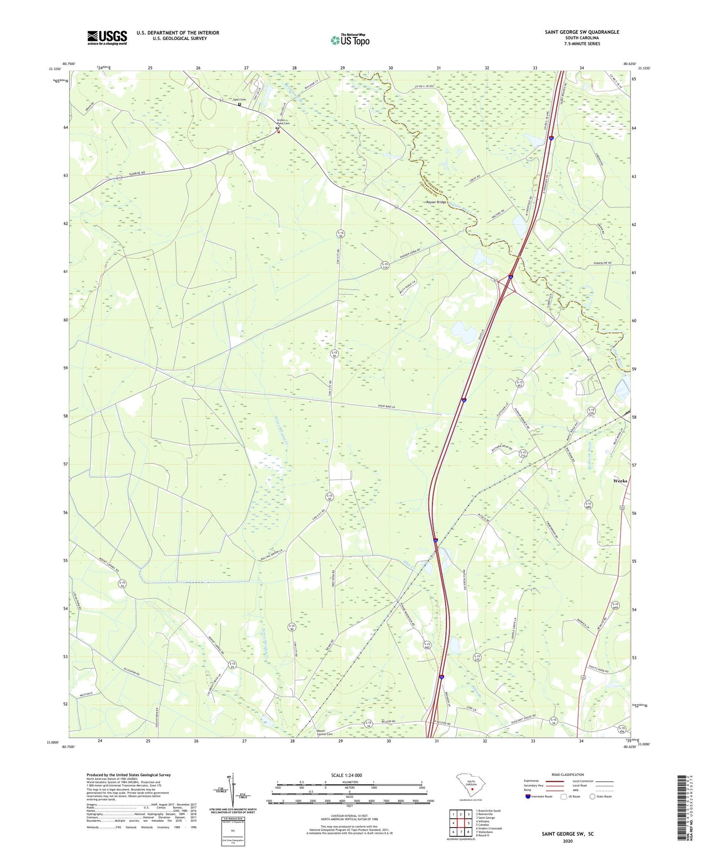
2024 topographic map quadrangle Saint George SW in the state of South Carolina. Scale: 1:24000. Based on the newly updated USGS 7.5' US Topo map series, this map is in the following counties: Colleton, Dorchester. The map contains contour data, water features, and other items you are used to seeing on USGS maps, but also has updated roads and other features. This is the next generation of topographic maps. Printed on high-quality waterproof paper with UV fade-resistant inks.
Quads adjacent to this one:
West: Williams
Northwest: Branchville South
North: Reevesville
Northeast: Saint George
East: Canadys
Southeast: Round O
South: Walterboro
Southwest: Sniders Crossroads
This map covers the same area as the classic USGS quad with code o33080a6.
Contains the following named places: Brickhouse Branch, Canaan Church, Cokers Pond, Cokers Pond Dam D-0649, Green Pond, Green Pond Cemetery, Green Pond Church, Linder School, Mount Carmel Church, Mount Carmel School, Mount Pleasant Church, Mount Pleasant School, Oakman Branch School, Oakman Church, Pleasant Grove Church, Pleasant Grove School, Raysor Bridge, Red Bank, Red Bank Church, Roadside School, South Carolina Noname 15033 D-2388 Dam, Spell Cemetery, Springtown, Springtown Church, Springtown Fire Department Station 17, Springtown School, Stokes Lookout Tower, Weeks