MyTopo
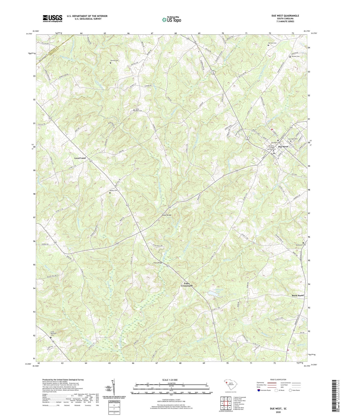
Due West South Carolina US Topo Map
Couldn't load pickup availability
2024 topographic map quadrangle Due West in the state of South Carolina. Scale: 1:24000. Based on the newly updated USGS 7.5' US Topo map series, this map is in the following counties: Abbeville, Anderson. The map contains contour data, water features, and other items you are used to seeing on USGS maps, but also has updated roads and other features. This is the next generation of topographic maps. Printed on high-quality waterproof paper with UV fade-resistant inks.
Quads adjacent to this one:
West: Antreville
Northwest: Saylors Crossroads
North: Honea Path
Northeast: Ware Shoals West
East: Shoals Junction
Southeast: Abbeville East
South: Abbeville West
Southwest: Latimer
This map covers the same area as the classic USGS quad with code o34082c4.
Contains the following named places: Abbeville County Fire Department Cold Spring Station 2, Ashley Cemetery, Bethlehem Associate Reformed Presbyterian Church, Bethlehem Cemetery, Blacks Creek, Buck Stand, Camp Creek, Campfield Church, Carver School, Cedar Spring Church, Cedar Spring School, Chickasaw Creek, Dixie High School, Due West, Due West Associate Reformed Presbyterian Church, Due West Baptist Church, Due West Cemetery, Due West Division, Due West Elementary School, Due West Fire Department, Duncan Cemetery, East Buckhorn Creek, Erskine College, Erskine College-Due West Historic District, Fairs Bridge, Fairs Crossroads, Free Will Church, Friendship Church, Hogskin Creek, Iris, Johnson Creek, L R Powell Lake, Level Land, Level Land School, Little Hogskin Creek, Little Mountain Cemetery, Little Mountain Presbyterian Church, Little River Baptist Church, Little River Cemetery, Long Branch, McClain Cemetery, Saint Mary Baptist Church, South Carolina Noname 01003 D-3037 Dam, Springfield Baptist Church, Spur Creek, The Hook, Town of Due West, Tucker Bridge, West Buckhorn Creek, West View, Westview School, Winona, Winona Baptist Church, Winona Cemetery, ZIP Code: 29639


