MyTopo
Latimer South Carolina US Topo Map
Couldn't load pickup availability
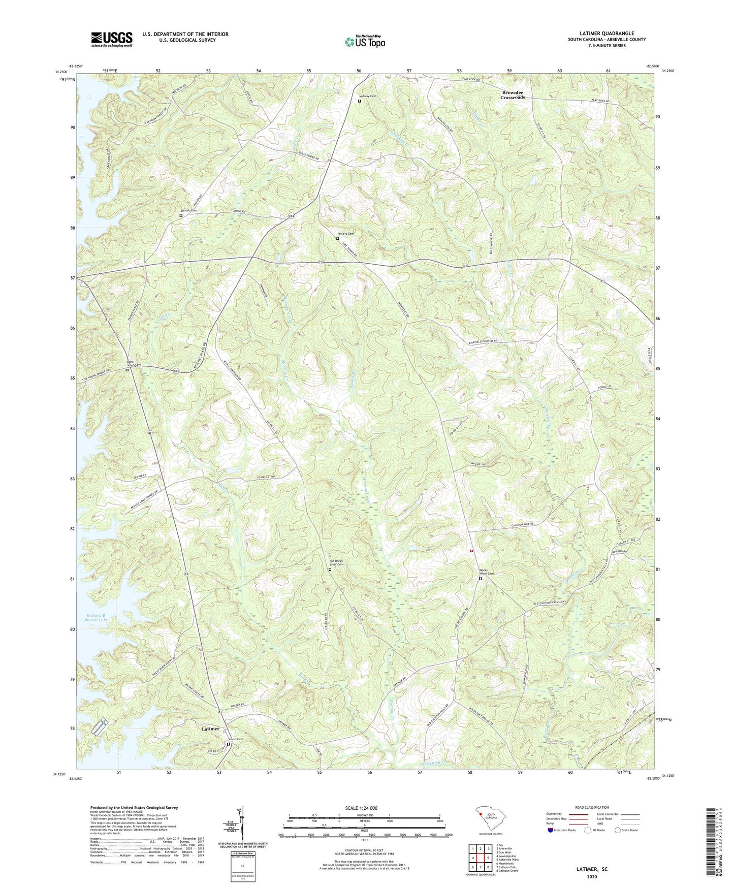
2024 topographic map quadrangle Latimer in the state of South Carolina. Scale: 1:24000. Based on the newly updated USGS 7.5' US Topo map series, this map is in the following counties: Abbeville. The map contains contour data, water features, and other items you are used to seeing on USGS maps, but also has updated roads and other features. This is the next generation of topographic maps. Printed on high-quality waterproof paper with UV fade-resistant inks.
Quads adjacent to this one:
West: Lowndesville
Northwest: Iva
North: Antreville
Northeast: Due West
East: Abbeville West
Southeast: Calhoun Creek
South: Calhoun Falls
Southwest: Heardmont
This map covers the same area as the classic USGS quad with code o34082b5.
Contains the following named places: Abbeville County Fire Department Monterey Station 9, Baskin Branch, Brown Oaks Church, Brownlee Crossroads, Brownlee School, Calhoun Falls Division, Campbell School, Daniels Cemetery, Fairfield Church, Fairfield School, Featherstone Pond Dam D-3028, Flat Rock Church, Gill Creek, Jacobs Chapel, Johnson School, Latimer, Latimer Pond Dam D-3033, Lowndesville Lookout Tower, Midway Baptist Church, Midway Cemetery, Monterey, Morrow Creek, Mount View School, Old Rocky River Cemetery, Pine Grove School, Powers Cemetery, Rocky River Cemetery, Rocky River Presbyterian Church, Rocky River School, Saint John Church, Saint Johns Cemetery, Salem Cemetery, Shanklin Creek, Smith Cross Roads School, Wilder Creek, Wilson Creek