MyTopo
Filbert South Carolina US Topo Map
Couldn't load pickup availability
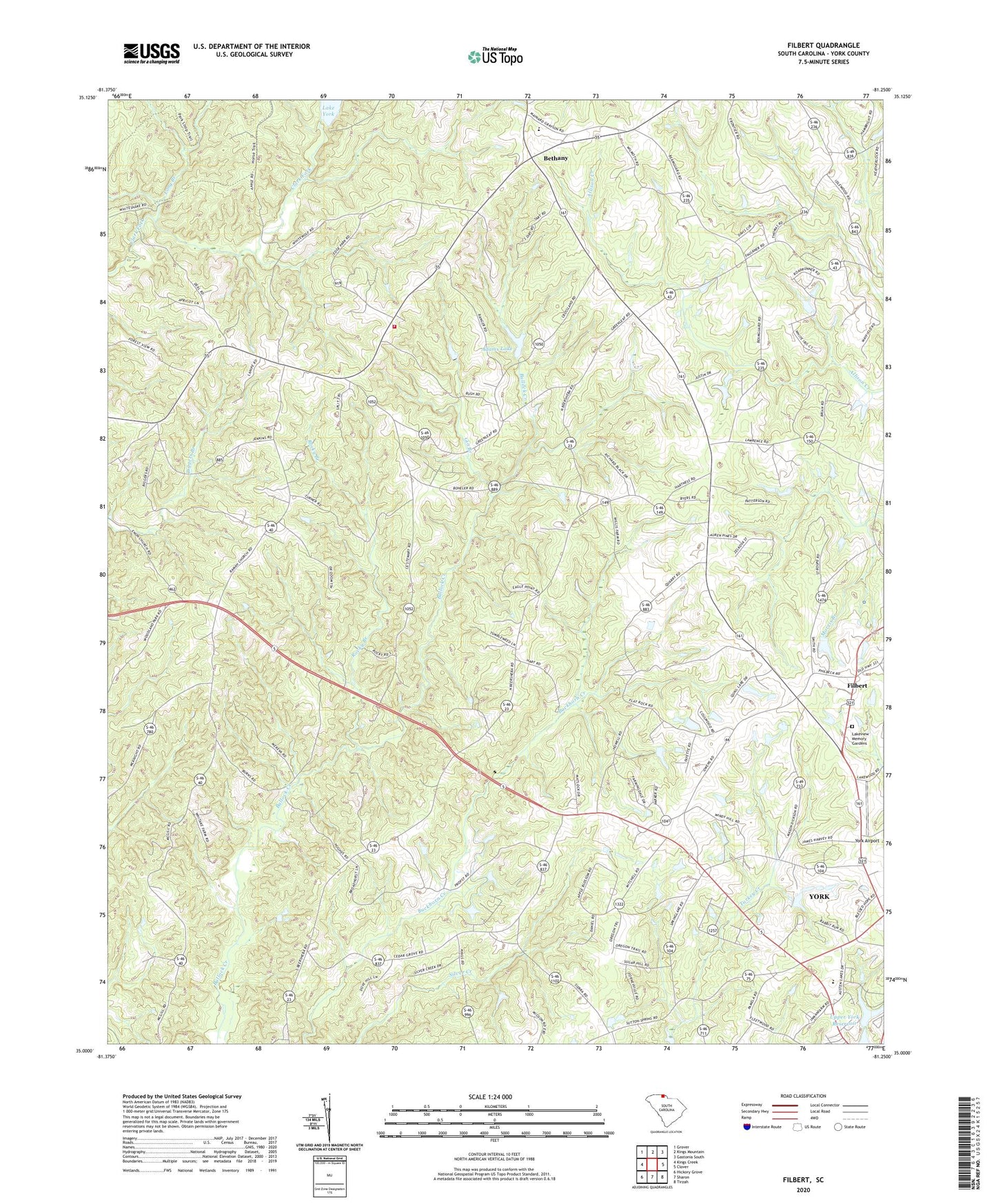
2024 topographic map quadrangle Filbert in the state of South Carolina. Scale: 1:24000. Based on the newly updated USGS 7.5' US Topo map series, this map is in the following counties: York. The map contains contour data, water features, and other items you are used to seeing on USGS maps, but also has updated roads and other features. This is the next generation of topographic maps. Printed on high-quality waterproof paper with UV fade-resistant inks.
Quads adjacent to this one:
West: Kings Creek
Northwest: Grover
North: Kings Mountain
Northeast: Gastonia South
East: Clover
Southeast: Tirzah
South: Sharon
Southwest: Hickory Grove
This map covers the same area as the classic USGS quad with code o35081a3.
Contains the following named places: Adams Lake, Battleground School, Beersheba, Beersheba Presbyterian Church, Bethany, Bethany - Santiago Fire Department, Bethany Associate Reformed Presbyterian Church Graveyard, Bethany Church, Bethany Elementary School, Bush-N-Vine Farm, Cane Spring School, Cedar Grove School, Cedar Grove United Methodist Church, Cedar Hill School, Center Hill School, Dixie School, Filbert, Filbert Presbyterian Church, Filbert School, Fishing Creek Baptist Church, Gin Branch, Kings Mountain Chapel United Methodist Church, Kings Mountain Church, Lakeview Memory Gardens, Long Branch, Midway Church, Mount Enon Church, New Zion Methodist Church, New Zion School, Oakdale Church, Ramah Presbyterian Church, Rocky Branch, Saint James School, Saint James United Methodist Church, Santiago School, Smiths Pond, Smiths School, South Carolina Noname 46002 D-3640 Dam, South Carolina Noname 46003 D-1215 Dam, South Carolina Noname 46006 D-1227 Dam, South Carolina Noname 46030 D-3642 Dam, Spring Lake Country Club, Spring Lake Country Club Dam D-1226, Sutton Springs School, Upper York Reservoir, Warlick Pond Dam D-3641, York Airport, Zadok