MyTopo
Sharon South Carolina US Topo Map
Couldn't load pickup availability
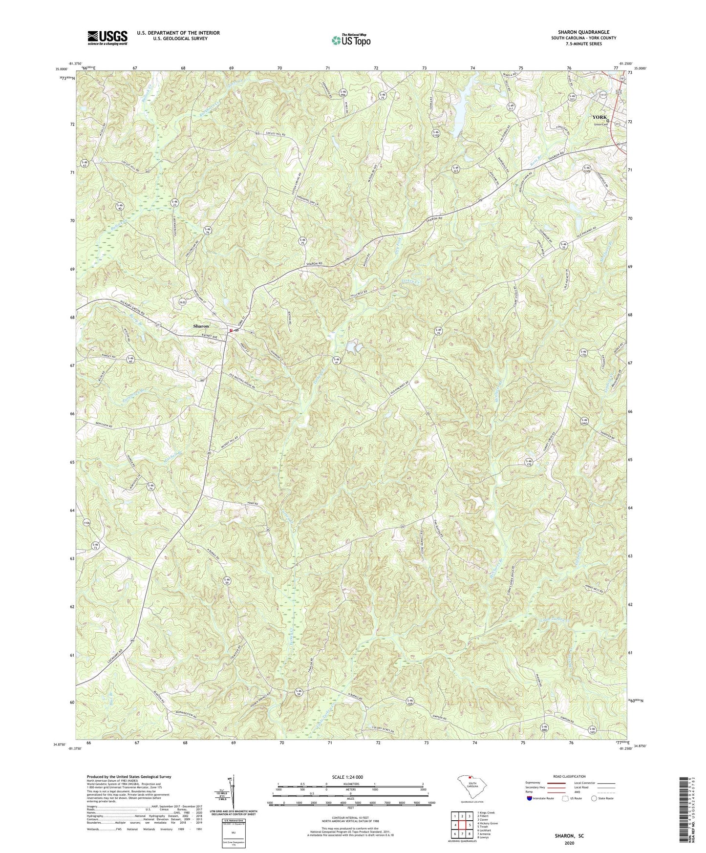
2024 topographic map quadrangle Sharon in the state of South Carolina. Scale: 1:24000. Based on the newly updated USGS 7.5' US Topo map series, this map is in the following counties: York. The map contains contour data, water features, and other items you are used to seeing on USGS maps, but also has updated roads and other features. This is the next generation of topographic maps. Printed on high-quality waterproof paper with UV fade-resistant inks.
Quads adjacent to this one:
West: Hickory Grove
Northwest: Kings Creek
North: Filbert
Northeast: Clover
East: Tirzah
Southeast: Lowrys
South: Armenia
Southwest: Lockhart
This map covers the same area as the classic USGS quad with code o34081h3.
Contains the following named places: Blairsville, Buckhorn Creek, Caldwell Lake, Calvary Church, Cuba School, Dry Fork, Harmony Church, Hill Street Church of God, Hillcrest Baptist Church, Hopewell School, Hopewell United Methodist Church, Lindsey Creek, Lower York Reservoir, Lower York Reservoir Dam D-1222, McClure Creek, McClures Branch, McConnells Division, Mount Carmel Freewill Baptist Church, Pine Bluff School, Pleasant Grove Presbyterian Church, Rainey Town School, Ross Branch, Saint John Baptist Church, Saint John Baptist Church Graveyard, Sharon, Sharon Associate Reformed Presbyterian Church, Sharon Baptist Church, Sharon Fire Department, Sharon School, Sharon United Methodist Church, Silver Creek, South Carolina Noname 46004 D-1230 Dam, South Carolina Noname 46007 D-3677 Dam, South Carolina Noname 46022 D-3643 Dam, Sutton Spring, Town of Sharon, Union Cemetery, WBZK-AM (York), Wilsons Chapel, Woodlawn Presbyterian Church, Woodlawn Presbyterian Church Cemetery